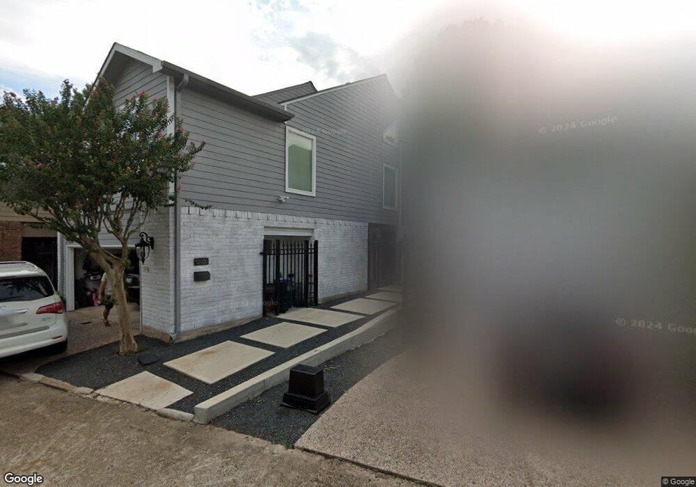
12035 Naughton St Houston, TX 77024
Memorial NeighborhoodEstimated Value: $529,000 - $672,000
3
Beds
3
Baths
2,550
Sq Ft
$229/Sq Ft
Est. Value
About This Home
This home is located at 12035 Naughton St, Houston, TX 77024 and is currently estimated at $584,110, approximately $229 per square foot. 12035 Naughton St is a home located in Harris County with nearby schools including Frostwood Elementary School, Memorial Middle, and Memorial High School.
Ownership History
Date
Name
Owned For
Owner Type
Purchase Details
Closed on
Oct 6, 1994
Sold by
Portwood Thomas B and Portwood Peggy J
Bought by
Pyle David and Pyle Nicole B
Current Estimated Value
Home Financials for this Owner
Home Financials are based on the most recent Mortgage that was taken out on this home.
Original Mortgage
$198,000
Interest Rate
5.62%
Create a Home Valuation Report for This Property
The Home Valuation Report is an in-depth analysis detailing your home's value as well as a comparison with similar homes in the area
Home Values in the Area
Average Home Value in this Area
Purchase History
| Date | Buyer | Sale Price | Title Company |
|---|---|---|---|
| Pyle David | -- | Texas American Title Co |
Source: Public Records
Mortgage History
| Date | Status | Borrower | Loan Amount |
|---|---|---|---|
| Closed | Pyle David | $198,000 |
Source: Public Records
Tax History Compared to Growth
Tax History
| Year | Tax Paid | Tax Assessment Tax Assessment Total Assessment is a certain percentage of the fair market value that is determined by local assessors to be the total taxable value of land and additions on the property. | Land | Improvement |
|---|---|---|---|---|
| 2025 | $9,161 | $508,929 | $157,349 | $351,580 |
| 2024 | $9,161 | $488,900 | $150,723 | $338,177 |
| 2023 | $9,161 | $499,722 | $150,723 | $348,999 |
| 2022 | $11,258 | $481,525 | $145,754 | $335,771 |
| 2021 | $11,618 | $539,653 | $150,723 | $388,930 |
| 2020 | $10,840 | $523,025 | $147,411 | $375,614 |
| 2019 | $10,296 | $500,000 | $154,036 | $345,964 |
| 2018 | $1,787 | $357,531 | $165,630 | $191,901 |
| 2017 | $20,835 | $398,199 | $165,630 | $232,569 |
| 2016 | $10,417 | $398,199 | $165,630 | $232,569 |
| 2015 | $2,161 | $398,199 | $165,630 | $232,569 |
| 2014 | $2,161 | $398,199 | $165,630 | $232,569 |
Source: Public Records
Map
Nearby Homes
- 6 Gessner Rd
- 3 Plantation Rd
- 10 Warrenton Dr
- 1 Woodstone St
- 8 Woodstone St
- 170 Haversham Dr
- 150 Gessner Rd Unit 5A
- 45 Bayou Pointe Dr
- 9620 Doliver Dr
- 45 Patti Lynn Ln
- 9632 Bayou Brook St
- 0 Gessner Rd
- 234 Plantation Rd
- 9618 Bayou Brook St
- 30 E Rivercrest Dr
- 9518 Bayou Brook St
- 31 Knipp Rd
- 318 Knipp Rd
- 2100 Tanglewilde St Unit 750
- 2100 Tanglewilde St Unit 169
- 12033 Naughton St
- 12037 Naughton St
- 12031 Naughton St
- 12005 Naughton St
- 12029 Naughton St
- 12007 Naughton St
- 12003 Naughton St
- 12027 Naughton St
- 12011 Naughton St
- 120 Stoney Creek Dr
- 12002 Naughton St
- 12025 Naughton St
- 12004 Naughton St
- 12013 Naughton St
- 12032 Naughton St
- 114 Stoney Creek Dr
- 12006 Naughton St
- 12023 Naughton St
- 12019 Naughton St
- 12030 Naughton St