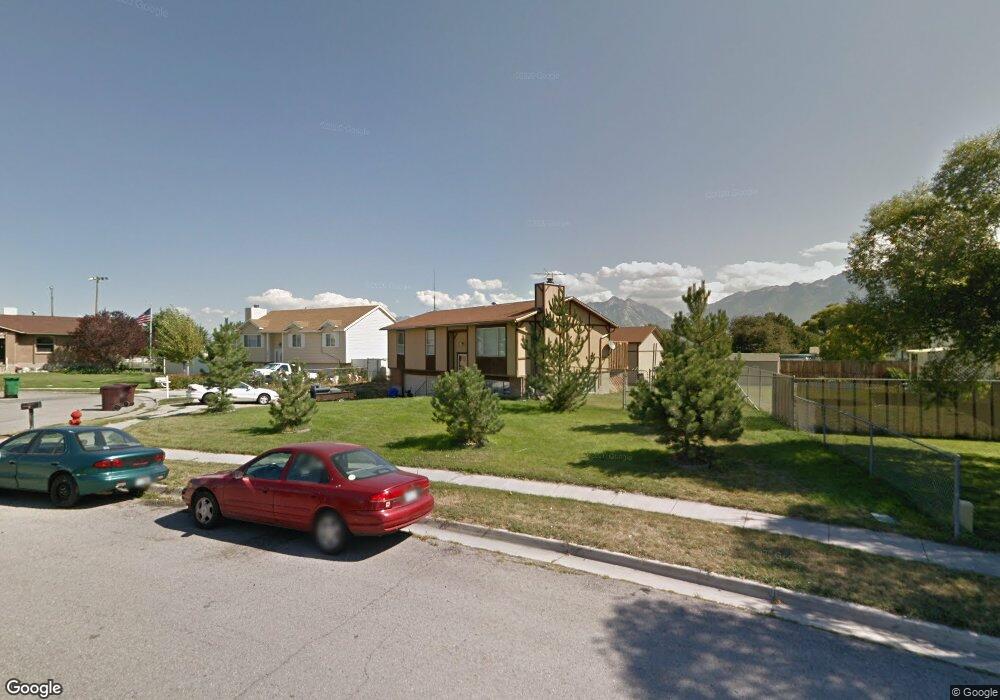
12037 S 1840 W Riverton, UT 84065
Estimated Value: $522,809 - $573,000
5
Beds
2
Baths
1,792
Sq Ft
$306/Sq Ft
Est. Value
About This Home
This home is located at 12037 S 1840 W, Riverton, UT 84065 and is currently estimated at $549,202, approximately $306 per square foot. 12037 S 1840 W is a home located in Salt Lake County with nearby schools including Rosamond Elementary School, Oquirrh Hills Middle School, and Riverton High School.
Ownership History
Date
Name
Owned For
Owner Type
Purchase Details
Closed on
Nov 21, 2020
Sold by
Whiteley Michael and Whiteley Kate
Bought by
Whiteley Michael and Whiteley Kate
Current Estimated Value
Home Financials for this Owner
Home Financials are based on the most recent Mortgage that was taken out on this home.
Original Mortgage
$258,100
Outstanding Balance
$229,672
Interest Rate
2.8%
Mortgage Type
New Conventional
Estimated Equity
$319,530
Purchase Details
Closed on
Jan 31, 2017
Sold by
Shelton Mark A and Shelton Sallie
Bought by
Whiteley Michael
Home Financials for this Owner
Home Financials are based on the most recent Mortgage that was taken out on this home.
Original Mortgage
$257,050
Interest Rate
4.16%
Mortgage Type
New Conventional
Create a Home Valuation Report for This Property
The Home Valuation Report is an in-depth analysis detailing your home's value as well as a comparison with similar homes in the area
Home Values in the Area
Average Home Value in this Area
Purchase History
| Date | Buyer | Sale Price | Title Company |
|---|---|---|---|
| Whiteley Michael | -- | Silk Title Utah | |
| Whiteley Michael | -- | Silk Title Utah Llc | |
| Whiteley Michael | -- | Monument Title Ins Co |
Source: Public Records
Mortgage History
| Date | Status | Borrower | Loan Amount |
|---|---|---|---|
| Open | Whiteley Michael | $258,100 | |
| Closed | Whiteley Michael | $258,100 | |
| Previous Owner | Whiteley Michael | $257,050 |
Source: Public Records
Tax History Compared to Growth
Tax History
| Year | Tax Paid | Tax Assessment Tax Assessment Total Assessment is a certain percentage of the fair market value that is determined by local assessors to be the total taxable value of land and additions on the property. | Land | Improvement |
|---|---|---|---|---|
| 2025 | $2,578 | $474,600 | $202,000 | $272,600 |
| 2024 | $2,578 | $446,200 | $198,300 | $247,900 |
| 2023 | $2,502 | $408,200 | $183,600 | $224,600 |
| 2022 | $2,603 | $416,600 | $180,000 | $236,600 |
| 2021 | $2,252 | $321,000 | $135,000 | $186,000 |
| 2020 | $2,222 | $295,200 | $121,000 | $174,200 |
| 2019 | $2,240 | $292,600 | $110,000 | $182,600 |
| 2018 | $2,113 | $271,800 | $110,000 | $161,800 |
| 2017 | $1,716 | $241,000 | $110,000 | $131,000 |
| 2016 | $63 | $224,100 | $102,000 | $122,100 |
| 2015 | $84 | $210,200 | $103,800 | $106,400 |
| 2014 | $27 | $197,500 | $98,900 | $98,600 |
Source: Public Records
Map
Nearby Homes
- 12034 S 1900 W
- 1721 W Hollow Cedar Ln Unit 1
- 1661 W Madison View Dr
- 1611 W Laurel Chase Dr
- 12317 S Redwood Rd
- 12325 S Redwood Rd
- 1767 W Lunford Ln
- 12345 S Redwood Rd
- 1410 W 12115 S
- 11666 S Gold Dust Dr
- 12294 S 1490 W
- 2295 W Myers Ln
- 11784 Stone Ridge Ct
- 11711 Stone Crest Cir
- 1056 W Kate Springs Ln S Unit 10
- 11788 S Myers Park Ln Unit 101
- 11694 Stone Crest Cir
- 1337 Natasha Cir
- 11707 S Myers Park Ln Unit 111
- 1592 W Andover Rd
- 1836 W 12015 S
- 12015 S 1840 W
- 1836 W 12050 S
- 1799 W Kenadi View Way
- 1816 W 12050 S
- 1838 W 12015 S
- 1849 W 12015 S
- 11994 S Kenadi View Way
- 1787 W Kenadi View Way
- 1850 W 12015 S
- 12046 S 1840 W
- 1798 W 12050 S
- 1837 W 12050 S
- 12058 S 1840 W
- 1866 W 12015 S
- 1817 W 12050 S
- 11992 S Kenadi View Way Unit 211
- 1786 W 12050 S
- 12023 S 1900 W
- 1773 W Kenadi View Way