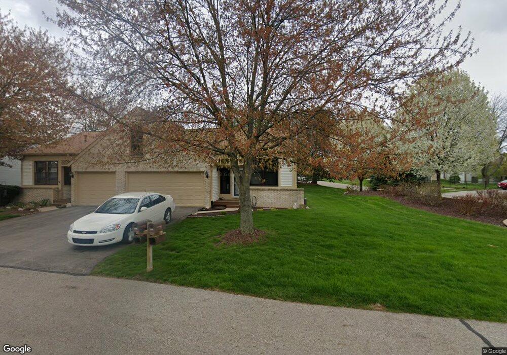
1204 Brook Trail Unit 36 Lansing, MI 48917
Estimated Value: $312,000 - $332,000
3
Beds
2
Baths
1,385
Sq Ft
$229/Sq Ft
Est. Value
About This Home
This home is located at 1204 Brook Trail Unit 36, Lansing, MI 48917 and is currently estimated at $317,799, approximately $229 per square foot. 1204 Brook Trail Unit 36 is a home located in Eaton County with nearby schools including Willow Ridge Elementary School, Leon W. Hayes Middle School, and Grand Ledge High School.
Ownership History
Date
Name
Owned For
Owner Type
Purchase Details
Closed on
Apr 21, 2015
Sold by
Elbers Arthur H and Elbers Lonnie
Bought by
Valo Michael and Valo Tammatha
Current Estimated Value
Home Financials for this Owner
Home Financials are based on the most recent Mortgage that was taken out on this home.
Original Mortgage
$119,200
Interest Rate
4.04%
Mortgage Type
New Conventional
Purchase Details
Closed on
Feb 23, 2010
Sold by
The Edward J Rondy Living Trust
Bought by
Elbers Family Living Trust
Create a Home Valuation Report for This Property
The Home Valuation Report is an in-depth analysis detailing your home's value as well as a comparison with similar homes in the area
Home Values in the Area
Average Home Value in this Area
Purchase History
| Date | Buyer | Sale Price | Title Company |
|---|---|---|---|
| Valo Michael | $149,000 | Transnation Title Agency | |
| Elbers Family Living Trust | $135,000 | None Available |
Source: Public Records
Mortgage History
| Date | Status | Borrower | Loan Amount |
|---|---|---|---|
| Previous Owner | Valo Michael | $119,200 |
Source: Public Records
Tax History Compared to Growth
Tax History
| Year | Tax Paid | Tax Assessment Tax Assessment Total Assessment is a certain percentage of the fair market value that is determined by local assessors to be the total taxable value of land and additions on the property. | Land | Improvement |
|---|---|---|---|---|
| 2025 | $3,741 | $138,700 | $0 | $0 |
| 2024 | $1,903 | $126,800 | $0 | $0 |
| 2023 | $1,772 | $118,600 | $0 | $0 |
| 2022 | $3,155 | $112,600 | $0 | $0 |
| 2021 | $3,012 | $104,700 | $0 | $0 |
| 2020 | $2,971 | $100,100 | $0 | $0 |
| 2019 | $2,926 | $93,134 | $0 | $0 |
| 2018 | $2,744 | $85,000 | $0 | $0 |
| 2017 | $2,683 | $79,200 | $0 | $0 |
| 2016 | -- | $74,000 | $0 | $0 |
| 2015 | -- | $73,600 | $0 | $0 |
| 2014 | -- | $63,906 | $0 | $0 |
| 2013 | -- | $62,900 | $0 | $0 |
Source: Public Records
Map
Nearby Homes
- 6512 Spring Tree Ln Unit 14
- 6542 Brook Trail
- 6531 Windsong Way
- 1108 Summergreen Ln Unit 103
- 1120 Rolling Green Ln
- 6725 French Creek Dr
- 1205 Woodmeadow Unit 201
- 1527 Lindy Dr
- 1106 S Ridge Rd
- 5910 Cabrena Dr
- 6361 Larocque Cir
- 1738 Willow Creek Dr Unit 63
- 6333 Larocque Cir
- 1909 Redbud Ln Unit 3
- 7757 Taragreen Dr
- 0 Lot B Willow
- 7754 Madrid Dr
- 5754 River Ridge Dr
- 6036 Madeira Dr Unit 100
- 6025 Madeira Dr Unit 111
- 1206 Brook Trail
- 1216 Brook Trail
- 6530 Springtree Ln Unit 32
- 6530 Springtree Ln Unit 310
- 6528 Springtree Ln
- 1218 Brook Trail
- 1205 Brook Trail Unit 42
- 1207 Brook Trail Unit 41
- 1201 Brook Trail
- 6630 Windsong Way
- 6545 Brook Trail Unit 26
- 6545 Brook Trail
- 6526 Springtree Ln
- 6524 Springtree Ln Unit 29
- 6543 Brook Trail Unit 25
- 1149 Meadow Glen
- 1215 Brook Trail Unit 40
- 6622 Windsong Way
- 6629 Windsong Way