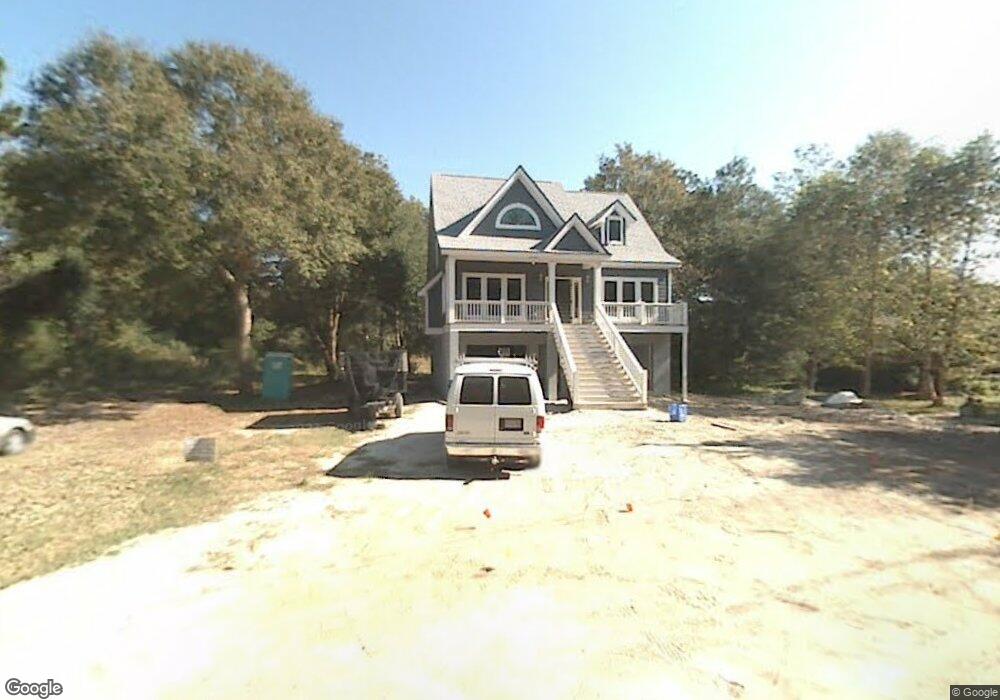
1204 Cecil Cir Charleston, SC 29412
James Island NeighborhoodEstimated Value: $558,000 - $680,681
3
Beds
3
Baths
1,706
Sq Ft
$366/Sq Ft
Est. Value
About This Home
This home is located at 1204 Cecil Cir, Charleston, SC 29412 and is currently estimated at $624,920, approximately $366 per square foot. 1204 Cecil Cir is a home located in Charleston County with nearby schools including Harbor View Elementary School, Camp Road Middle, and James Island Charter High School.
Ownership History
Date
Name
Owned For
Owner Type
Purchase Details
Closed on
Feb 6, 2026
Sold by
Prevost Jacob and Jennings Gina
Bought by
Seften Adam and Simson Valarie
Current Estimated Value
Home Financials for this Owner
Home Financials are based on the most recent Mortgage that was taken out on this home.
Original Mortgage
$688,500
Outstanding Balance
$688,500
Interest Rate
6.15%
Mortgage Type
New Conventional
Estimated Equity
-$63,580
Purchase Details
Closed on
Feb 11, 2008
Sold by
Prevost Jacob
Bought by
Prevost Gina
Home Financials for this Owner
Home Financials are based on the most recent Mortgage that was taken out on this home.
Original Mortgage
$221,500
Interest Rate
5.12%
Mortgage Type
New Conventional
Purchase Details
Closed on
Feb 4, 2008
Sold by
Prevost Gina
Bought by
Prevost Jacob
Home Financials for this Owner
Home Financials are based on the most recent Mortgage that was taken out on this home.
Original Mortgage
$221,500
Interest Rate
5.12%
Mortgage Type
New Conventional
Purchase Details
Closed on
May 10, 2007
Sold by
Whaley John S and Whaley Gayle L
Bought by
Prevost Jacob and Prevost Gina
Create a Home Valuation Report for This Property
The Home Valuation Report is an in-depth analysis detailing your home's value as well as a comparison with similar homes in the area
Home Values in the Area
Average Home Value in this Area
Purchase History
| Date | Buyer | Sale Price | Title Company |
|---|---|---|---|
| Seften Adam | $765,000 | None Listed On Document | |
| Prevost Gina | -- | -- | |
| Prevost Jacob | -- | None Available | |
| Prevost Jacob | $87,000 | None Available |
Source: Public Records
Mortgage History
| Date | Status | Borrower | Loan Amount |
|---|---|---|---|
| Open | Seften Adam | $688,500 | |
| Previous Owner | Prevost Jacob | $221,500 |
Source: Public Records
Tax History
| Year | Tax Paid | Tax Assessment Tax Assessment Total Assessment is a certain percentage of the fair market value that is determined by local assessors to be the total taxable value of land and additions on the property. | Land | Improvement |
|---|---|---|---|---|
| 2024 | $5,688 | $18,190 | $0 | $0 |
| 2023 | $5,009 | $18,190 | $0 | $0 |
| 2022 | $4,581 | $18,190 | $0 | $0 |
| 2021 | $4,561 | $18,190 | $0 | $0 |
| 2020 | $1,456 | $12,130 | $0 | $0 |
| 2019 | $1,331 | $10,550 | $0 | $0 |
| 2017 | $4,048 | $15,810 | $0 | $0 |
| 2016 | $3,912 | $15,810 | $0 | $0 |
| 2015 | $1,388 | $10,550 | $0 | $0 |
| 2014 | $1,323 | $0 | $0 | $0 |
| 2011 | -- | $0 | $0 | $0 |
Source: Public Records
Map
Nearby Homes
- 1174 Fort Johnson Rd
- 1138 Oxbow Dr
- 1128 Hillman St
- 8 Laurel Leaf Ln
- 1344 Teal Ave
- 1120 Fort Johnson Rd Unit A
- 1050 Ben Rd
- 1349 Sea Aire Dr
- 1138 Cottage Rd
- Tbd 3 Rebel Kat Ct
- 1427 Rivers Cotton Rd
- 1439 Rivers Cotton Rd
- 1475 Swamp Fox Ln
- 1315 Camp Rd
- 1032 Greenhill Rd Unit A
- Tbd Rebel Kat Ct
- 1099 Farmington Rd
- 976 McElveen St
- 1462 Harborsun Dr
- 1328 Hermitage Ave
Your Personal Tour Guide
Ask me questions while you tour the home.