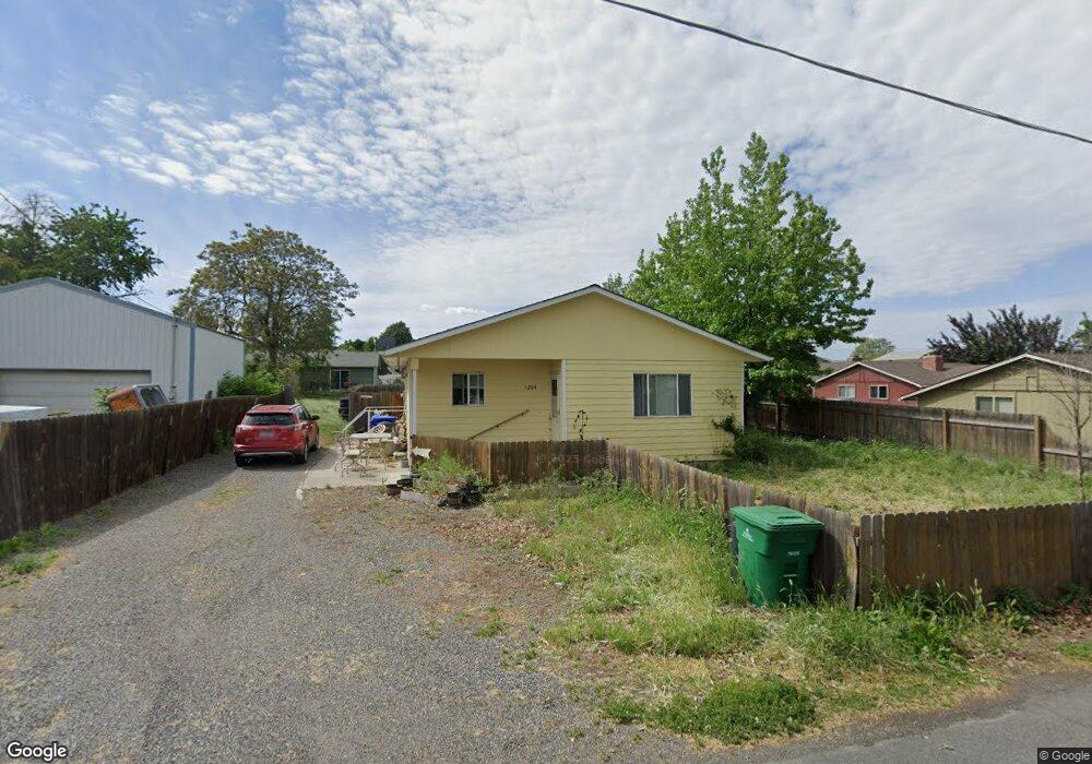
1204 Cedar Ave Lewiston, ID 83501
Estimated Value: $309,000 - $339,000
3
Beds
2
Baths
1,092
Sq Ft
$302/Sq Ft
Est. Value
About This Home
This home is located at 1204 Cedar Ave, Lewiston, ID 83501 and is currently estimated at $329,876, approximately $302 per square foot. 1204 Cedar Ave is a home located in Nez Perce County with nearby schools including Orchards Elementary School, Lewiston High School, and Wonder World Learning Center.
Ownership History
Date
Name
Owned For
Owner Type
Purchase Details
Closed on
May 16, 2025
Sold by
Curry Chad J
Bought by
Curry Chad and Strickler Lisa
Current Estimated Value
Home Financials for this Owner
Home Financials are based on the most recent Mortgage that was taken out on this home.
Original Mortgage
$130,000
Outstanding Balance
$128,171
Interest Rate
5.82%
Mortgage Type
New Conventional
Estimated Equity
$201,705
Purchase Details
Closed on
Jan 22, 2014
Sold by
Curry Josee L
Bought by
Curry Chad J
Create a Home Valuation Report for This Property
The Home Valuation Report is an in-depth analysis detailing your home's value as well as a comparison with similar homes in the area
Home Values in the Area
Average Home Value in this Area
Purchase History
| Date | Buyer | Sale Price | Title Company |
|---|---|---|---|
| Curry Chad | -- | Alliance Title | |
| Curry Chad J | -- | None Available |
Source: Public Records
Mortgage History
| Date | Status | Borrower | Loan Amount |
|---|---|---|---|
| Open | Curry Chad | $130,000 |
Source: Public Records
Tax History Compared to Growth
Tax History
| Year | Tax Paid | Tax Assessment Tax Assessment Total Assessment is a certain percentage of the fair market value that is determined by local assessors to be the total taxable value of land and additions on the property. | Land | Improvement |
|---|---|---|---|---|
| 2025 | $2,778 | $304,554 | $65,500 | $239,054 |
| 2024 | $25 | $310,532 | $62,250 | $248,282 |
| 2023 | $2,190 | $295,167 | $60,500 | $234,667 |
| 2022 | $3,357 | $324,607 | $52,500 | $272,107 |
| 2021 | $2,148 | $218,097 | $46,500 | $171,597 |
| 2020 | $1,678 | $169,827 | $38,750 | $131,077 |
| 2019 | $1,733 | $159,903 | $38,750 | $121,153 |
| 2018 | $1,752 | $160,385 | $36,750 | $123,635 |
| 2017 | $1,504 | $0 | $0 | $0 |
| 2016 | $1,504 | $0 | $0 | $0 |
| 2015 | $1,394 | $0 | $0 | $0 |
| 2014 | $1,284 | $129,825 | $33,750 | $96,075 |
Source: Public Records
Map
Nearby Homes
- 1125 Grelle Ave
- 1220 Burrell Ave
- 3531 11th Street D
- 1224 Burrell Ave
- 1128 Burrell Ave Unit 2
- 1227 Alder Ave Unit 7
- 3530 11th St Unit 14
- 1211 Powers Ave
- 1029 Cedar Ave Unit Sp 11
- 1128 Bryden Ave
- 1719 Pathway Ct
- 3716 11th St E
- 1217 Birch Ave
- 3334 11th Saint C
- 1402 Burrell Ave
- 3507 10th St
- 3427 14th St
- 3506 10th St
- 935 Grelle Ave
- 3426 10th St
- 1208 Cedar Ave
- 1207 1/4 Cedar Ave
- 1207.5 Cedar Ave
- 1207 Cedar Ave
- 1207 Cedar Ave Unit between 12th & Thain
- 3519 12th St
- 1205 Cedar Ave
- 3527 12th St
- 1212 Cedar Ave Unit 3
- 1212 Cedar Ave
- 1211 Cedar Ave
- 3515 12th St
- 3524 12th St
- 1207 1/2 Cedar Ave
- 1207 1/2 Cedar Ave Unit Between 12Th and Tha
- 1214 Cedar Ave
- 3511 12th St
- 518 Thain Rd
- 530 Thain Rd
- 3533 12th St