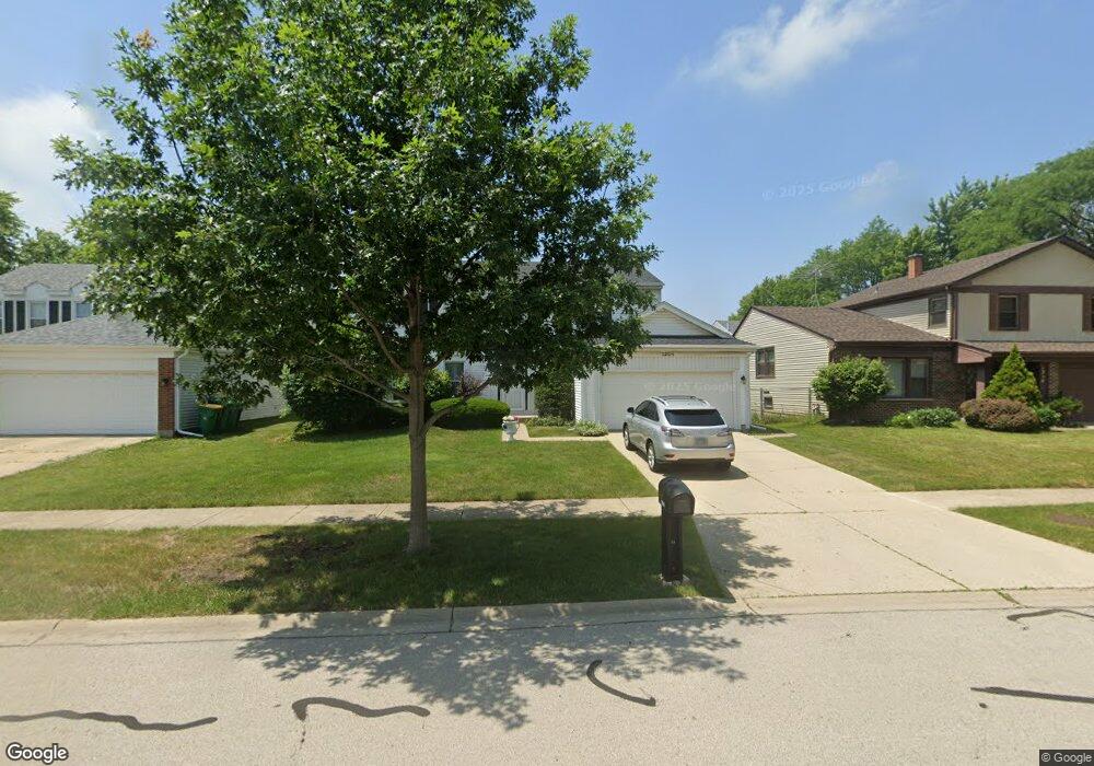
1204 Devonshire Rd Buffalo Grove, IL 60089
Prairie Park-Lake County NeighborhoodEstimated Value: $561,139 - $608,000
4
Beds
3
Baths
2,199
Sq Ft
$267/Sq Ft
Est. Value
About This Home
This home is located at 1204 Devonshire Rd, Buffalo Grove, IL 60089 and is currently estimated at $587,285, approximately $267 per square foot. 1204 Devonshire Rd is a home located in Lake County with nearby schools including Prairie Elementary School, Twin Groves Middle School, and Adlai E Stevenson High School.
Ownership History
Date
Name
Owned For
Owner Type
Purchase Details
Closed on
Dec 26, 1995
Sold by
Wolf Steven B and Wolf Nancy P
Bought by
Motamedi Mohammad R and Nosrat Fatemeh
Current Estimated Value
Home Financials for this Owner
Home Financials are based on the most recent Mortgage that was taken out on this home.
Original Mortgage
$187,200
Outstanding Balance
$5,056
Interest Rate
7.3%
Estimated Equity
$582,229
Create a Home Valuation Report for This Property
The Home Valuation Report is an in-depth analysis detailing your home's value as well as a comparison with similar homes in the area
Home Values in the Area
Average Home Value in this Area
Purchase History
| Date | Buyer | Sale Price | Title Company |
|---|---|---|---|
| Motamedi Mohammad R | $234,000 | First American Title |
Source: Public Records
Mortgage History
| Date | Status | Borrower | Loan Amount |
|---|---|---|---|
| Open | Motamedi Mohammad R | $187,200 |
Source: Public Records
Tax History
| Year | Tax Paid | Tax Assessment Tax Assessment Total Assessment is a certain percentage of the fair market value that is determined by local assessors to be the total taxable value of land and additions on the property. | Land | Improvement |
|---|---|---|---|---|
| 2024 | $13,151 | $152,831 | $33,162 | $119,669 |
| 2023 | $12,722 | $144,208 | $31,291 | $112,917 |
| 2022 | $12,722 | $133,006 | $28,860 | $104,146 |
| 2021 | $12,234 | $131,572 | $28,549 | $103,023 |
| 2020 | $12,441 | $132,020 | $28,646 | $103,374 |
| 2019 | $12,270 | $131,533 | $28,540 | $102,993 |
| 2018 | $11,918 | $131,818 | $28,208 | $103,610 |
| 2017 | $11,692 | $128,742 | $27,550 | $101,192 |
| 2016 | $11,387 | $123,280 | $26,381 | $96,899 |
| 2015 | $11,086 | $115,290 | $24,671 | $90,619 |
| 2014 | $10,050 | $103,652 | $26,496 | $77,156 |
| 2012 | $9,976 | $103,860 | $26,549 | $77,311 |
Source: Public Records
Map
Nearby Homes
- 1234 Devonshire Rd
- 1265 Devonshire Rd
- 1318 Gail Dr Unit 4
- 1361 Brandywyn Ln
- 327 Lasalle Ln
- 1152 Courtland Dr Unit 406
- 962 Thompson Blvd
- 1380 Larchmont Dr
- 5176 Aptakisic Rd
- 810 Silver Rock Ln
- 1161 Parker Ln
- 531 Lasalle Ln
- 5107 N Arlington Heights Rd
- 533 Lyon Dr
- 1265 Franklin Ln Unit L1
- 5135 Bridlewood Ct
- 1325 Fairfax Ln
- 938 Hidden Lake Dr
- 1096 Pine Tree Cir N
- 126 Autumn Ct Unit CT76021
- 1214 Devonshire Rd
- 1194 Devonshire Rd
- 1195 Dayton Rd
- 1205 Dayton Rd
- 1184 Devonshire Rd
- 1224 Devonshire Rd
- 1185 Dayton Rd
- 1215 Dayton Rd
- 1209 Devonshire Rd
- 1203 Devonshire Rd
- 1174 Devonshire Rd
- 1215 Devonshire Rd
- 1225 Dayton Rd
- 1187 Devonshire Rd
- 1175 Dayton Rd
- 1181 Devonshire Rd
- 1235 Dayton Rd
- 1244 Devonshire Rd
- 1164 Devonshire Rd
- 1165 Dayton Rd
Your Personal Tour Guide
Ask me questions while you tour the home.