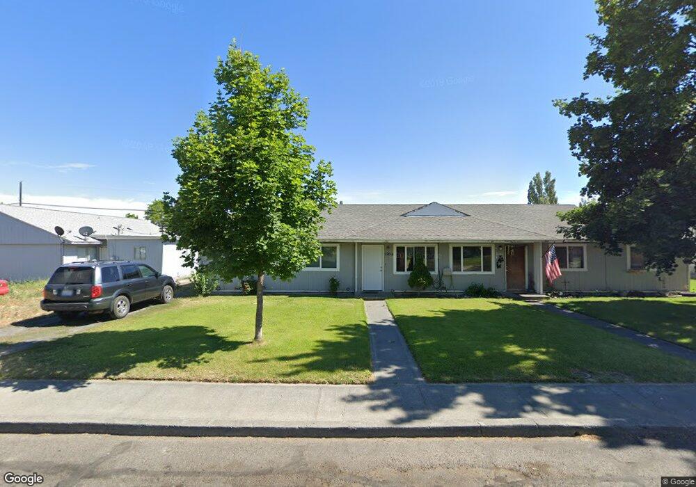
1204 Doolittle Dr Unit 1206 Moses Lake, WA 98837
Estimated Value: $245,000 - $297,903
6
Beds
6
Baths
2,016
Sq Ft
$130/Sq Ft
Est. Value
About This Home
This home is located at 1204 Doolittle Dr Unit 1206, Moses Lake, WA 98837 and is currently estimated at $262,476, approximately $130 per square foot. 1204 Doolittle Dr Unit 1206 is a home located in Grant County with nearby schools including Larson Heights Elementary School, Endeavor Middle School, and Moses Lake High School.
Ownership History
Date
Name
Owned For
Owner Type
Purchase Details
Closed on
Jun 21, 2019
Sold by
Dekoekkoek Brian De and Dekoekoek Leslie De
Bought by
1204 1206 Doolittle Dr Llc
Current Estimated Value
Purchase Details
Closed on
Sep 7, 2005
Sold by
Ducharme Richard J and Menti Rick A
Bought by
Dekoekkoek Brian and Dekoekkoek Leslie
Home Financials for this Owner
Home Financials are based on the most recent Mortgage that was taken out on this home.
Original Mortgage
$68,000
Interest Rate
5.81%
Mortgage Type
Fannie Mae Freddie Mac
Purchase Details
Closed on
Aug 29, 2005
Sold by
Moses Lake Partners
Bought by
Menti Rick A and Ducharme Richard J
Home Financials for this Owner
Home Financials are based on the most recent Mortgage that was taken out on this home.
Original Mortgage
$68,000
Interest Rate
5.81%
Mortgage Type
Fannie Mae Freddie Mac
Create a Home Valuation Report for This Property
The Home Valuation Report is an in-depth analysis detailing your home's value as well as a comparison with similar homes in the area
Home Values in the Area
Average Home Value in this Area
Purchase History
| Date | Buyer | Sale Price | Title Company |
|---|---|---|---|
| 1204 1206 Doolittle Dr Llc | -- | None Available | |
| Dekoekkoek Brian | $85,000 | Security Title Guara | |
| Menti Rick A | -- | Security Title Guara |
Source: Public Records
Mortgage History
| Date | Status | Borrower | Loan Amount |
|---|---|---|---|
| Previous Owner | Dekoekkoek Brian | $68,000 |
Source: Public Records
Tax History Compared to Growth
Tax History
| Year | Tax Paid | Tax Assessment Tax Assessment Total Assessment is a certain percentage of the fair market value that is determined by local assessors to be the total taxable value of land and additions on the property. | Land | Improvement |
|---|---|---|---|---|
| 2025 | $2,294 | $215,831 | -- | -- |
| 2024 | $1,852 | $143,373 | $25,500 | $117,873 |
| 2023 | $1,934 | $151,585 | $25,500 | $126,085 |
| 2022 | $1,996 | $151,585 | $25,500 | $126,085 |
| 2021 | $1,715 | $151,585 | $25,500 | $126,085 |
| 2020 | $1,690 | $123,455 | $25,500 | $97,955 |
| 2019 | $1,587 | $105,495 | $20,000 | $85,495 |
| 2018 | $1,615 | $99,705 | $20,000 | $79,705 |
| 2017 | $1,717 | $118,490 | $20,000 | $98,490 |
| 2016 | $1,519 | $102,580 | $20,000 | $82,580 |
| 2013 | -- | $102,420 | $20,000 | $82,420 |
Source: Public Records
Map
Nearby Homes
- 8910 Travis Dr Unit B
- 1127 Arlington Dr
- 9008 Bong Loop Unit B
- 9035 Forrestal Ln
- 9021 Mcconnell Dr Unit A
- 141 Carswell Dr
- 9023 Mcconnell Dr Unit A
- 8958 Tinker Loop Unit A & B
- 9016 Bong Loop Unit B
- 410 Biggs Dr NE
- 205 March Dr NE
- 0 22nd Ave NE
- 541 Fairchild Loop
- 538 Fairchild Loop
- 7613 Cox St NE
- 535 Castle Dr
- 4926 Shorecrest Dr NE
- 4898 Shorecrest Dr NE
- 0 I Rd NE Unit NWM2459711
- 0 Kopp Ln NE
- 1204 Doolittle Dr
- 1207 Mitchell Ave Unit 1209
- 1207 Mitchell Ave
- 815 Cannon Ln
- 813 Cannon Ln
- 1212 Doolittle Dr
- 1211 Mitchell Ave
- 1209 Mitchell Ave
- 1213 Mitchell Ave
- 1209 Doolittle Dr
- 1213 Doolilttle Dr
- 1213 Doolittle Dr
- 1217 Mitchell Ave
- 1213 1215 Doolittle Dr
- 1213 1215 Doolittle Dr
- 1213 -1215 Doolilttle Dr
- 1208 Mitchell Ave
- 1219 Mitchell Ave
- 803 Cannon Ln
- 801 Cannon Ln