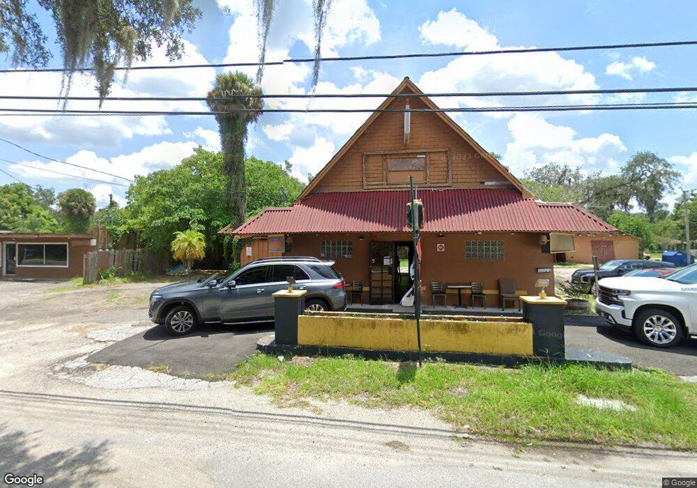
1204 E New York Ave de Land, FL 32724
Estimated Value: $566,589
--
Bed
2
Baths
2,104
Sq Ft
$269/Sq Ft
Est. Value
About This Home
This home is located at 1204 E New York Ave, de Land, FL 32724 and is currently estimated at $566,589, approximately $269 per square foot. 1204 E New York Ave is a home located in Volusia County with nearby schools including Blue Lake Elementary School, Deland High School, and Deland Middle School.
Ownership History
Date
Name
Owned For
Owner Type
Purchase Details
Closed on
May 23, 2025
Sold by
Willie Ray Beard Revocable Trust and Beard Willie Ray
Bought by
Mgt Enterprises Llc
Current Estimated Value
Purchase Details
Closed on
Apr 19, 2024
Sold by
Beard Willie R
Bought by
Willie Ray Beard Revocable Trust and Beard
Purchase Details
Closed on
Dec 31, 2002
Sold by
Pursley Ron C and Pursely Diane L
Bought by
Beard Willie R
Home Financials for this Owner
Home Financials are based on the most recent Mortgage that was taken out on this home.
Original Mortgage
$35,000
Interest Rate
6.16%
Mortgage Type
Commercial
Purchase Details
Closed on
Jun 15, 1989
Bought by
Beard Willie R
Purchase Details
Closed on
Apr 15, 1984
Bought by
Beard Willie R
Create a Home Valuation Report for This Property
The Home Valuation Report is an in-depth analysis detailing your home's value as well as a comparison with similar homes in the area
Home Values in the Area
Average Home Value in this Area
Purchase History
| Date | Buyer | Sale Price | Title Company |
|---|---|---|---|
| Mgt Enterprises Llc | $101,203 | None Listed On Document | |
| Willie Ray Beard Revocable Trust | $100 | None Listed On Document | |
| Willie Ray Beard Revocable Trust | $100 | None Listed On Document | |
| Beard Willie R | $200,000 | -- | |
| Beard Willie R | $100 | -- | |
| Beard Willie R | $150,000 | -- |
Source: Public Records
Mortgage History
| Date | Status | Borrower | Loan Amount |
|---|---|---|---|
| Previous Owner | Beard Willie R | $35,000 |
Source: Public Records
Tax History Compared to Growth
Tax History
| Year | Tax Paid | Tax Assessment Tax Assessment Total Assessment is a certain percentage of the fair market value that is determined by local assessors to be the total taxable value of land and additions on the property. | Land | Improvement |
|---|---|---|---|---|
| 2025 | $3,057 | $168,943 | $64,800 | $104,143 |
| 2024 | $3,057 | $168,150 | $64,800 | $103,350 |
| 2023 | $3,057 | $164,751 | $64,800 | $99,951 |
| 2022 | $2,896 | $157,765 | $64,800 | $92,965 |
| 2021 | $2,810 | $136,795 | $64,800 | $71,995 |
| 2020 | $3,086 | $150,319 | $55,080 | $95,239 |
| 2019 | $3,136 | $143,038 | $50,760 | $92,278 |
| 2018 | $3,106 | $139,735 | $48,600 | $91,135 |
| 2017 | $2,925 | $124,580 | $48,600 | $75,980 |
| 2016 | $2,734 | $118,398 | $0 | $0 |
| 2015 | $2,685 | $112,803 | $0 | $0 |
| 2014 | $2,646 | $111,313 | $0 | $0 |
Source: Public Records
Map
Nearby Homes
- 1304 Tilapia Trail
- 1307 Pup Fish Ln
- 206 Winslow Ave
- 1318 Pup Fish Ln
- 1401 E Carolina Ave
- 1401 E Voorhis Ave
- 151 N Hill Ave Unit 100
- 183 N Hill Ave Unit 90
- 239 N Hill Ave Unit 110
- 241 N Hill Ave
- 201 N Hill Ave Unit 150
- 217 N Hill Ave Unit 20
- 1402 E Voorhis Ave
- 318 S Massachusetts Ave
- 109 S Colorado Ave
- 311 S Hill Ave
- 1420 Wood St
- 418 Berwick Cir
- 1305 E Ohio Ave
- 319 Knot Way
- 1200 E New York Ave
- 1212 E New York Ave
- 1158 E New York Ave
- 1158 E Ave
- 140 Winslow Ave
- 175 Winslow Ave
- 1152 E New York Ave
- 150 S Massachusetts Ave
- 1310 E New York Ave
- 170 Winslow Ave
- 155 S Massachusetts Ave
- 185 Winslow Ave
- 190 Winslow Ave
- 195 Winslow Ave
- 1300 Tilapia Trail
- 202 S Massachusetts Ave
- 1315 E Howry Ave
- E Howry Ave
- 210 Winslow Ave
- 109 Pecan St