Estimated Value: $2,295,412
Studio
--
Bath
44,356
Sq Ft
$52/Sq Ft
Est. Value
About This Home
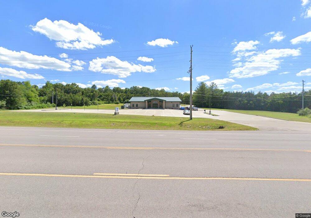
This home is located at 1204 E State Route 72, Rolla, MO 65401 and is currently estimated at $2,295,412, approximately $51 per square foot. 1204 E State Route 72 is a home located in Phelps County with nearby schools including Rolla Junior High School, Rolla Senior High School, and Rolla Seventh-Day Adventist School.
Ownership History
Date
Name
Owned For
Owner Type
Purchase Details
Closed on
Feb 10, 2023
Sold by
72 Centre Llc
Bought by
Rolla Pregnancy Resource Cente
Current Estimated Value
Home Financials for this Owner
Home Financials are based on the most recent Mortgage that was taken out on this home.
Original Mortgage
$1,480,000
Outstanding Balance
$1,424,547
Interest Rate
5.33%
Mortgage Type
Construction
Estimated Equity
$870,865
Create a Home Valuation Report for This Property
The Home Valuation Report is an in-depth analysis detailing your home's value as well as a comparison with similar homes in the area
Home Values in the Area
Average Home Value in this Area
Purchase History
| Date | Buyer | Sale Price | Title Company |
|---|---|---|---|
| Rolla Pregnancy Resource Cente | $1,850,000 | Other |
Source: Public Records
Mortgage History
| Date | Status | Borrower | Loan Amount |
|---|---|---|---|
| Open | Rolla Pregnancy Resource Cente | $1,480,000 |
Source: Public Records
Tax History
| Year | Tax Paid | Tax Assessment Tax Assessment Total Assessment is a certain percentage of the fair market value that is determined by local assessors to be the total taxable value of land and additions on the property. | Land | Improvement |
|---|---|---|---|---|
| 2025 | -- | $555,520 | $113,710 | $441,810 |
| 2024 | -- | $555,520 | $113,710 | $441,810 |
| 2023 | $32,164 | $555,520 | $113,710 | $441,810 |
| 2022 | $34,544 | $694,400 | $142,140 | $552,260 |
| 2021 | $34,762 | $694,400 | $142,140 | $552,260 |
| 2020 | $35,559 | $694,400 | $142,140 | $552,260 |
| 2019 | $35,375 | $694,400 | $142,140 | $552,260 |
| 2018 | $35,085 | $694,400 | $142,140 | $552,260 |
| 2017 | $35,027 | $694,400 | $142,140 | $552,260 |
| 2016 | $36,238 | $740,780 | $142,140 | $598,640 |
| 2015 | -- | $740,780 | $142,140 | $598,640 |
| 2014 | -- | $762,240 | $124,610 | $637,630 |
| 2013 | -- | $762,240 | $0 | $0 |
Source: Public Records
Map
Nearby Homes
- 38 Johnson Dr
- 814 Oxford Dr
- 1206 Elliott Dr
- 821 Cambridge Dr
- 1132 Leonard Ave
- 687 Salem Ave
- 60 Richard Dr
- 403 Hutchinson Dr
- 45 Mcfarland Dr
- 1102 Sycamore Dr
- Lot 74 B Cedar Hill Ct
- Lot 74 A Cedar Hill Ct
- 816 Laurel Dr
- 654 Holmes Ln
- 0 Sherwood Unit MIS25076064
- 622 Scottsvale Dr
- 807 Lariat Ln
- 0 Redbud Ln
- 708 E State Route 72
- 1608 Coventry Ln
- 802 Halifax Dr
- 804 Halifax Dr
- 600 Newcastle Dr
- 806 Halifax Dr
- 801 Halifax Dr
- 803 Halifax Dr
- 814 Halifax Dr
- 805 Halifax Dr
- 603 Newcastle Ct
- 608 Newcastle Dr
- 1111 Missouri 72
- 807 Halifax Dr
- 816 Halifax Dr
- 905 Hampton Ct
- 907 Hampton Ct
- 601 Newcastle Ct
- 601 Newcastle Ct
- 905 Hampton Ct
- 614 Brighton Ct
- 21 King Dr
Your Personal Tour Guide
Ask me questions while you tour the home.