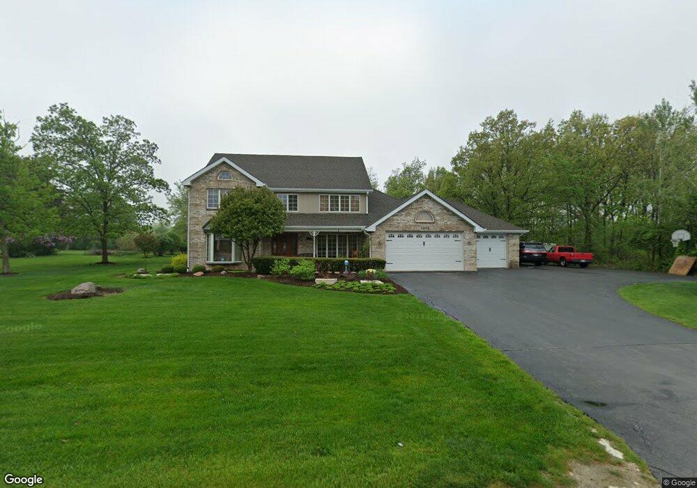
1204 Emerald Dr Lemont, IL 60439
West Lemont NeighborhoodEstimated Value: $556,000 - $820,000
3
Beds
3
Baths
2,925
Sq Ft
$229/Sq Ft
Est. Value
About This Home
This home is located at 1204 Emerald Dr, Lemont, IL 60439 and is currently estimated at $668,455, approximately $228 per square foot. 1204 Emerald Dr is a home located in Cook County with nearby schools including Oakwood School, River Valley School, and Old Quarry Middle School.
Ownership History
Date
Name
Owned For
Owner Type
Purchase Details
Closed on
Mar 31, 2008
Sold by
Burns John J and Burns Wendy L
Bought by
Burns John J and Burns Wendy L
Current Estimated Value
Purchase Details
Closed on
Feb 24, 2003
Sold by
Cantero Miguel and Cantero Michael A
Bought by
Cantero Michael A and Michael A Cantero Revocable Trust
Create a Home Valuation Report for This Property
The Home Valuation Report is an in-depth analysis detailing your home's value as well as a comparison with similar homes in the area
Home Values in the Area
Average Home Value in this Area
Purchase History
| Date | Buyer | Sale Price | Title Company |
|---|---|---|---|
| Burns John J | -- | None Available | |
| Cantero Michael A | -- | -- |
Source: Public Records
Tax History
| Year | Tax Paid | Tax Assessment Tax Assessment Total Assessment is a certain percentage of the fair market value that is determined by local assessors to be the total taxable value of land and additions on the property. | Land | Improvement |
|---|---|---|---|---|
| 2025 | $9,699 | $56,000 | $26,020 | $29,980 |
| 2024 | $9,699 | $56,000 | $26,020 | $29,980 |
| 2023 | $8,464 | $56,000 | $26,020 | $29,980 |
| 2022 | $8,464 | $43,731 | $10,008 | $33,723 |
| 2021 | $8,258 | $43,730 | $10,007 | $33,723 |
| 2020 | $8,467 | $43,730 | $10,007 | $33,723 |
| 2019 | $8,199 | $41,451 | $10,007 | $31,444 |
| 2018 | $8,070 | $41,451 | $10,007 | $31,444 |
| 2017 | $7,975 | $41,451 | $10,007 | $31,444 |
| 2016 | $7,927 | $38,543 | $8,006 | $30,537 |
| 2015 | $8,038 | $38,543 | $8,006 | $30,537 |
| 2014 | $8,144 | $38,543 | $8,006 | $30,537 |
| 2013 | $7,181 | $36,379 | $8,006 | $28,373 |
Source: Public Records
Map
Nearby Homes
- 15500 E 127th St
- 1025 Walter St
- 1023 Walter St
- 12755 Saint Andrews Ct Unit 302
- 1009 Walter St
- 1012 Warner Ave
- 5 Melissa Dr
- 1365 State St
- 1224 Prairie Ln
- 1228 Prairie Ln Unit 4B
- 1228 Prairie Ln
- 1232 Prairie Ln Unit 5-A
- 1236 Prairie Ln Unit 5-B
- 1204 Prairie Ln
- 1200 Prairie Ln Unit 1-A
- 15976 132nd St
- 1365 Gordon Ln
- 724 Ridge Rd
- 16511 Kayla Dr
- 508 Keepataw Dr
- 1206 Emerald Dr
- 15770 W 127th St
- 1205 Leinster Dr
- 1201 Leinster Dr
- 1208 Emerald Dr
- 1205 Emerald Dr
- 1211 Leinster Dr
- 15783 W 127th St
- 15747 W 127th St
- 1209 Emerald Dr
- 1212 Emerald Dr
- 1192 Walter St Unit C
- 15723 W 127th St
- 1213 Leinster Dr
- 15701 W 127th St
- 1206 Leinster Dr
- 1213 Emerald Dr
- 1216 Emerald Dr
- 1208 Leinster Dr
- 12260 Copper Ridge Dr Unit 39
Your Personal Tour Guide
Ask me questions while you tour the home.