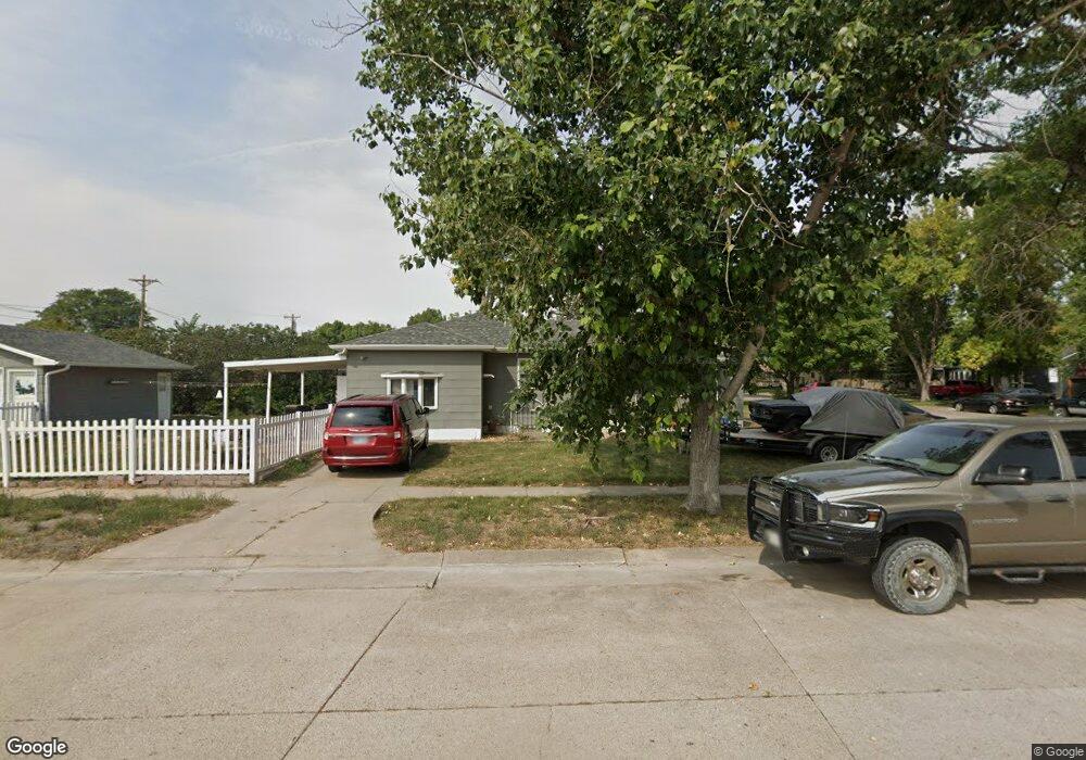
1204 Platte Ave Alliance, NE 69301
Estimated Value: $129,000 - $209,000
3
Beds
2
Baths
1,364
Sq Ft
$135/Sq Ft
Est. Value
About This Home
This home is located at 1204 Platte Ave, Alliance, NE 69301 and is currently estimated at $184,565, approximately $135 per square foot. 1204 Platte Ave is a home located in Box Butte County with nearby schools including Alliance High School, St. Agnes Academy, and Immanuel Evangelical Lutheran School.
Ownership History
Date
Name
Owned For
Owner Type
Purchase Details
Closed on
Mar 9, 2022
Sold by
Whitney Kevin J and Whitney Aubrey R
Bought by
Pryor Neil G
Current Estimated Value
Home Financials for this Owner
Home Financials are based on the most recent Mortgage that was taken out on this home.
Original Mortgage
$178,500
Outstanding Balance
$166,473
Interest Rate
3.76%
Mortgage Type
VA
Estimated Equity
$18,092
Purchase Details
Closed on
Aug 20, 2020
Sold by
Smaha Jack W
Bought by
Kevin Whitney J and Aubrey Whitney R
Purchase Details
Closed on
Dec 15, 2008
Sold by
Smaha Jack Warren and Smaha Marybelle
Bought by
Smith Jason A and Smith Cassandra L
Home Financials for this Owner
Home Financials are based on the most recent Mortgage that was taken out on this home.
Original Mortgage
$83,125
Interest Rate
6.08%
Mortgage Type
Purchase Money Mortgage
Create a Home Valuation Report for This Property
The Home Valuation Report is an in-depth analysis detailing your home's value as well as a comparison with similar homes in the area
Home Values in the Area
Average Home Value in this Area
Purchase History
| Date | Buyer | Sale Price | Title Company |
|---|---|---|---|
| Pryor Neil G | -- | New Title Company Name | |
| Kevin Whitney J | $171,000 | -- | |
| Smith Jason A | -- | Kunzman Title Co |
Source: Public Records
Mortgage History
| Date | Status | Borrower | Loan Amount |
|---|---|---|---|
| Open | Pryor Neil G | $178,500 | |
| Previous Owner | Smith Jason A | $83,125 |
Source: Public Records
Tax History Compared to Growth
Tax History
| Year | Tax Paid | Tax Assessment Tax Assessment Total Assessment is a certain percentage of the fair market value that is determined by local assessors to be the total taxable value of land and additions on the property. | Land | Improvement |
|---|---|---|---|---|
| 2024 | $2,133 | $171,125 | $8,400 | $162,725 |
| 2023 | $3,001 | $174,565 | $8,400 | $166,165 |
| 2022 | $2,193 | $120,445 | $7,560 | $112,885 |
| 2021 | $2,220 | $120,445 | $7,560 | $112,885 |
| 2020 | $2,214 | $120,445 | $7,560 | $112,885 |
| 2019 | $2,162 | $120,445 | $7,560 | $112,885 |
| 2018 | $2,152 | $120,445 | $7,560 | $112,885 |
| 2017 | $1,872 | $100,860 | $7,140 | $93,720 |
| 2016 | $1,850 | $100,860 | $7,140 | $93,720 |
| 2015 | $1,789 | $95,555 | $7,140 | $88,415 |
| 2014 | $1,789 | $95,325 | $7,140 | $88,185 |
Source: Public Records
Map
Nearby Homes
- 1239 Toluca Ave
- 1021 Dakota Ave
- 936 Platte Ave
- 1232 Cheyenne Ave
- 911 Emerson Ave
- 819 Black Hills Ave
- 924 Big Horn Ave
- 907 Toluca Ave
- 20th St Emerson Ave To Colorado Ave
- 1019 Laramie Ave
- 672 W 20th St
- 719 Toluca Ave
- 904 Laramie Ave
- 621 Emerson Ave
- 420 Laramie Ave
- 316 Big Horn Ave
- 2039 Niobrara Ave
- 1004 Missouri Ave
- 615 Sweetwater Ave
- 917 Missouri Ave
- 1208 Platte Ave
- 1212 Platte Ave
- 1124 Platte Ave
- 720 W 12th St
- 1216 Platte Ave
- 1120 Platte Ave
- 719 W 12th St
- 724 W 12th St
- 1203 Platte Ave
- 1220 Platte Ave
- 1207 Platte Ave
- 719 W 13th St
- 1211 Platte Ave
- 1123 Platte Ave
- 723 W 12th St
- 1215 Platte Ave
- 723 W 13th St
- 1119 Platte Ave
- 1108 Platte Ave
- 1219 Platte Ave