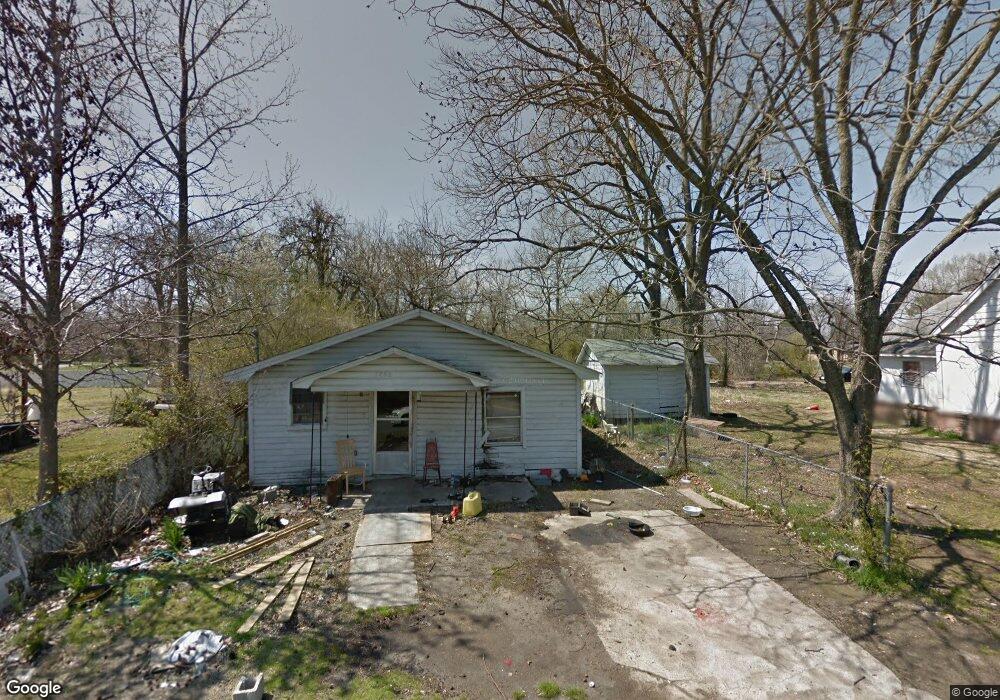
1204 S Fir St Pine Bluff, AR 71603
Estimated Value: $37,047 - $46,000
Studio
1
Bath
1,075
Sq Ft
$39/Sq Ft
Est. Value
About This Home
This home is located at 1204 S Fir St, Pine Bluff, AR 71603 and is currently estimated at $42,012, approximately $39 per square foot. 1204 S Fir St is a home located in Jefferson County with nearby schools including Coleman Elementary School, Edgewood Elementary School, and L.L. Owen Elementary School.
Ownership History
Date
Name
Owned For
Owner Type
Purchase Details
Closed on
Oct 9, 2017
Sold by
Herm Eric
Bought by
Casey James and Casey Julie
Current Estimated Value
Purchase Details
Closed on
Aug 4, 2016
Sold by
Commissioner Of State Lands State Of Ark
Bought by
386 Land Trust
Purchase Details
Closed on
Sep 9, 1992
Bought by
Batzos George
Purchase Details
Closed on
Aug 14, 1964
Bought by
Smith Asilee M
Create a Home Valuation Report for This Property
The Home Valuation Report is an in-depth analysis detailing your home's value as well as a comparison with similar homes in the area
Purchase History
| Date | Buyer | Sale Price | Title Company |
|---|---|---|---|
| Casey James | $820 | None Available | |
| 386 Land Trust | $150 | -- | |
| Batzos George | $5,000 | -- | |
| Smith Asilee M | -- | -- |
Source: Public Records
Tax History
| Year | Tax Paid | Tax Assessment Tax Assessment Total Assessment is a certain percentage of the fair market value that is determined by local assessors to be the total taxable value of land and additions on the property. | Land | Improvement |
|---|---|---|---|---|
| 2025 | $150 | $2,230 | $450 | $1,780 |
| 2024 | $150 | $2,230 | $450 | $1,780 |
| 2023 | $150 | $2,230 | $450 | $1,780 |
| 2022 | $129 | $2,100 | $250 | $1,850 |
| 2021 | $129 | $2,100 | $250 | $1,850 |
| 2020 | $129 | $2,100 | $250 | $1,850 |
| 2019 | $129 | $2,100 | $250 | $1,850 |
| 2018 | $129 | $2,100 | $250 | $1,850 |
| 2017 | $144 | $2,340 | $250 | $2,090 |
| 2016 | $144 | $2,340 | $250 | $2,090 |
| 2015 | $137 | $2,340 | $250 | $2,090 |
| 2014 | -- | $2,340 | $250 | $2,090 |
Source: Public Records
Map
Nearby Homes
- 2202 W 10th Ave
- 1211 S Birch St
- 3007 W 15th Ave
- 2001 W 16th Ave
- 5508 W 17th Ave
- 3412 W 12th Ave
- 1734 E Circle Dr
- 3215 Miramar Dr
- 1700 & 1702 W 15th Ave
- 77 Cypress Dr
- 3501 W 15th Ave
- 0 W 5th Ave
- 1815 E Circle Dr
- 1906 Edmar Dr
- 3411 W 7th Ave
- 1506 W 15th Ave Unit 1500 W 17th Ave, Pin
- 4208 W 10th Ave
- 3203 S Iris St
- 1405 W 9th Ave
- 3307 S Iris St
- 1200 S Fir St
- 1218 S Fir St Unit S
- 2516 W 12th Ave
- 2601 W 13th Ave
- 2514 W 12th Ave
- 2601 W 12th Ave
- 2509 W 13th Ave
- 2615 W 12th Ave
- 1112 S Fir St
- 1109 S Orange St
- S Orange
- 2500 W 12th Ave
- 2503 W 12th Ave
- 2618 W 13th Ave
- 2508 W 11th Ave
- 2501 W 12th Ave
- 1304 S Fir St
- 2506 W 11th Ave
- 2710 W 12th Ave
- 2520 W 13th Ave
Your Personal Tour Guide
Ask me questions while you tour the home.