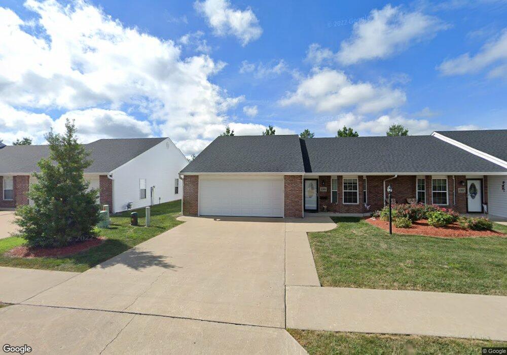
1204 Shepherds Dr Moberly, MO 65270
Estimated Value: $202,574 - $253,000
2
Beds
2
Baths
1,344
Sq Ft
$165/Sq Ft
Est. Value
About This Home
This home is located at 1204 Shepherds Dr, Moberly, MO 65270 and is currently estimated at $221,144, approximately $164 per square foot. 1204 Shepherds Dr is a home with nearby schools including Moberly Senior High School, St. Pius X. Catholic School, and Maranatha Seventh-day Adventist School.
Ownership History
Date
Name
Owned For
Owner Type
Purchase Details
Closed on
Mar 21, 2019
Sold by
Ogden Joseph and Ogden Nancy S
Bought by
Mcmanus Lori A and Cross Catherine A
Current Estimated Value
Purchase Details
Closed on
Jun 15, 2018
Sold by
Edwards Mildred and Edwards Randall K
Bought by
Ogden Joseph and Ogden Nancy
Home Financials for this Owner
Home Financials are based on the most recent Mortgage that was taken out on this home.
Original Mortgage
$101,600
Interest Rate
4.6%
Mortgage Type
New Conventional
Create a Home Valuation Report for This Property
The Home Valuation Report is an in-depth analysis detailing your home's value as well as a comparison with similar homes in the area
Home Values in the Area
Average Home Value in this Area
Purchase History
| Date | Buyer | Sale Price | Title Company |
|---|---|---|---|
| Mcmanus Lori A | -- | None Available | |
| Ogden Joseph | -- | -- |
Source: Public Records
Mortgage History
| Date | Status | Borrower | Loan Amount |
|---|---|---|---|
| Previous Owner | Ogden Joseph | $101,600 |
Source: Public Records
Tax History
| Year | Tax Paid | Tax Assessment Tax Assessment Total Assessment is a certain percentage of the fair market value that is determined by local assessors to be the total taxable value of land and additions on the property. | Land | Improvement |
|---|---|---|---|---|
| 2025 | $1,874 | $27,440 | $650 | $26,790 |
| 2024 | $19 | $25,730 | $570 | $25,160 |
| 2023 | $1,902 | $25,730 | $570 | $25,160 |
| 2022 | $1,783 | $24,760 | $570 | $24,190 |
| 2020 | $1,782 | $24,760 | $570 | $24,190 |
| 2019 | $1,778 | $24,760 | $570 | $24,190 |
| 2018 | $1,744 | $24,360 | $570 | $23,790 |
| 2017 | $1,740 | $24,360 | $0 | $0 |
| 2016 | $1,626 | $22,880 | $0 | $0 |
| 2014 | -- | $19,680 | $0 | $0 |
| 2013 | -- | $19,680 | $0 | $0 |
Source: Public Records
Map
Nearby Homes
- 1215 Shepherds Dr
- 1000 S Williams St
- 411 Shumate Ave
- 1365 Lantern Pointe Dr
- 501 W Longview St
- 1150 S Morley St
- 707 S 5th St
- 1339 Overland Ln
- 402 Halleck St
- 612 S 4th St
- 621 Gilman St
- LOT 2 County Rd
- 508 S Williams St
- 1701 S Williams St
- 709 Gilman St
- 4 Fair Oaks
- 311 Epperson St
- 309 S 4th St
- 321 S 5th St
- 216 S 5th St
- 1206 Shepherds Dr
- 1202 Shepherds Dr
- 1208 Shepherds Dr
- 1253 Shepherds Dr
- 1251 Shepherds Dr
- 1249 Shepherds Dr
- 1203 Shepherds Dr
- 1210 Shepherds Dr
- 1205 Shepherds Dr
- 1207 Shepherds Dr
- 1247 Shepherds Dr
- 1201 Shepherds Dr
- 1209 Shepherds Dr
- 1212 Shepherds Dr
- 1245 Shepherds Dr
- 1211 Shepherds Dr
- 1214 Shepherds Dr
- 1123 Lowry Ct
- 1213 Shepherds Dr
- 1254 Shepherds Dr
Your Personal Tour Guide
Ask me questions while you tour the home.