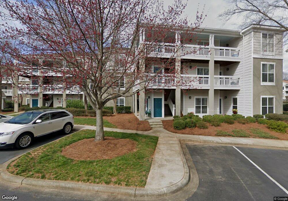
1204 Torrence Cir Unit 5 Davidson, NC 28036
Estimated Value: $603,000 - $651,000
3
Beds
2
Baths
1,425
Sq Ft
$440/Sq Ft
Est. Value
About This Home
This home is located at 1204 Torrence Cir Unit 5, Davidson, NC 28036 and is currently estimated at $626,883, approximately $439 per square foot. 1204 Torrence Cir Unit 5 is a home located in Mecklenburg County with nearby schools including Davidson Elementary School, William Amos Hough High School, and Davidson Day School.
Ownership History
Date
Name
Owned For
Owner Type
Purchase Details
Closed on
Nov 4, 2006
Sold by
Rowe John Benson
Bought by
Rowe Elise
Current Estimated Value
Purchase Details
Closed on
Jul 17, 2002
Sold by
Hart Fran Barber and Hart John Hall
Bought by
Liszeo Elise and Rowe John Benson
Home Financials for this Owner
Home Financials are based on the most recent Mortgage that was taken out on this home.
Original Mortgage
$128,800
Interest Rate
6.67%
Mortgage Type
Purchase Money Mortgage
Create a Home Valuation Report for This Property
The Home Valuation Report is an in-depth analysis detailing your home's value as well as a comparison with similar homes in the area
Home Values in the Area
Average Home Value in this Area
Purchase History
| Date | Buyer | Sale Price | Title Company |
|---|---|---|---|
| Rowe Elise | -- | None Available | |
| Liszeo Elise | $163,500 | -- |
Source: Public Records
Mortgage History
| Date | Status | Borrower | Loan Amount |
|---|---|---|---|
| Previous Owner | Liszeo Elise | $128,800 |
Source: Public Records
Tax History
| Year | Tax Paid | Tax Assessment Tax Assessment Total Assessment is a certain percentage of the fair market value that is determined by local assessors to be the total taxable value of land and additions on the property. | Land | Improvement |
|---|---|---|---|---|
| 2025 | -- | $445,012 | -- | $445,012 |
| 2024 | -- | $445,012 | -- | $445,012 |
| 2023 | $2,936 | $445,012 | $0 | $445,012 |
| 2022 | $2,936 | $323,700 | $0 | $323,700 |
| 2021 | $2,936 | $323,700 | $0 | $323,700 |
| 2020 | $2,936 | $323,700 | $0 | $323,700 |
| 2019 | $2,807 | $323,700 | $0 | $323,700 |
| 2018 | $2,807 | $231,800 | $90,000 | $141,800 |
| 2017 | $2,786 | $231,800 | $90,000 | $141,800 |
| 2016 | $2,783 | $231,800 | $90,000 | $141,800 |
| 2015 | $2,779 | $231,800 | $90,000 | $141,800 |
| 2014 | $2,777 | $283,500 | $100,000 | $183,500 |
Source: Public Records
Map
Nearby Homes
- 1125 Torrence Cir Unit 67
- 1113 Torrence Cir Unit 61
- 1018 Southwest Dr
- 854 Southwest Dr Unit 54
- 754 Southwest Dr Unit 5
- 753 Southwest Dr Unit 4
- 633 Portside Dr
- 306 Northwest Dr
- 345 Northwest Dr Unit 45
- 367 Northwest Dr Unit 67
- 21300 Carina Ln
- 21216 Norman Shores Dr
- 245 Davidson Gateway Dr
- 241 Davidson Gateway Dr
- 233 Davidson Gateway Dr
- 714 Northeast Dr Unit 44
- 714 Northeast Dr Unit 52
- 229 Davidson Gateway Dr
- 441 Delburg Mill Aly
- 930 Jetton St Unit 20
- 1205 Torrence Cir Unit 6
- 1203 Torrence Cir Unit 4
- 1207 Torrence Cir Unit 8
- 1200 Torrence Cir
- 1208 Torrence Cir Unit 9
- 1208 Torrence Cir Unit 1208
- 1201 Torrence Cir Unit 2
- 1201 Torrence Cir Unit 2U/F
- 1206 Torrence Cir
- 1202 Torrence Cir Unit 3
- 1211 Torrence Cir Unit 12
- 1237 Torrence Cir Unit 31
- 1226 Torrence Cir
- 1227 Torrence Cir Unit 21
- 1213 Torrence Cir Unit 14
- 1210 Torrence Cir Unit 11
- 1209 Torrence Cir
- 1213 Torrence Cir Unit 1213
- 1211 Torrence Cir Unit 1211
- 1141 Torrence Cir
Your Personal Tour Guide
Ask me questions while you tour the home.