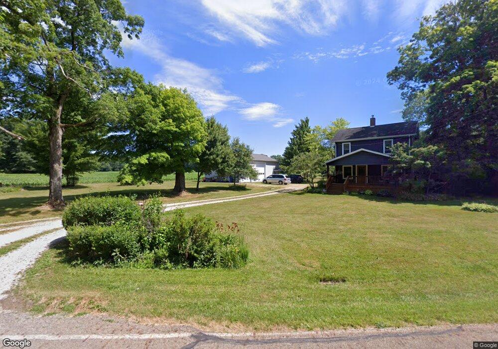
12040 Lair Rd NE Alliance, OH 44601
Estimated Value: $168,649 - $236,000
3
Beds
1
Bath
1,563
Sq Ft
$126/Sq Ft
Est. Value
About This Home
This home is located at 12040 Lair Rd NE, Alliance, OH 44601 and is currently estimated at $196,912, approximately $125 per square foot. 12040 Lair Rd NE is a home located in Stark County with nearby schools including Marlington High School.
Ownership History
Date
Name
Owned For
Owner Type
Purchase Details
Closed on
Dec 21, 2018
Sold by
Smith Timothy and Smith Roselea K
Bought by
Smith Teresa A
Current Estimated Value
Home Financials for this Owner
Home Financials are based on the most recent Mortgage that was taken out on this home.
Original Mortgage
$88,000
Outstanding Balance
$77,685
Interest Rate
4.9%
Mortgage Type
New Conventional
Estimated Equity
$119,227
Purchase Details
Closed on
Nov 18, 1992
Purchase Details
Closed on
Jul 27, 1992
Purchase Details
Closed on
Jul 21, 1992
Create a Home Valuation Report for This Property
The Home Valuation Report is an in-depth analysis detailing your home's value as well as a comparison with similar homes in the area
Home Values in the Area
Average Home Value in this Area
Purchase History
| Date | Buyer | Sale Price | Title Company |
|---|---|---|---|
| Smith Teresa A | $110,000 | Clear Title Solutions Inc | |
| -- | $40,500 | -- | |
| -- | $20,000 | -- | |
| -- | $32,000 | -- |
Source: Public Records
Mortgage History
| Date | Status | Borrower | Loan Amount |
|---|---|---|---|
| Open | Smith Teresa A | $88,000 |
Source: Public Records
Tax History Compared to Growth
Tax History
| Year | Tax Paid | Tax Assessment Tax Assessment Total Assessment is a certain percentage of the fair market value that is determined by local assessors to be the total taxable value of land and additions on the property. | Land | Improvement |
|---|---|---|---|---|
| 2025 | -- | $29,510 | $17,050 | $12,460 |
| 2024 | -- | $29,510 | $17,050 | $12,460 |
| 2023 | $1,135 | $32,130 | $15,400 | $16,730 |
| 2022 | $1,140 | $32,130 | $15,400 | $16,730 |
| 2021 | $1,143 | $32,130 | $15,400 | $16,730 |
| 2020 | $1,123 | $28,110 | $13,300 | $14,810 |
| 2019 | $1,115 | $28,320 | $13,300 | $15,020 |
| 2018 | $1,129 | $28,320 | $13,300 | $15,020 |
| 2017 | $1,016 | $23,810 | $6,760 | $17,050 |
| 2016 | $1,016 | $23,810 | $6,760 | $17,050 |
| 2015 | $1,162 | $28,670 | $6,860 | $21,810 |
| 2014 | $1,099 | $24,760 | $5,920 | $18,840 |
| 2013 | $547 | $24,760 | $5,920 | $18,840 |
Source: Public Records
Map
Nearby Homes
- German Church Street North E Unit LotWP001
- 12415 Snode St NE
- 12252 Snode St NE
- 0 German Church St NE
- 12355 Edison St NE
- 14350 Reeder Ave NE
- 11960 Freshley Ave NE
- 13975 Greenbower St NE
- 11940 Freshley Ave NE
- 13109 Edison St NE
- 5615 Laubert Rd
- 0 New Milford Rd Unit 5119787
- 11480 Aebi Ave NE
- 10666 Wilma Ave NE
- 0 Meadow St NE
- 14422 Sturbridge Rd NE
- 1015 Stroup Rd
- 0 Klinger Ave NE
- 13334 Cindy St NE
- 4829 Laubert Rd
- 11984 Lair Rd NE
- 11945 Lair Rd NE
- 11844 Lair Rd NE
- 11904 Lair Rd NE
- 12127 Lair Rd NE
- 11891 Lair Rd NE
- 13684 Mccallum Ave NE
- 13716 Mccallum Ave NE
- 13666 Mccallum Ave NE
- 13644 Mccallum Ave NE
- 13948 Mccallum Ave NE
- 14041 Lair Rd NE
- 13685 Mccallum Ave NE
- 13661 Mccallum Ave NE
- 13540 Mccallum Ave NE
- 13925 Mccallum Ave NE
- 14044 Lair Rd NE
- 14068 Mccallum Ave NE
- 13500 Mccallum Ave NE
- 13529 Mccallum Ave NE