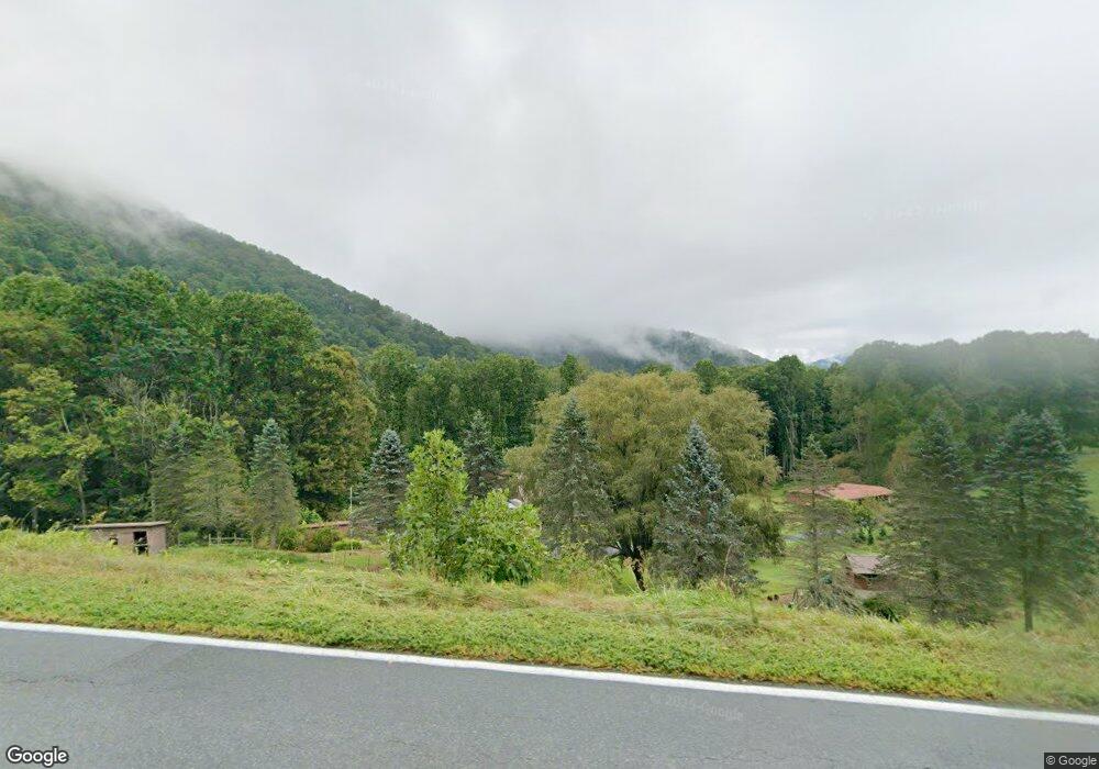
12040 State Highway 197 S Burnsville, NC 28714
Estimated Value: $184,553 - $284,000
3
Beds
1
Bath
1,200
Sq Ft
$197/Sq Ft
Est. Value
About This Home
This home is located at 12040 State Highway 197 S, Burnsville, NC 28714 and is currently estimated at $236,388, approximately $196 per square foot. 12040 State Highway 197 S is a home located in Yancey County with nearby schools including Mountain Heritage High School.
Ownership History
Date
Name
Owned For
Owner Type
Purchase Details
Closed on
Jun 20, 2023
Sold by
Daquin Gerard E and Daquin Deborah
Bought by
Davis Joshua and Davis Gabrielle
Current Estimated Value
Purchase Details
Closed on
May 27, 2021
Sold by
Aquin Gerard E D and Aquin Deborah D
Bought by
Butner Lisa Denise
Purchase Details
Closed on
May 26, 2021
Sold by
Wilson Peggy Atkins and Wilson Bill
Bought by
Daquin Deborah and Daquin Gerard E
Create a Home Valuation Report for This Property
The Home Valuation Report is an in-depth analysis detailing your home's value as well as a comparison with similar homes in the area
Home Values in the Area
Average Home Value in this Area
Purchase History
| Date | Buyer | Sale Price | Title Company |
|---|---|---|---|
| Davis Joshua | $130,000 | None Listed On Document | |
| Davis Joshua | $130,000 | None Listed On Document | |
| Butner Lisa Denise | $45,000 | Westcor Land Title Ins Co | |
| Daquin Deborah | $135,000 | None Available |
Source: Public Records
Tax History Compared to Growth
Tax History
| Year | Tax Paid | Tax Assessment Tax Assessment Total Assessment is a certain percentage of the fair market value that is determined by local assessors to be the total taxable value of land and additions on the property. | Land | Improvement |
|---|---|---|---|---|
| 2025 | $1,233 | $205,500 | $89,700 | $115,800 |
| 2024 | $1,233 | $205,500 | $89,700 | $115,800 |
| 2023 | $848 | $124,710 | $74,000 | $50,710 |
| 2022 | $831 | $124,710 | $74,000 | $50,710 |
| 2021 | $668 | $116,310 | $65,600 | $50,710 |
| 2020 | $791 | $116,310 | $65,600 | $50,710 |
| 2019 | $791 | $116,310 | $65,600 | $50,710 |
| 2018 | $791 | $116,310 | $65,600 | $50,710 |
| 2017 | $791 | $116,310 | $65,600 | $50,710 |
| 2016 | $768 | $116,310 | $65,600 | $50,710 |
| 2015 | $524 | $93,510 | $44,800 | $48,710 |
| 2014 | $524 | $93,510 | $44,800 | $48,710 |
Source: Public Records
Map
Nearby Homes
- 11820 State Highway 197 None S
- 596 N Ridge Runner Rd
- Lot 64 Hawks Nest Dr
- NA N Ridgerunner Rd
- 000 N Ridgerunner Rd Unit 92
- 377 S Ridgerunner Rd
- Lot 21 N Carolina 197
- 197 Eagle Bald Trail Unit 34
- 143 Daniel Boone Trail
- 165 Cattail Creek Rd
- 0000 Cattail Creek Rd
- 170 Mountain Farm Rd
- 616 Old Growth Forest Rd
- 88 Mountain Farm Rd
- Lots 61 and 62 Wildwood Dr
- Lot 9 Wormy Chestnut Rd
- TBD Wildwood Acres Dr Unit 16,17,23
- 370 Appaloosa Trail
- 26 Cold Spring Rd
- 346 Appaloosa Trail
- 356 Cc Allen Rd
- 200 Cc Allen Rd
- 374 Cc Allen Rd
- 164 Cc Allen Rd
- 12041 State Highway 197 S
- 11820 State Highway 197 S
- TBD State Highway 197 None S
- 12005 State Highway 197 S
- 12005 Highway 197 S
- 000 Cc Allen Rd
- 12460 State Highway 197 S
- 11828 State Highway 197 S
- 11828 State Hwy 197 Hwy S
- 70 Cc Allen Rd
- 11818 State Highway 197 S
- 12447 State Highway 197 S
- 197 197 South Lot 17
- 197 197 South Lot 16 Unit 16
- 197 197 South Lot 2 Unit 2
- 197 197 South Lot 29 Unit 29
