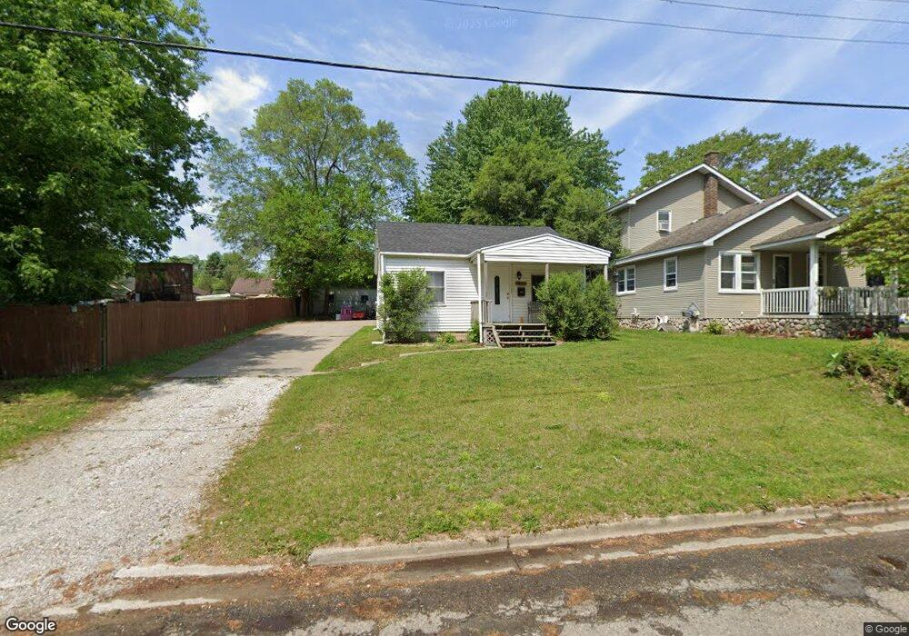
12045 Highland St Mount Morris, MI 48458
Estimated Value: $74,957 - $121,000
Studio
--
Bath
688
Sq Ft
$140/Sq Ft
Est. Value
About This Home
This home is located at 12045 Highland St, Mount Morris, MI 48458 and is currently estimated at $95,989, approximately $139 per square foot. 12045 Highland St is a home located in Genesee County with nearby schools including Elisabeth Ann Johnson High School and St. Mary's School.
Ownership History
Date
Name
Owned For
Owner Type
Purchase Details
Closed on
Feb 20, 2018
Sold by
Jarrard John
Bought by
First Secured Investment Group Llc
Current Estimated Value
Purchase Details
Closed on
Feb 15, 2018
Sold by
Genesse County Land Bank Authority
Bought by
Bigger Edith
Purchase Details
Closed on
Oct 14, 2017
Sold by
Ranney Dale and Ranney Meagan
Bought by
Jarrard John
Purchase Details
Closed on
Dec 22, 2014
Sold by
Genesee County Treasurer
Bought by
Genesee County Land Bank
Purchase Details
Closed on
Dec 2, 2004
Sold by
Walden Thomas H and Walden Kerrie
Bought by
Ranney Dale
Home Financials for this Owner
Home Financials are based on the most recent Mortgage that was taken out on this home.
Original Mortgage
$71,500
Interest Rate
5.83%
Mortgage Type
Purchase Money Mortgage
Purchase Details
Closed on
Jan 20, 2004
Sold by
Horton Walter and Horton Paula
Bought by
Rubbo Michael
Create a Home Valuation Report for This Property
The Home Valuation Report is an in-depth analysis detailing your home's value as well as a comparison with similar homes in the area
Home Values in the Area
Average Home Value in this Area
Purchase History
| Date | Buyer | Sale Price | Title Company |
|---|---|---|---|
| First Secured Investment Group Llc | -- | Lighthouse Title Inc | |
| Bigger Edith | -- | None Available | |
| Jarrard John | $1,000 | None Available | |
| Genesee County Land Bank | -- | None Available | |
| Ranney Dale | $71,500 | Lawyers Title | |
| Rubbo Michael | $42,000 | Guaranty Title Company |
Source: Public Records
Mortgage History
| Date | Status | Borrower | Loan Amount |
|---|---|---|---|
| Previous Owner | Ranney Dale | $71,500 |
Source: Public Records
Tax History
| Year | Tax Paid | Tax Assessment Tax Assessment Total Assessment is a certain percentage of the fair market value that is determined by local assessors to be the total taxable value of land and additions on the property. | Land | Improvement |
|---|---|---|---|---|
| 2025 | $1,296 | $33,600 | $0 | $0 |
| 2024 | $651 | $33,000 | $0 | $0 |
| 2023 | $622 | $29,600 | $0 | $0 |
| 2022 | $1,181 | $24,300 | $0 | $0 |
| 2021 | $1,170 | $21,200 | $0 | $0 |
| 2020 | $581 | $19,900 | $0 | $0 |
| 2019 | $572 | $16,300 | $0 | $0 |
| 2018 | $902 | $16,800 | $0 | $0 |
| 2017 | $817 | $15,500 | $0 | $0 |
| 2016 | $424 | $13,000 | $0 | $0 |
| 2015 | -- | $10,800 | $0 | $0 |
| 2014 | -- | $9,900 | $0 | $0 |
| 2012 | -- | $8,500 | $8,500 | $0 |
Source: Public Records
Map
Nearby Homes
- 8151 Benson Rd
- 8190 Roosevelt Ave
- 12210 W Washington Ave
- 328 W Mount Morris St
- 8250 Rockwood Ave
- 5372 W Mount Morris Rd
- 643 Roosevelt Ave
- 1095 Pine St
- 1477 W Mt Morris Rd
- 335 Beach St
- 1063 W Pine Ave
- 1501 Mount Morris Rd
- 11916 Saginaw St
- 1051 Pinehurst Blvd
- 4181 E Mount Morris Rd
- V/L Saginaw St
- V/L Washington Ave
- 705 Maple St
- 1053 Wisner St
- 11145 N Saginaw St
- 12063 Highland St
- 12040 Benson Rd
- 11951 Highland St
- 12010 Benson Rd
- 12137 Highland St
- 11942 Benson Rd
- 12070 Benson Rd
- 11947 Highland St
- 11956 Highland St
- 12138 Highland St
- 11938 Benson Rd
- 11952 Highland St
- 12072 Highland St
- 11945 Highland St
- 12148 Benson Rd
- 12094 Benson Rd
- 11934 Benson Rd
- 12142 Benson Rd
- 11943 Highland St
- 11950 Highland St
Your Personal Tour Guide
Ask me questions while you tour the home.