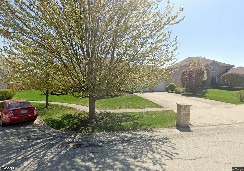
12046 Flint Dr Homer Glen, IL 60491
Estimated Value: $540,857 - $702,000
--
Bed
--
Bath
3,169
Sq Ft
$195/Sq Ft
Est. Value
About This Home
This home is located at 12046 Flint Dr, Homer Glen, IL 60491 and is currently estimated at $617,464, approximately $194 per square foot. 12046 Flint Dr is a home located in Will County with nearby schools including Goodings Grove School, Hadley Middle School, and Homer Jr High School.
Ownership History
Date
Name
Owned For
Owner Type
Purchase Details
Closed on
Aug 10, 1999
Sold by
Bosco Albert F and Bosco Mary F
Bought by
Mastorakos Chris and Mastorakos Maria
Current Estimated Value
Home Financials for this Owner
Home Financials are based on the most recent Mortgage that was taken out on this home.
Original Mortgage
$185,000
Outstanding Balance
$53,578
Interest Rate
7.75%
Estimated Equity
$563,886
Purchase Details
Closed on
May 30, 1996
Sold by
Colm Connolly Builders Inc
Bought by
Bosco Albert F and Bosco Mary F
Home Financials for this Owner
Home Financials are based on the most recent Mortgage that was taken out on this home.
Original Mortgage
$247,200
Interest Rate
7.37%
Purchase Details
Closed on
Dec 1, 1994
Sold by
Midamerica Fsb
Bought by
Colm Connolly Builders Inc
Create a Home Valuation Report for This Property
The Home Valuation Report is an in-depth analysis detailing your home's value as well as a comparison with similar homes in the area
Home Values in the Area
Average Home Value in this Area
Purchase History
| Date | Buyer | Sale Price | Title Company |
|---|---|---|---|
| Mastorakos Chris | $331,000 | -- | |
| Bosco Albert F | $309,000 | Chicago Title Insurance Co | |
| Colm Connolly Builders Inc | $55,000 | Chicago Title Insurance Co |
Source: Public Records
Mortgage History
| Date | Status | Borrower | Loan Amount |
|---|---|---|---|
| Open | Mastorakos Chris | $185,000 | |
| Previous Owner | Bosco Albert F | $247,200 |
Source: Public Records
Tax History Compared to Growth
Tax History
| Year | Tax Paid | Tax Assessment Tax Assessment Total Assessment is a certain percentage of the fair market value that is determined by local assessors to be the total taxable value of land and additions on the property. | Land | Improvement |
|---|---|---|---|---|
| 2024 | $11,984 | $181,069 | $43,723 | $137,346 |
| 2023 | $11,984 | $164,131 | $39,633 | $124,498 |
| 2022 | $11,083 | $153,251 | $37,006 | $116,245 |
| 2021 | $9,701 | $145,193 | $35,060 | $110,133 |
| 2020 | $10,124 | $139,851 | $33,770 | $106,081 |
| 2019 | $10,456 | $163,513 | $32,487 | $131,026 |
| 2018 | $12,501 | $157,865 | $32,114 | $125,751 |
| 2017 | $12,278 | $153,446 | $31,215 | $122,231 |
| 2016 | $11,986 | $148,329 | $30,174 | $118,155 |
| 2015 | $11,484 | $142,761 | $29,041 | $113,720 |
| 2014 | $11,484 | $139,811 | $28,441 | $111,370 |
| 2013 | $11,484 | $139,811 | $28,441 | $111,370 |
Source: Public Records
Map
Nearby Homes
- 14405 Creekwood Dr
- 14328 Pinewood Dr
- 14533 Mallard Dr
- 11901 Windemere Ct Unit 301
- 14225 Mallard Dr
- 11851 Windemere Ct Unit 201
- 11701 Waters Edge Trail
- 11501 W 143rd St
- 11901 Somerset Rd Unit 2
- 11637 Brookview Ln
- 14467 Creekview Dr
- 87 Windmill Rd
- 14124 Pheasant Ln
- 12360 Derby Ln
- 14561 S Appaloosa Ln
- 15022 S Woodcrest Ave Unit 3
- 137 Singletree Rd
- 12459 Rosewood Dr Unit 1
- 14042 Churchill Dr
- 80 Windmill Rd
- 12040 Flint Dr
- 12014 Flint Dr
- 12052 Flint Dr
- 12020 Flint Dr
- 12008 Flint Dr
- 12053 Flint Dr
- 12059 Flint Dr
- 12057 Flint Dr
- 12049 Flint Dr
- 12002 Flint Dr
- 12061 Flint Dr
- 12037 Flint Dr
- 12033 Flint Dr
- 12013 Flint Dr
- 12045 Flint Dr
- 12017 Flint Dr
- 12041 Flint Dr
- 12033 Meadowland Dr
- 12025 Meadowland Dr
- 12029 Flint Dr