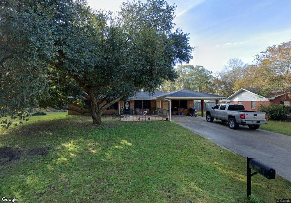
1205 Barnes Cir Monticello, MS 39654
Estimated Value: $123,190 - $179,000
3
Beds
2
Baths
1,736
Sq Ft
$84/Sq Ft
Est. Value
About This Home
This home is located at 1205 Barnes Cir, Monticello, MS 39654 and is currently estimated at $145,548, approximately $83 per square foot. 1205 Barnes Cir is a home located in Lawrence County with nearby schools including Monticello Elementary School, Rod Paige Middle School, and Lawrence County High School.
Ownership History
Date
Name
Owned For
Owner Type
Purchase Details
Closed on
Mar 4, 2023
Bought by
Tanner Case Benson
Current Estimated Value
Purchase Details
Closed on
Jul 17, 2017
Sold by
Case Sara K
Bought by
Ferguson Fcu
Purchase Details
Closed on
May 6, 2009
Sold by
Sutton Jimmy R
Bought by
Evans Robert Benton and Evans Amanda H
Home Financials for this Owner
Home Financials are based on the most recent Mortgage that was taken out on this home.
Original Mortgage
$80,000
Interest Rate
4.89%
Create a Home Valuation Report for This Property
The Home Valuation Report is an in-depth analysis detailing your home's value as well as a comparison with similar homes in the area
Purchase History
| Date | Buyer | Sale Price | Title Company |
|---|---|---|---|
| Tanner Case Benson | $80,000 | -- | |
| Ferguson Fcu | $85,950 | -- | |
| Evans Robert Benton | -- | -- |
Source: Public Records
Mortgage History
| Date | Status | Borrower | Loan Amount |
|---|---|---|---|
| Previous Owner | Evans Robert Benton | $80,000 |
Source: Public Records
Tax History
| Year | Tax Paid | Tax Assessment Tax Assessment Total Assessment is a certain percentage of the fair market value that is determined by local assessors to be the total taxable value of land and additions on the property. | Land | Improvement |
|---|---|---|---|---|
| 2025 | $1,014 | $7,529 | $0 | $0 |
| 2024 | $1,014 | $7,767 | $0 | $0 |
| 2023 | $991 | $7,767 | $0 | $0 |
| 2022 | $987 | $7,767 | $0 | $0 |
| 2021 | $960 | $7,767 | $0 | $0 |
| 2020 | $944 | $7,667 | $0 | $0 |
| 2019 | $923 | $7,667 | $0 | $0 |
| 2018 | $1,818 | $7,667 | $0 | $0 |
| 2017 | $1,818 | $11,501 | $0 | $0 |
| 2016 | $531 | $7,705 | $0 | $0 |
| 2015 | $463 | $7,705 | $0 | $0 |
| 2014 | $463 | $7,401 | $0 | $0 |
Source: Public Records
Map
Nearby Homes
- 1450 Barnes Cir
- 1610 Barnes Cir
- 1124 Smith Ln
- 351 E Mcpherson Dr
- 429 2nd Ave
- 23 Woodie Ln
- 857 Rockport Ave
- 914 Mary St
- 0 Light Plant Rd Unit LotWP001
- 74 Timberlane Rd
- 370 Roan Ready Rd
- 326 Roan Ready Rd
- 7 Bethel Rd
- Highway 84
- 81 Henry Cox Rd
- 11 Carsey Ln
- 167 Crawford Camp Ln
- 0 Cub Brown Rd
- 2697 River Rd
- 93 Hammond Rd
- 1113 Barnes Cir
- 1207 Barnes Cir
- 422 Mcpherson Dr
- 422 W Mcpherson Dr
- 424 Mcpherson Dr
- 420 W Mcpherson Dr
- 1116 Barnes Cir
- 1111 Barnes Cir
- 1227 Stormo Ave
- 1210 Barnes Cir
- 1109 Barnes Cir
- 1112 Barnes Cir
- 1247 Stormo Ave
- 1216 Barnes Cir
- 1107 Barnes Cir
- 1103 Barnes Cir
- 1110 Barnes Cir
- 1122 W Mcpherson Hwy
- 1212 Stormo Ave
- 1212 Stormo Ln
Your Personal Tour Guide
Ask me questions while you tour the home.