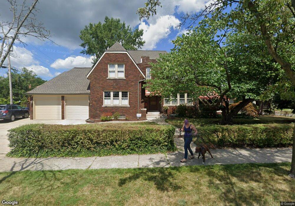
1205 Bedford Rd Grosse Pointe Park, MI 48230
Estimated Value: $543,835 - $695,000
Studio
1
Bath
2,546
Sq Ft
$246/Sq Ft
Est. Value
About This Home
This home is located at 1205 Bedford Rd, Grosse Pointe Park, MI 48230 and is currently estimated at $626,459, approximately $246 per square foot. 1205 Bedford Rd is a home located in Wayne County with nearby schools including George Defer Elementary School, Pierce Middle School, and Grosse Pointe South High School.
Ownership History
Date
Name
Owned For
Owner Type
Purchase Details
Closed on
Jan 30, 2008
Sold by
Roberge Christopher and Roberge Elizabeth
Bought by
Ezop Mark E
Current Estimated Value
Purchase Details
Closed on
Sep 22, 2004
Sold by
Osgood Denne J and Osgood Peggy J
Bought by
Roberge Christopher
Create a Home Valuation Report for This Property
The Home Valuation Report is an in-depth analysis detailing your home's value as well as a comparison with similar homes in the area
Home Values in the Area
Average Home Value in this Area
Purchase History
We collect this data history from publicly available records. To have your information removed, we recommend requesting removal directly through your county’s website.
| Date | Buyer | Sale Price | Title Company |
|---|---|---|---|
| Ezop Mark E | $326,500 | Greco | |
| Roberge Christopher | -- | Greco |
Source: Public Records
Tax History
| Year | Tax Paid | Tax Assessment Tax Assessment Total Assessment is a certain percentage of the fair market value that is determined by local assessors to be the total taxable value of land and additions on the property. | Land | Improvement |
|---|---|---|---|---|
| 2025 | $4,055 | $250,500 | $0 | $0 |
| 2024 | $3,903 | $233,900 | $0 | $0 |
| 2023 | $3,727 | $222,700 | $0 | $0 |
| 2022 | $3,541 | $217,500 | $0 | $0 |
| 2021 | $6,982 | $207,200 | $0 | $0 |
| 2019 | $7,185 | $175,000 | $0 | $0 |
| 2018 | $3,376 | $149,000 | $0 | $0 |
| 2017 | $7,698 | $98,100 | $0 | $0 |
| 2016 | $7,126 | $144,900 | $0 | $0 |
| 2015 | $12,635 | $137,800 | $0 | $0 |
| 2013 | $12,240 | $124,500 | $0 | $0 |
| 2012 | $3,452 | $131,200 | $46,800 | $84,400 |
Source: Public Records
Map
Nearby Homes
- 1150 Buckingham Rd
- 1350 Buckingham Rd
- 1206 Balfour St
- 1204 Kensington Ave
- 1043 Whittier Rd
- 1008 Berkshire Rd
- 3430 Bedford St
- 1044 Somerset Ave
- 3432 Buckingham Ave
- 3460 Bedford St
- 1254 Beaconsfield Ave
- 3467 Haverhill St
- 1330 Beaconsfield Ave
- 1020 Kensington Ave
- 943 Harcourt Rd Unit 45
- 16350 Mack Ave
- 3520 Audubon Rd
- 1373 Beaconsfield Ave
- 3619 Buckingham Ave
- 15545 Mack Ave
- 1211 Bedford Rd
- 1217 Bedford Rd
- 1179 Bedford Rd
- 1200 Devonshire Rd
- 1204 Bedford Rd
- 1216 Devonshire Rd
- 1223 Bedford Rd
- 1210 Bedford Rd
- 1178 Devonshire Rd
- 1171 Bedford Rd
- 1216 Bedford Rd
- 1180 Bedford Rd
- 1224 Devonshire Rd
- 1229 Bedford Rd
- 1222 Bedford Rd
- 1170 Devonshire Rd
- 1172 Bedford Rd
- 1169 Bedford Rd
- 1232 Devonshire Rd
- 1228 Bedford Rd
Your Personal Tour Guide
Ask me questions while you tour the home.