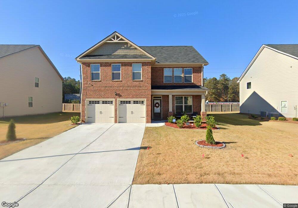
1205 Brookstone Cir Conyers, GA 30012
Estimated Value: $365,000 - $395,000
5
Beds
3
Baths
2,570
Sq Ft
$147/Sq Ft
Est. Value
About This Home
This home is located at 1205 Brookstone Cir, Conyers, GA 30012 and is currently estimated at $377,283, approximately $146 per square foot. 1205 Brookstone Cir is a home with nearby schools including Hicks Elementary School, Conyers Middle School, and Rockdale County High School.
Ownership History
Date
Name
Owned For
Owner Type
Purchase Details
Closed on
Apr 27, 2021
Sold by
Dr Horton Inc
Bought by
Reid Gordon Roslyn A and Gordon Dwight L
Current Estimated Value
Home Financials for this Owner
Home Financials are based on the most recent Mortgage that was taken out on this home.
Original Mortgage
$273,000
Outstanding Balance
$247,406
Interest Rate
3.1%
Mortgage Type
New Conventional
Estimated Equity
$129,877
Create a Home Valuation Report for This Property
The Home Valuation Report is an in-depth analysis detailing your home's value as well as a comparison with similar homes in the area
Home Values in the Area
Average Home Value in this Area
Purchase History
| Date | Buyer | Sale Price | Title Company |
|---|---|---|---|
| Reid Gordon Roslyn A | $287,440 | -- |
Source: Public Records
Mortgage History
| Date | Status | Borrower | Loan Amount |
|---|---|---|---|
| Open | Reid Gordon Roslyn A | $273,000 |
Source: Public Records
Tax History Compared to Growth
Tax History
| Year | Tax Paid | Tax Assessment Tax Assessment Total Assessment is a certain percentage of the fair market value that is determined by local assessors to be the total taxable value of land and additions on the property. | Land | Improvement |
|---|---|---|---|---|
| 2024 | $6,159 | $165,800 | $31,920 | $133,880 |
| 2023 | $5,373 | $147,160 | $30,800 | $116,360 |
| 2022 | $4,405 | $120,160 | $24,240 | $95,920 |
| 2021 | $1,343 | $18,800 | $18,800 | $0 |
| 2020 | $801 | $12,880 | $12,880 | $0 |
| 2019 | $232 | $3,160 | $3,160 | $0 |
| 2018 | $142 | $3,160 | $3,160 | $0 |
| 2017 | $193 | $3,160 | $3,160 | $0 |
| 2016 | $194 | $3,160 | $3,160 | $0 |
| 2015 | $144 | $3,160 | $3,160 | $0 |
| 2014 | $55 | $1,200 | $1,200 | $0 |
| 2013 | -- | $1,200 | $1,200 | $0 |
Source: Public Records
Map
Nearby Homes
- 1217 Brookstone Cir
- 1262 Brookstone Cir
- 1260 Brookstone Cir
- 1469 Cliff View Terrace
- 1666 E Brook Dr
- 1669 E Brook Dr
- 1526 Battle Brook Dr
- 1915 Cornerstone Pass
- 1492 Saint George Place
- 1903 Cobblestone Ct
- 0 Sigman Rd NE Unit 10655367
- 2131 Bridgestone Business Pkwy
- 1962 Bridgestone Cir
- 2089 Belmont Cir
- 1954 Bridgestone Cir
- 1255 Norton Rd NE
- 2102 Belmont Cir
- 2140 Belmont Cir
- 2144 Belmont Cir
- 1170 Eastview Rd NE
- 1207 Brookstone Cir
- 1203 Brookstone Cir
- 1209 Brookstone Cir
- 1201 Brookstone Cir
- 1202 Brookstone Cir
- 1204 Brookstone Cir
- 1206 Brookstone Cir
- 1200 Brookstone Cir
- 1200 Brookstone Cir Unit 12
- 1211 Brookstone Cir
- 1208 Brookstone Cir
- 1313 Brookstone Lake Dr
- 1213 Brookstone Cir
- 1210 Brookstone Cir
- 1315 Brookstone Lake Dr
- 1304 Brookstone Lake Dr
- 1212 Brookstone Cir
- 1212 Brookstone Cir
- 1317 Brookstone Lake Dr
- 1306 Brookstone Lake Dr