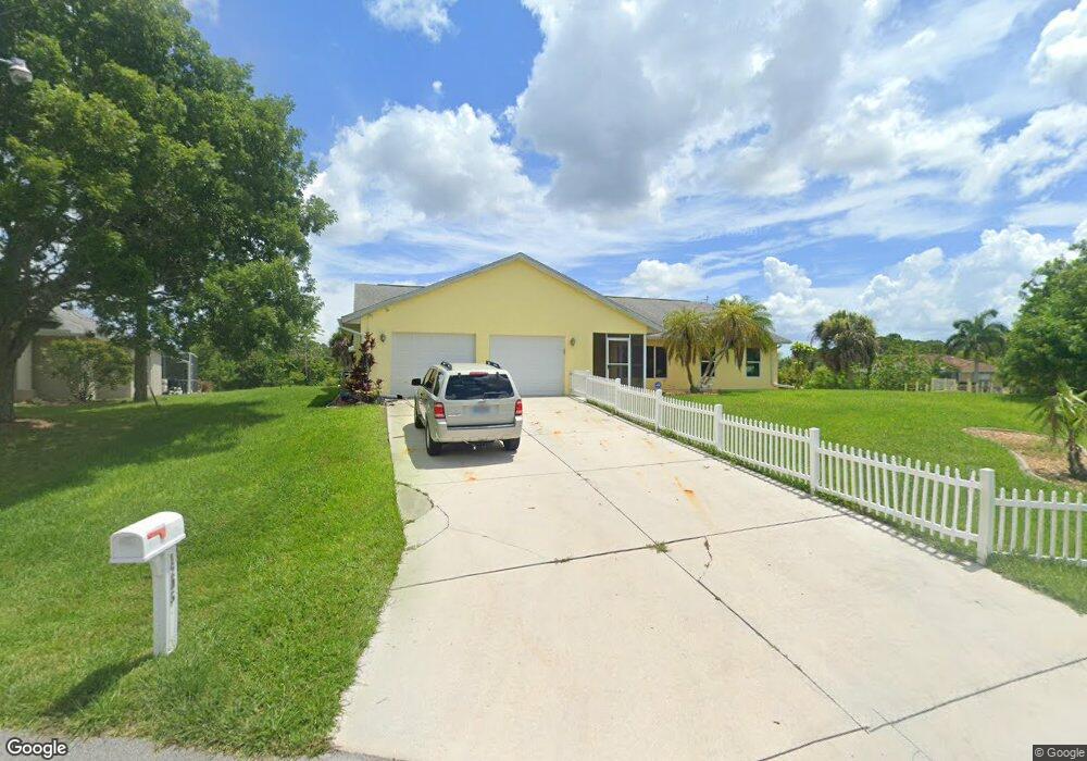
1205 Cheshire St Port Charlotte, FL 33953
Northwest Port Charlotte NeighborhoodEstimated Value: $338,000 - $512,591
3
Beds
4
Baths
2,578
Sq Ft
$166/Sq Ft
Est. Value
About This Home
This home is located at 1205 Cheshire St, Port Charlotte, FL 33953 and is currently estimated at $427,898, approximately $165 per square foot. 1205 Cheshire St is a home located in Charlotte County with nearby schools including Liberty Elementary School, Murdock Middle School, and Port Charlotte High School.
Ownership History
Date
Name
Owned For
Owner Type
Purchase Details
Closed on
Aug 11, 2015
Sold by
Colby Carrie Rose and Estate Of Brian J O Neil
Bought by
Mosbacker Scott and Mosbacker Cynthia
Current Estimated Value
Purchase Details
Closed on
May 7, 2012
Sold by
Dingas Emmeline
Bought by
Oneil Brian J and Oneil Timothy M
Purchase Details
Closed on
Dec 10, 2009
Sold by
Dingas Emmeline
Bought by
Dingas Emmeline and Dingas Robert L
Purchase Details
Closed on
Oct 1, 2003
Sold by
Dingas Emmeline
Bought by
Dingas Emmeline
Create a Home Valuation Report for This Property
The Home Valuation Report is an in-depth analysis detailing your home's value as well as a comparison with similar homes in the area
Home Values in the Area
Average Home Value in this Area
Purchase History
| Date | Buyer | Sale Price | Title Company |
|---|---|---|---|
| Mosbacker Scott | $200,000 | Attorney | |
| Oneil Brian J | $130,000 | Burnt Store Title & Escrow L | |
| Dingas Emmeline | -- | Attorney | |
| Dingas Emmeline | -- | -- |
Source: Public Records
Tax History Compared to Growth
Tax History
| Year | Tax Paid | Tax Assessment Tax Assessment Total Assessment is a certain percentage of the fair market value that is determined by local assessors to be the total taxable value of land and additions on the property. | Land | Improvement |
|---|---|---|---|---|
| 2023 | $2,419 | $141,378 | $86,057 | $55,321 |
| 2022 | $4,747 | $285,159 | $0 | $0 |
| 2021 | $4,759 | $276,853 | $0 | $0 |
| 2020 | $4,692 | $273,031 | $0 | $0 |
| 2019 | $4,262 | $248,300 | $0 | $0 |
| 2018 | $3,307 | $202,908 | $0 | $0 |
| 2017 | $3,279 | $198,735 | $0 | $0 |
| 2016 | $3,431 | $195,276 | $0 | $0 |
| 2015 | $3,642 | $157,703 | $0 | $0 |
| 2014 | $3,187 | $143,366 | $0 | $0 |
Source: Public Records
Map
Nearby Homes
- 1211 Cheshire St
- 1188 Beekman Cir
- 12306 Defender Dr
- 12332 Corporal Cir
- 1217 Beekman Cir
- 12256 Corporal Cir
- 12280 Greenleaf Ln
- 1124 Cheshire St
- 12333 Koenig Ln
- 1225 Beekman Cir
- 12357 Koenig Ln
- 12324 Koenig Ln
- 12281 Greenleaf Ln
- 12345 Greenleaf Ln
- 12360 Greenleaf Ln
- 12266 Defender Dr
- 12373 Toynbee Ln
- 12349 Toynbee Ln
- 12262 Toynbee Ln
- 12359 Corporal Cir
- 1199 Cheshire St
- 1217 Cheshire St
- 1216 Cheshire St
- 1162 Beekman Cir
- 1152 Beekman Cir
- 1144 Beekman Cir
- 1168 Cheshire St
- 12296 Corporal Cir
- 1134 Beekman Cir
- 12288 Corporal Cir
- 1181 Cheshire St
- 12304 Corporal Cir
- 1235 Cheshire St
- 12324 Defender Dr
- 12336 Defender Dr
- 1169 Cheshire St
- 12280 Corporal Cir
- 1122 Beekman Cir
- 1193 Beekman Cir