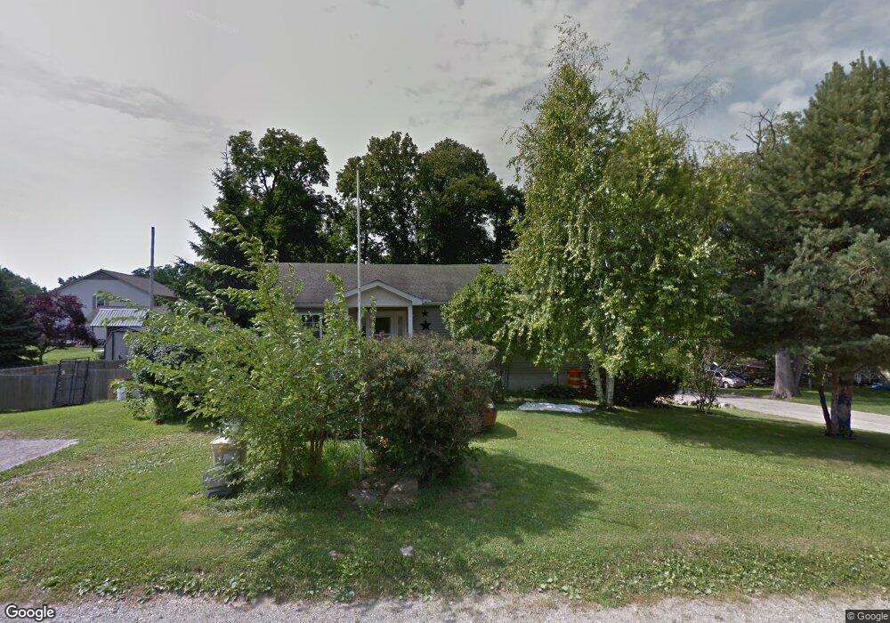
1205 Justin Ave Jackson, MI 49203
Estimated Value: $203,000 - $220,000
2
Beds
3
Baths
1,456
Sq Ft
$144/Sq Ft
Est. Value
About This Home
This home is located at 1205 Justin Ave, Jackson, MI 49203 and is currently estimated at $209,491, approximately $143 per square foot. 1205 Justin Ave is a home located in Jackson County with nearby schools including Townsend Elementary School, Vandercook Lake High School, and Jackson Preparatory & Early College.
Ownership History
Date
Name
Owned For
Owner Type
Purchase Details
Closed on
Jan 22, 2018
Sold by
Hamisfar Kenneth S and Hamisfar Lisa
Bought by
Hamisfar Lisa
Current Estimated Value
Purchase Details
Closed on
Dec 30, 2005
Sold by
Wood Brian D and Wood Mary A
Bought by
Hamisfar Kenneth S and Hamisfar Lisa
Home Financials for this Owner
Home Financials are based on the most recent Mortgage that was taken out on this home.
Original Mortgage
$132,000
Outstanding Balance
$74,501
Interest Rate
6.34%
Mortgage Type
Fannie Mae Freddie Mac
Estimated Equity
$134,990
Create a Home Valuation Report for This Property
The Home Valuation Report is an in-depth analysis detailing your home's value as well as a comparison with similar homes in the area
Home Values in the Area
Average Home Value in this Area
Purchase History
| Date | Buyer | Sale Price | Title Company |
|---|---|---|---|
| Hamisfar Lisa | -- | None Available | |
| Hamisfar Kenneth S | $165,000 | At |
Source: Public Records
Mortgage History
| Date | Status | Borrower | Loan Amount |
|---|---|---|---|
| Open | Hamisfar Kenneth S | $132,000 |
Source: Public Records
Tax History
| Year | Tax Paid | Tax Assessment Tax Assessment Total Assessment is a certain percentage of the fair market value that is determined by local assessors to be the total taxable value of land and additions on the property. | Land | Improvement |
|---|---|---|---|---|
| 2025 | $2,423 | $99,300 | $0 | $0 |
| 2024 | $16 | $87,800 | $0 | $0 |
| 2023 | $1,517 | $79,200 | $0 | $0 |
| 2022 | $2,426 | $69,800 | $0 | $0 |
| 2021 | $2,520 | $84,800 | $0 | $0 |
| 2020 | $2,486 | $75,600 | $0 | $0 |
| 2019 | $2,279 | $69,100 | $0 | $0 |
| 2018 | $2,222 | $69,000 | $0 | $0 |
| 2017 | $1,972 | $67,800 | $0 | $0 |
| 2016 | $1,301 | $65,800 | $65,800 | $0 |
| 2015 | $1,878 | $58,300 | $58,300 | $0 |
| 2014 | $1,878 | $55,600 | $0 | $0 |
| 2013 | -- | $55,600 | $55,600 | $0 |
Source: Public Records
Map
Nearby Homes
- 4711 Draper Rd
- 172 Taylor Ave Unit 84
- 1400 Floyd Ave
- 323 S Maurice Ave
- 1248 Upper Lucy #111 Unit 111
- 1 Pete St Unit 39
- 5400 Sharon Dr
- 406 E Mcdevitt Ave
- 5182 Grande View Ln
- 4030 Gatewood Dr
- 204 Meyers Ave
- VL S Meridian Rd
- 206 W Vandercook Dr
- 118 Ridge St
- 108 S Cove St
- VL Hague Ave
- 411 Hinckley Blvd
- 615 Sioux St
- 5472 S Meridian Rd
- 6000 Riverview Dr Unit 5
- 510 Comstock St
- 800 Bagg Ave
- 1107 Justin Ave
- 508 Bagg Ave
- 517 Bagg Ave
- 408 Comstock St
- 411 Bagg Ave
- 0 Comstock St Unit G31235681
- 0 Comstock St Unit G31276727
- 0 Comstock St Unit COMSTOCK 31235681
- 0 Comstock St Unit COMSTOCK
- 410 Bagg Ave
- 410 Bagg Ave
- 501 Vera Cruz St
- 501 Comstock St
- 512 Comstock St
- 505 Vera Cruz St
- 507 Comstock St
- 407 Bagg Ave
- 409 Vera Cruz St
Your Personal Tour Guide
Ask me questions while you tour the home.