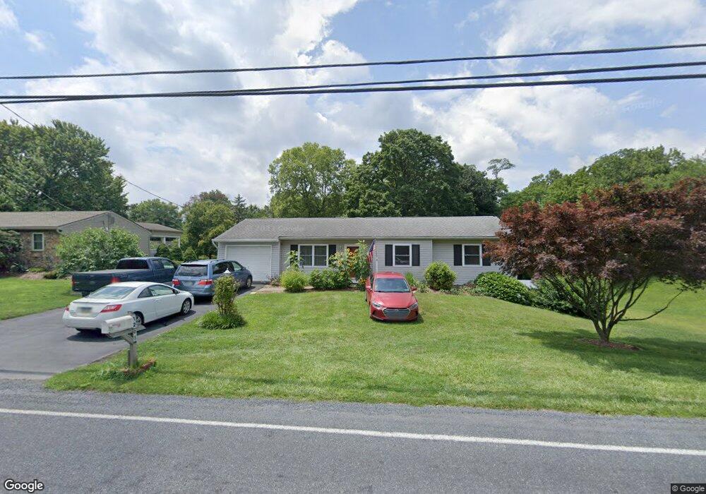
1205 Lambs Gap Rd Mechanicsburg, PA 17050
Hampden NeighborhoodEstimated Value: $344,369 - $383,000
3
Beds
2
Baths
1,686
Sq Ft
$218/Sq Ft
Est. Value
About This Home
This home is located at 1205 Lambs Gap Rd, Mechanicsburg, PA 17050 and is currently estimated at $368,342, approximately $218 per square foot. 1205 Lambs Gap Rd is a home located in Cumberland County with nearby schools including Winding Creek Elementary School, Mountain View Middle School, and Cumberland Valley High School.
Ownership History
Date
Name
Owned For
Owner Type
Purchase Details
Closed on
May 20, 2005
Sold by
Miller William
Bought by
Mitchell Joel A
Current Estimated Value
Home Financials for this Owner
Home Financials are based on the most recent Mortgage that was taken out on this home.
Original Mortgage
$120,000
Outstanding Balance
$63,010
Interest Rate
5.95%
Mortgage Type
New Conventional
Estimated Equity
$305,332
Create a Home Valuation Report for This Property
The Home Valuation Report is an in-depth analysis detailing your home's value as well as a comparison with similar homes in the area
Home Values in the Area
Average Home Value in this Area
Purchase History
| Date | Buyer | Sale Price | Title Company |
|---|---|---|---|
| Mitchell Joel A | $170,000 | -- |
Source: Public Records
Mortgage History
| Date | Status | Borrower | Loan Amount |
|---|---|---|---|
| Open | Mitchell Joel A | $120,000 |
Source: Public Records
Tax History Compared to Growth
Tax History
| Year | Tax Paid | Tax Assessment Tax Assessment Total Assessment is a certain percentage of the fair market value that is determined by local assessors to be the total taxable value of land and additions on the property. | Land | Improvement |
|---|---|---|---|---|
| 2025 | $3,104 | $207,400 | $64,100 | $143,300 |
| 2024 | $2,942 | $207,400 | $64,100 | $143,300 |
| 2023 | $2,781 | $207,400 | $64,100 | $143,300 |
| 2022 | $2,707 | $207,400 | $64,100 | $143,300 |
| 2021 | $2,643 | $207,400 | $64,100 | $143,300 |
| 2020 | $2,589 | $207,400 | $64,100 | $143,300 |
| 2019 | $2,543 | $207,400 | $64,100 | $143,300 |
| 2018 | $2,496 | $207,400 | $64,100 | $143,300 |
| 2017 | $2,448 | $207,400 | $64,100 | $143,300 |
| 2016 | -- | $207,400 | $64,100 | $143,300 |
| 2015 | -- | $207,400 | $64,100 | $143,300 |
| 2014 | -- | $207,400 | $64,100 | $143,300 |
Source: Public Records
Map
Nearby Homes
- 1109 E Powderhorn Rd
- 1431 Summit Way
- 110 Balfour Dr
- 6331 Bennington Rd
- 6205 Galleon Dr
- 6223 Stanford Ct
- 1167 Cross Creek Dr
- 1 Bridgeport Dr
- 5 Gunpowder Rd
- 1650 Shady Maple Ct
- 6206 Westover Dr
- Lots 2, 3, and 4 Jerusalem Rd
- 1555 Revere Dr
- 1501 Dalkeith Dr
- 22 Gunpowder Rd
- 2 Freedom Ct
- 122 Silver Dr Unit ANDREWS
- 122 Silver Dr Unit ETHAN
- 122 Silver Dr Unit ADDISON
- 6304 Creekbend Dr
- 1203 Lambs Gap Rd
- 1207 Lambs Gap Rd
- 6400 Cannon Dr
- 6402 Cannon Dr
- 6402 Lexington Dr
- 6403 Lexington Dr
- 6405 Lexington Dr
- 1122 W Powderhorn Rd
- 6404 Cannon Dr
- 6359 N Powderhorn Rd
- 6357 N Powderhorn Rd
- 1124 W Powderhorn Rd
- 6401 Cannon Dr
- 6407 Lexington Dr
- 6406 Cannon Dr
- 6403 Cannon Dr
- 1206 Gunstock Ln
- 6404 Lexington Dr
- 6405 Cannon Dr
- 1202 Gunstock Ln