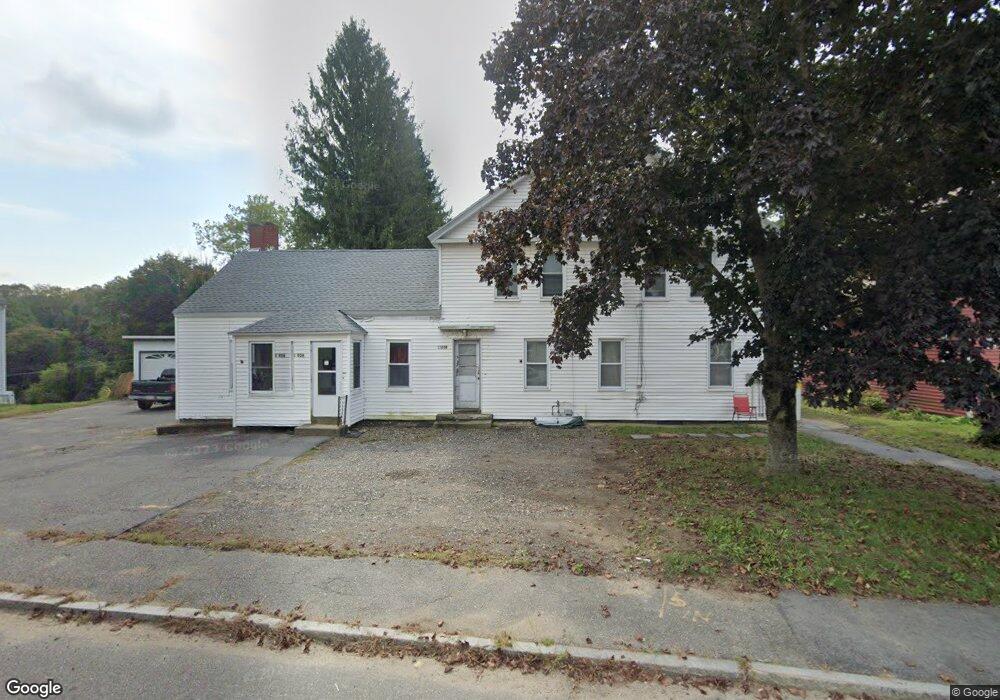
1205 Main St Warren, MA 01083
Estimated Value: $333,000 - $393,000
8
Beds
3
Baths
3,271
Sq Ft
$109/Sq Ft
Est. Value
About This Home
This home is located at 1205 Main St, Warren, MA 01083 and is currently estimated at $356,667, approximately $109 per square foot. 1205 Main St is a home located in Worcester County with nearby schools including Quaboag Regional High School.
Ownership History
Date
Name
Owned For
Owner Type
Purchase Details
Closed on
Dec 30, 2008
Sold by
Long Beach Mtg Loan T and Deutsche Bank Natl T C
Bought by
Jacques Robert T
Current Estimated Value
Purchase Details
Closed on
May 19, 2008
Sold by
Picco John L and Long Beach Mtg Loan T
Bought by
Deutsche Bank Natl T C and Long Beach Mtg Loan T
Purchase Details
Closed on
Aug 18, 1997
Sold by
Balchunas Ella R
Bought by
Picco John L
Home Financials for this Owner
Home Financials are based on the most recent Mortgage that was taken out on this home.
Original Mortgage
$68,400
Interest Rate
7.56%
Mortgage Type
Purchase Money Mortgage
Create a Home Valuation Report for This Property
The Home Valuation Report is an in-depth analysis detailing your home's value as well as a comparison with similar homes in the area
Home Values in the Area
Average Home Value in this Area
Purchase History
| Date | Buyer | Sale Price | Title Company |
|---|---|---|---|
| Jacques Robert T | $31,000 | -- | |
| Jacques Robert T | $31,000 | -- | |
| Deutsche Bank Natl T C | $112,000 | -- | |
| Deutsche Bank Natl T C | $112,000 | -- | |
| Picco John L | $85,500 | -- | |
| Picco John L | $85,500 | -- |
Source: Public Records
Mortgage History
| Date | Status | Borrower | Loan Amount |
|---|---|---|---|
| Previous Owner | Picco John L | $81,600 | |
| Previous Owner | Picco John L | $68,400 |
Source: Public Records
Tax History Compared to Growth
Tax History
| Year | Tax Paid | Tax Assessment Tax Assessment Total Assessment is a certain percentage of the fair market value that is determined by local assessors to be the total taxable value of land and additions on the property. | Land | Improvement |
|---|---|---|---|---|
| 2025 | $3,399 | $229,500 | $42,400 | $187,100 |
| 2024 | $3,459 | $229,500 | $42,400 | $187,100 |
| 2023 | $3,365 | $213,000 | $42,400 | $170,600 |
| 2022 | $2,967 | $190,700 | $36,600 | $154,100 |
| 2021 | $94 | $178,000 | $34,500 | $143,500 |
| 2020 | $2,867 | $167,100 | $34,500 | $132,600 |
| 2019 | $2,870 | $158,100 | $34,500 | $123,600 |
| 2018 | $127 | $152,800 | $34,500 | $118,300 |
| 2017 | $129 | $147,200 | $35,900 | $111,300 |
| 2016 | $2,793 | $140,800 | $34,200 | $106,600 |
| 2015 | $2,640 | $140,800 | $34,200 | $106,600 |
| 2014 | $2,689 | $140,800 | $34,200 | $106,600 |
Source: Public Records
Map
Nearby Homes
- 44 Mill St
- 21 Hitchcock Ave
- 72 Maple St
- 233 Maple St
- 0 Town Farm Rd
- Lot 4 Brimfield Rd
- 35 Bacon St
- 82 Comins Pond Rd
- 58 Nelson St
- Lot 3 Brimfield Rd
- Lot 5 Brimfield Rd
- Lot 8 Southbridge Rd
- LOT 7 Southbridge Rd
- Lot 3 Reed St
- Lot 7 Reed St
- Lot 6 Reed St
- Lot 4 Reed St
- 38 Elm St
- 124 Southbridge Rd
- 31 Carpenter St
- 1205 Main St
- 1213 Main St
- 1215 Main St
- 1197 Main St
- 1210 Main St
- 1231 Main St
- 1224 Main St
- 1277 Main St Unit B
- 1235 Main St
- 1172 Main St
- 0 Bridge St Unit 70760753
- 0 Bridge St Unit 71228817
- 0 Bridge St Unit 71344088
- 0 Bridge St Unit 71504533
- 1241 Main St
- 1241 Main St
- 1241 Main St Unit 1
- 1172 Main St
- 21 Moore Ave
- 13 Mill St Unit 5