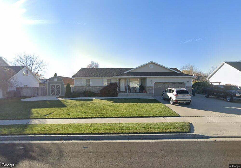
1205 N 280 W American Fork, UT 84003
Estimated Value: $543,000 - $589,000
3
Beds
2
Baths
1,462
Sq Ft
$390/Sq Ft
Est. Value
About This Home
This home is located at 1205 N 280 W, American Fork, UT 84003 and is currently estimated at $569,647, approximately $389 per square foot. 1205 N 280 W is a home located in Utah County with nearby schools including Legacy Elementary School, American Fork Junior High School, and American Fork High School.
Ownership History
Date
Name
Owned For
Owner Type
Purchase Details
Closed on
Nov 14, 2019
Sold by
Edwards Randy F and Edwards Nancybrooke
Bought by
Edwards Randy Forrest and Edwards Nancy Brooke
Current Estimated Value
Create a Home Valuation Report for This Property
The Home Valuation Report is an in-depth analysis detailing your home's value as well as a comparison with similar homes in the area
Home Values in the Area
Average Home Value in this Area
Purchase History
| Date | Buyer | Sale Price | Title Company |
|---|---|---|---|
| Edwards Randy Forrest | -- | None Available |
Source: Public Records
Tax History Compared to Growth
Tax History
| Year | Tax Paid | Tax Assessment Tax Assessment Total Assessment is a certain percentage of the fair market value that is determined by local assessors to be the total taxable value of land and additions on the property. | Land | Improvement |
|---|---|---|---|---|
| 2025 | $2,358 | $285,230 | $223,800 | $294,800 |
| 2024 | $2,358 | $262,020 | $0 | $0 |
| 2023 | $2,209 | $260,260 | $0 | $0 |
| 2022 | $2,455 | $285,395 | $0 | $0 |
| 2021 | $2,102 | $381,700 | $160,500 | $221,200 |
| 2020 | $1,966 | $346,200 | $143,300 | $202,900 |
| 2019 | $1,813 | $330,300 | $132,600 | $197,700 |
| 2018 | $1,707 | $297,300 | $125,400 | $171,900 |
| 2017 | $1,656 | $155,650 | $0 | $0 |
| 2016 | $1,550 | $135,355 | $0 | $0 |
| 2015 | $1,584 | $131,285 | $0 | $0 |
| 2014 | $1,455 | $118,910 | $0 | $0 |
Source: Public Records
Map
Nearby Homes
- 344 W 1080 N
- 356 W 1300 N
- 425 W 1120 N
- 287 W 1360 N
- 179 W 1290 N
- 471 W 1040 N
- 984 N 300 W
- 1438 N 400 W
- 987 N 410 W
- 3889 W 950 Cir N Unit 366
- 914 N 400 W Unit A
- 1071 Timpview Dr
- 35 W 1350 N
- 796 N 200 W
- 10238 N 6530 W Unit 15
- 1051 N 390 E Unit 103
- 6079 W Whisper Ln Unit 404
- 1220 E 700 N
- 1039 N 390 E Unit 102
- 11338 N Annes Way Unit 8