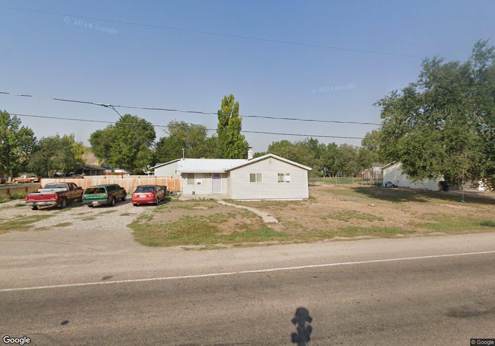
1205 N 3500 W Vernal, UT 84078
Estimated Value: $245,000 - $306,000
3
Beds
1
Bath
1,201
Sq Ft
$233/Sq Ft
Est. Value
About This Home
This home is located at 1205 N 3500 W, Vernal, UT 84078 and is currently estimated at $279,787, approximately $232 per square foot. 1205 N 3500 W is a home located in Uintah County with nearby schools including Maeser School, Uintah Middle School, and Vernal Middle School.
Ownership History
Date
Name
Owned For
Owner Type
Purchase Details
Closed on
Nov 23, 2021
Sold by
Cox Boyd and Cox Brooke
Bought by
Stoddard Kelly
Current Estimated Value
Home Financials for this Owner
Home Financials are based on the most recent Mortgage that was taken out on this home.
Original Mortgage
$184,500
Outstanding Balance
$169,412
Interest Rate
3.14%
Mortgage Type
Stand Alone Refi Refinance Of Original Loan
Estimated Equity
$110,375
Purchase Details
Closed on
Nov 22, 2019
Sold by
Henrie Christopher W and Henrie Megan R
Bought by
Cox Boyd and Cox Brooke
Home Financials for this Owner
Home Financials are based on the most recent Mortgage that was taken out on this home.
Original Mortgage
$152,192
Interest Rate
5.25%
Mortgage Type
FHA
Purchase Details
Closed on
Oct 26, 2007
Sold by
Packard Jared M
Bought by
Packard Jared M and Packard Janaina
Home Financials for this Owner
Home Financials are based on the most recent Mortgage that was taken out on this home.
Original Mortgage
$130,000
Interest Rate
6.27%
Mortgage Type
New Conventional
Create a Home Valuation Report for This Property
The Home Valuation Report is an in-depth analysis detailing your home's value as well as a comparison with similar homes in the area
Home Values in the Area
Average Home Value in this Area
Purchase History
| Date | Buyer | Sale Price | Title Company |
|---|---|---|---|
| Stoddard Kelly | -- | None Available | |
| Cox Boyd | -- | -- | |
| Packard Jared M | -- | -- | |
| Packard Jared M | -- | -- |
Source: Public Records
Mortgage History
| Date | Status | Borrower | Loan Amount |
|---|---|---|---|
| Open | Stoddard Kelly | $184,500 | |
| Previous Owner | Cox Boyd | $152,192 | |
| Previous Owner | Cox Boyd | $6,087 | |
| Previous Owner | Packard Jared M | $130,000 |
Source: Public Records
Tax History Compared to Growth
Tax History
| Year | Tax Paid | Tax Assessment Tax Assessment Total Assessment is a certain percentage of the fair market value that is determined by local assessors to be the total taxable value of land and additions on the property. | Land | Improvement |
|---|---|---|---|---|
| 2024 | $1,077 | $125,798 | $18,357 | $107,441 |
| 2023 | $1,077 | $111,659 | $18,357 | $93,302 |
| 2022 | $931 | $88,350 | $22,000 | $66,350 |
| 2021 | $934 | $40,017 | $10,588 | $29,429 |
| 2020 | $892 | $71,199 | $19,250 | $51,949 |
| 2019 | $860 | $67,801 | $19,250 | $48,551 |
| 2018 | $830 | $65,489 | $19,250 | $46,239 |
| 2017 | $9 | $71,148 | $19,250 | $51,898 |
| 2016 | $909 | $78,698 | $19,250 | $59,448 |
| 2015 | $839 | $78,698 | $19,250 | $59,448 |
| 2014 | $826 | $78,698 | $19,250 | $59,448 |
| 2013 | $845 | $78,698 | $19,250 | $59,448 |
Source: Public Records
Map
Nearby Homes
- 3543 W 700 N
- 1168 N 4090 W
- 1198 N 4090 W
- 1428 N 4075 W
- 1165 N 4090 W Unit 11
- 2993 W 1500 N
- 1482 N 4075 W
- 486 N 3500 W
- 2396 W 1500 N
- 2756 W 1000 N
- 1388 N 4075 W
- 1298 N 4075 W
- 1320 N 4075 W
- 4231 W 650 N
- 689 N 4250 W
- 631 N 4250 W
- 2690 W 500 N
- 4190 W Delray Rd Unit 39
- 4571 W Hillside Dr
- 4181 W Delray Rd