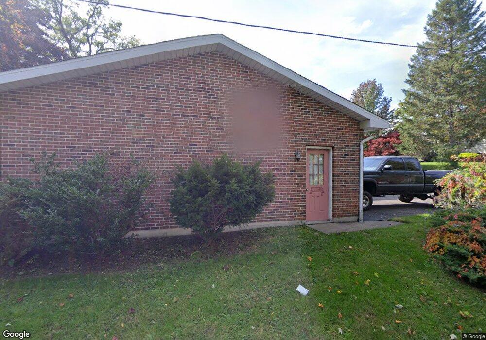
1205 N Main Ave Scranton, PA 18508
Tripp's Park NeighborhoodEstimated Value: $186,000 - $260,000
3
Beds
1
Bath
1,344
Sq Ft
$166/Sq Ft
Est. Value
About This Home
This home is located at 1205 N Main Ave, Scranton, PA 18508 and is currently estimated at $223,103, approximately $165 per square foot. 1205 N Main Ave is a home located in Lackawanna County with nearby schools including Isaac Tripp Elementary School, Northeast Scranton Intermediate School, and Scranton High School.
Ownership History
Date
Name
Owned For
Owner Type
Purchase Details
Closed on
Jul 7, 2006
Sold by
Fasulo John J and Fasulo Carol
Bought by
Cavallo Catherine M and Roszak Michael A
Current Estimated Value
Home Financials for this Owner
Home Financials are based on the most recent Mortgage that was taken out on this home.
Original Mortgage
$149,600
Interest Rate
6.27%
Mortgage Type
New Conventional
Create a Home Valuation Report for This Property
The Home Valuation Report is an in-depth analysis detailing your home's value as well as a comparison with similar homes in the area
Home Values in the Area
Average Home Value in this Area
Purchase History
| Date | Buyer | Sale Price | Title Company |
|---|---|---|---|
| Cavallo Catherine M | $187,000 | None Available |
Source: Public Records
Mortgage History
| Date | Status | Borrower | Loan Amount |
|---|---|---|---|
| Closed | Cavallo Catherine M | $149,600 |
Source: Public Records
Tax History Compared to Growth
Tax History
| Year | Tax Paid | Tax Assessment Tax Assessment Total Assessment is a certain percentage of the fair market value that is determined by local assessors to be the total taxable value of land and additions on the property. | Land | Improvement |
|---|---|---|---|---|
| 2025 | $5,010 | $14,000 | $4,800 | $9,200 |
| 2024 | $4,612 | $14,000 | $4,800 | $9,200 |
| 2023 | $4,612 | $14,000 | $4,800 | $9,200 |
| 2022 | $4,512 | $14,000 | $4,800 | $9,200 |
| 2021 | $4,512 | $14,000 | $4,800 | $9,200 |
| 2020 | $4,436 | $14,000 | $4,800 | $9,200 |
| 2019 | $4,184 | $14,000 | $4,800 | $9,200 |
| 2018 | $4,184 | $14,000 | $4,800 | $9,200 |
| 2017 | $4,118 | $14,000 | $4,800 | $9,200 |
| 2016 | $1,581 | $14,000 | $4,800 | $9,200 |
| 2015 | $2,854 | $14,000 | $4,800 | $9,200 |
| 2014 | -- | $14,000 | $4,800 | $9,200 |
Source: Public Records
Map
Nearby Homes
- 1235 N Sumner Ave
- 656 Philo St
- 1311 Short Ave
- 0 Philo St Unit GSBSC4763
- 1430 N Main Ave
- 1436 Church Ave
- 1057 Euclid Ave
- 1210-1212 N Rebecca Ave
- 1402 N Rebecca Ave
- 1008 Mount Vernon Ave
- 1425 Bulwer St
- 1121 Albright Ave
- 116 Little Spike Way Unit L 40
- 18 Green Ridge St
- 375 Grove St
- 955-961 Providence Rd
- 942 Providence Rd
- 938 Providence Rd
- 1431 Dorothy St
- 1513 Meylert Ave
- 1201 N Main Ave
- 1233 N Main Ave
- 1120 Court St
- 1241 N Main Ave
- 1235 N Main Ave
- 1122 Court St
- 1218 N Main Ave
- 1239 N Main Ave
- 1222 N Main Ave
- 1220 N Main Ave
- 1224 N Main Ave
- 1226 N Main Ave
- 1214 N Main Ave
- 1216 N Main Ave
- 1230 N Main Ave
- 1129 Pierce St
- 1232 N Main Ave
- 1212 N Main Ave
- 1234 N Main Ave
- 1130 Court St