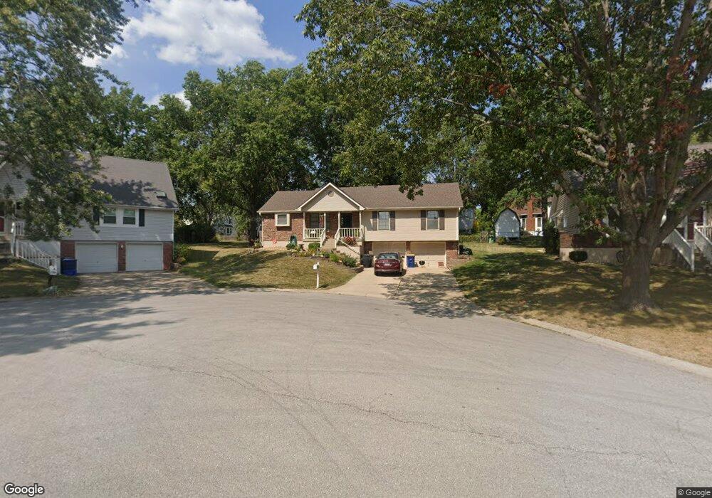
1205 NW Oak Leaf Ct Blue Springs, MO 64015
Estimated Value: $292,793 - $326,000
3
Beds
2
Baths
1,558
Sq Ft
$202/Sq Ft
Est. Value
About This Home
This home is located at 1205 NW Oak Leaf Ct, Blue Springs, MO 64015 and is currently estimated at $313,948, approximately $201 per square foot. 1205 NW Oak Leaf Ct is a home located in Jackson County with nearby schools including James Lewis Elementary School, Brittany Hill Middle School, and Blue Springs High School.
Ownership History
Date
Name
Owned For
Owner Type
Purchase Details
Closed on
Mar 24, 2000
Sold by
Mulhollan Roger D and Mulhollan Karol E
Bought by
Stewart Brian V and Stewart Natalie M
Current Estimated Value
Home Financials for this Owner
Home Financials are based on the most recent Mortgage that was taken out on this home.
Original Mortgage
$127,812
Outstanding Balance
$43,535
Interest Rate
8.36%
Mortgage Type
FHA
Estimated Equity
$270,413
Purchase Details
Closed on
Sep 8, 1997
Sold by
Crenshaw John L and Crenshaw Debbie A
Bought by
Mulhollan Roger D and Mulhollan Karol E
Home Financials for this Owner
Home Financials are based on the most recent Mortgage that was taken out on this home.
Original Mortgage
$117,000
Interest Rate
7.34%
Mortgage Type
Purchase Money Mortgage
Create a Home Valuation Report for This Property
The Home Valuation Report is an in-depth analysis detailing your home's value as well as a comparison with similar homes in the area
Home Values in the Area
Average Home Value in this Area
Purchase History
| Date | Buyer | Sale Price | Title Company |
|---|---|---|---|
| Stewart Brian V | -- | Stewart Title | |
| Mulhollan Roger D | -- | Old Republic Title |
Source: Public Records
Mortgage History
| Date | Status | Borrower | Loan Amount |
|---|---|---|---|
| Open | Stewart Brian V | $127,812 | |
| Previous Owner | Mulhollan Roger D | $117,000 |
Source: Public Records
Tax History Compared to Growth
Tax History
| Year | Tax Paid | Tax Assessment Tax Assessment Total Assessment is a certain percentage of the fair market value that is determined by local assessors to be the total taxable value of land and additions on the property. | Land | Improvement |
|---|---|---|---|---|
| 2025 | $3,448 | $42,465 | $7,437 | $35,028 |
| 2024 | $3,382 | $42,269 | $6,804 | $35,465 |
| 2023 | $3,382 | $42,269 | $6,950 | $35,319 |
| 2022 | $2,907 | $32,110 | $6,023 | $26,087 |
| 2021 | $2,904 | $32,110 | $6,023 | $26,087 |
| 2020 | $2,674 | $30,070 | $6,023 | $24,047 |
| 2019 | $2,585 | $30,070 | $6,023 | $24,047 |
| 2018 | $2,502 | $28,014 | $3,860 | $24,154 |
| 2017 | $2,502 | $28,014 | $3,860 | $24,154 |
| 2016 | $2,456 | $27,569 | $4,921 | $22,648 |
| 2014 | $2,307 | $25,808 | $4,604 | $21,204 |
Source: Public Records
Map
Nearby Homes
- 1113 NW Roanoke Dr
- 1201 NW Burr Oak Ct
- 2100 NW 12th St
- 2100 NW Parker Ct
- 904 NW Oakridge Dr
- 1000 NW Forest Dr
- 912 NW Forest Dr
- 1601 NW Weatherstone Ct
- 1701 NW Duncan Rd
- 2105 NW 5th St
- 1504 NW Weatherstone Dr
- 516 NW Brett Cir
- 2904 NW 5th St
- 1501 NW 18th St
- 2323 NW Acorn Dr
- 25609 E 31st Terrace S
- 1604 NW Sunridge Dr
- 1209 NW Hawk Creek Dr
- 280 NW Beau Dr
- 1912 NW Manor Dr
- 1209 NW Oak Leaf Ct
- 1201 NW Oak Leaf Ct
- 1204 NW Roanoke Dr
- 1200 NW Roanoke Dr
- 1208 NW Roanoke Dr
- 1208 NW Oak Leaf Ct
- 1212 NW Roanoke Dr
- 2316 NW 13th St
- 2312 NW 13th St
- 1204 NW Oak Leaf Ct
- 1200 NW Oak Leaf Ct
- 1216 NW Roanoke Dr
- 2308 NW 13th St
- 2304 NW 12th St
- 1116 NW Roanoke Dr
- 2228 NW 12th St
- 2300 NW 12th St
- 2306 NW 13th St
- 1201 NW Roanoke Dr
- 1205 NW Roanoke Dr