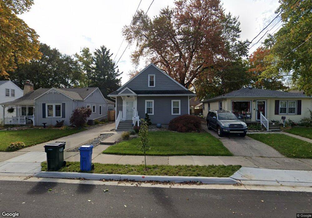
1205 Poxson Ave Lansing, MI 48910
Colonial Village NeighborhoodEstimated Value: $139,561 - $171,000
Studio
--
Bath
1,036
Sq Ft
$153/Sq Ft
Est. Value
About This Home
This home is located at 1205 Poxson Ave, Lansing, MI 48910 and is currently estimated at $158,140, approximately $152 per square foot. 1205 Poxson Ave is a home located in Ingham County with nearby schools including Averill Elementary School, Attwood School, and J.W. Sexton High School.
Ownership History
Date
Name
Owned For
Owner Type
Purchase Details
Closed on
Jun 14, 2000
Sold by
Warriner Wade T and Warriner Coleen V
Bought by
West Jennifer
Current Estimated Value
Home Financials for this Owner
Home Financials are based on the most recent Mortgage that was taken out on this home.
Original Mortgage
$89,264
Outstanding Balance
$32,410
Interest Rate
8.64%
Mortgage Type
FHA
Estimated Equity
$125,730
Purchase Details
Closed on
Sep 6, 1996
Sold by
Frisk Philip J and Audette Donna
Bought by
Warriner Wade T and Warriner Coleen
Create a Home Valuation Report for This Property
The Home Valuation Report is an in-depth analysis detailing your home's value as well as a comparison with similar homes in the area
Home Values in the Area
Average Home Value in this Area
Purchase History
We collect this data history from publicly available records. To have your information removed, we recommend requesting removal directly through your county’s website.
| Date | Buyer | Sale Price | Title Company |
|---|---|---|---|
| West Jennifer | $90,000 | -- | |
| Warriner Wade T | $69,000 | -- |
Source: Public Records
Mortgage History
We collect this data history from publicly available records. To have your information removed, we recommend requesting removal directly through your county’s website.
| Date | Status | Borrower | Loan Amount |
|---|---|---|---|
| Open | West Jennifer | $89,264 |
Source: Public Records
Tax History
| Year | Tax Paid | Tax Assessment Tax Assessment Total Assessment is a certain percentage of the fair market value that is determined by local assessors to be the total taxable value of land and additions on the property. | Land | Improvement |
|---|---|---|---|---|
| 2025 | $3,060 | $65,700 | $7,000 | $58,700 |
| 2024 | $24 | $62,200 | $7,000 | $55,200 |
| 2023 | $2,869 | $56,700 | $7,000 | $49,700 |
| 2022 | $2,587 | $50,700 | $7,000 | $43,700 |
| 2021 | $2,533 | $47,800 | $7,100 | $40,700 |
| 2020 | $2,517 | $44,800 | $7,100 | $37,700 |
| 2019 | $2,413 | $42,100 | $7,100 | $35,000 |
| 2018 | $2,261 | $40,000 | $7,100 | $32,900 |
| 2017 | $2,165 | $40,000 | $7,100 | $32,900 |
| 2016 | $2,070 | $39,400 | $7,100 | $32,300 |
| 2015 | $2,070 | $38,200 | $14,210 | $23,990 |
| 2014 | $2,070 | $36,700 | $15,811 | $20,889 |
Source: Public Records
Map
Nearby Homes
- 1208 Gordon Ave
- 1125 Poxson Ave
- 1209 W Mount Hope Ave
- 1033 Kelsey Ave
- 1312 W Mount Hope Ave
- 1830 Fletcher St
- 815 Woodbine Ave
- 1116 George St
- 2421 S Rundle Ave
- 1516 Berkeley Dr
- 1823 Delevan Ave
- 712 Lenore Ave
- 1824 S Rundle Ave
- 917 W Barnes Ave
- 1810 Cooper Ave
- 1633 Park Ave
- 1817 Gordon Ave
- 612 W Mount Hope Ave
- 1309 Hammond St
- 1915 Cooper Ave
- 1201 Poxson Ave
- 1209 Poxson Ave
- 1213 Poxson Ave
- 1129 Poxson Ave
- 1204 Gordon Ave
- 1200 Gordon Ave
- 1212 Gordon Ave
- 1126 Gordon Ave
- 1121 Poxson Ave
- 2205 Marion Ave
- 1124 Gordon Ave
- 1217 Poxson Ave
- 1204 Poxson Ave
- 2211 Marion Ave
- 1200 Poxson Ave
- 1208 Poxson Ave
- 1218 Gordon Ave
- 1212 Poxson Ave
- 1128 Poxson Ave
- 1120 Gordon Ave
Your Personal Tour Guide
Ask me questions while you tour the home.