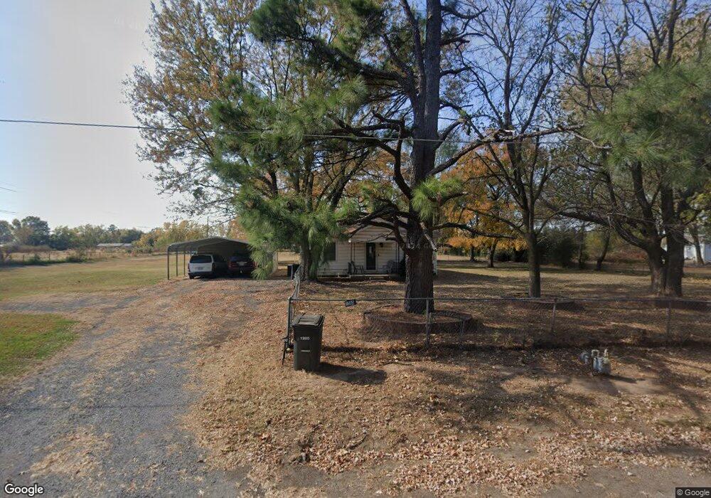
1205 S 61st St W Muskogee, OK 74401
Honor Heights NeighborhoodEstimated Value: $79,456 - $125,000
3
Beds
1
Bath
1,044
Sq Ft
$103/Sq Ft
Est. Value
About This Home
This home is located at 1205 S 61st St W, Muskogee, OK 74401 and is currently estimated at $107,364, approximately $102 per square foot. 1205 S 61st St W is a home located in Muskogee County with nearby schools including Cherokee Elementary School, 8th & 9th Grade Academy @ Alice Robertson, and Muskogee High School.
Ownership History
Date
Name
Owned For
Owner Type
Purchase Details
Closed on
Oct 2, 2019
Sold by
Phillips Weston W and Phillips Janet M
Bought by
Schrader Matthew
Current Estimated Value
Purchase Details
Closed on
Feb 25, 2004
Bought by
Phillips Weston W and Phillips Janet M
Purchase Details
Closed on
Oct 20, 1993
Purchase Details
Closed on
Mar 1, 1993
Purchase Details
Closed on
Jan 1, 1993
Create a Home Valuation Report for This Property
The Home Valuation Report is an in-depth analysis detailing your home's value as well as a comparison with similar homes in the area
Home Values in the Area
Average Home Value in this Area
Purchase History
| Date | Buyer | Sale Price | Title Company |
|---|---|---|---|
| Schrader Matthew | $15,000 | None Available | |
| Phillips Weston W | $20,000 | -- | |
| -- | -- | -- | |
| -- | $15,000 | -- | |
| -- | -- | -- |
Source: Public Records
Tax History Compared to Growth
Tax History
| Year | Tax Paid | Tax Assessment Tax Assessment Total Assessment is a certain percentage of the fair market value that is determined by local assessors to be the total taxable value of land and additions on the property. | Land | Improvement |
|---|---|---|---|---|
| 2025 | $211 | $3,065 | $906 | $2,159 |
| 2024 | $211 | $2,975 | $879 | $2,096 |
| 2023 | $211 | $2,366 | $688 | $1,678 |
| 2022 | $135 | $2,366 | $688 | $1,678 |
| 2021 | $136 | $2,366 | $688 | $1,678 |
| 2020 | $135 | $2,366 | $688 | $1,678 |
| 2019 | $252 | $2,606 | $688 | $1,918 |
| 2018 | $239 | $2,606 | $688 | $1,918 |
| 2017 | $227 | $2,411 | $688 | $1,723 |
| 2016 | $216 | $2,297 | $688 | $1,609 |
| 2015 | $219 | $2,297 | $688 | $1,609 |
| 2014 | $1 | $2,297 | $688 | $1,609 |
Source: Public Records
Map
Nearby Homes
- 1231 S 61st St W
- 1005 Kershaw Dr
- 907 Kershaw Dr
- 0 Junction St Unit 2537657
- 5431 Estelle
- 501 S 64th St W
- 5419 Pine St
- 1741 S 64th St W
- 711 W Broadway St
- 2251 S 64th St W
- 5016 Denison St
- 0 W Hancock St Unit 2544790
- 0 W Hancock St Unit 16398614
- 000000 N 12th
- 1500 W Shawnee
- 4410 W Okmulgee Ave
- 5400 Rolling Oaks Trail
- 4207 Denison St
- 4140 S Robb Ave
- 309 S 38th St Unit 2
- 1204 S 61st St W
- 1210 S 63rd St W
- 1200 S 61st St W
- 1220 S 61st St W
- 1210 S 61st St W
- 1225 S 61st St W
- 1151 S 61st St W
- 1150 S 61st St W
- 241 S 61st St W
- 1141 S 61st St W
- 1235 S 61st St W
- 6040 Border Ave
- 101 S 61st St W
- 1131 S 61st St W
- 1231 S 63rd St W
- 6250 Border Ave
- 1121 S 61st St W
- 6302 Border Ave
- 6310 Border Ave
- 1141 Kershaw Dr