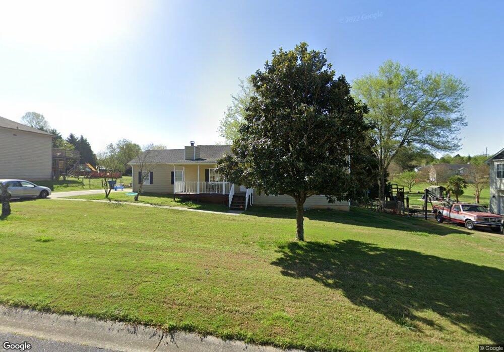
1205 Saint Andrews Dr Unit 1 Auburn, GA 30011
Estimated Value: $298,000 - $346,000
4
Beds
3
Baths
2,229
Sq Ft
$147/Sq Ft
Est. Value
About This Home
This home is located at 1205 Saint Andrews Dr Unit 1, Auburn, GA 30011 and is currently estimated at $327,735, approximately $147 per square foot. 1205 Saint Andrews Dr Unit 1 is a home located in Barrow County with nearby schools including Auburn Elementary School, Westside Middle School, and Apalachee High School.
Ownership History
Date
Name
Owned For
Owner Type
Purchase Details
Closed on
Mar 15, 2018
Sold by
Maukwei Yin
Bought by
Tyler Gable
Current Estimated Value
Home Financials for this Owner
Home Financials are based on the most recent Mortgage that was taken out on this home.
Original Mortgage
$149,246
Outstanding Balance
$130,052
Interest Rate
5.12%
Mortgage Type
FHA
Estimated Equity
$197,683
Purchase Details
Closed on
Nov 7, 2000
Sold by
Gardner David L and Gardner Sharon G
Bought by
Yin Maukwei
Home Financials for this Owner
Home Financials are based on the most recent Mortgage that was taken out on this home.
Original Mortgage
$97,650
Interest Rate
7.93%
Mortgage Type
New Conventional
Purchase Details
Closed on
Jun 30, 1992
Bought by
Gardner David L and Gardner Sh
Create a Home Valuation Report for This Property
The Home Valuation Report is an in-depth analysis detailing your home's value as well as a comparison with similar homes in the area
Home Values in the Area
Average Home Value in this Area
Purchase History
| Date | Buyer | Sale Price | Title Company |
|---|---|---|---|
| Tyler Gable | $152,000 | -- | |
| Yin Maukwei | $108,500 | -- | |
| Gardner David L | $78,700 | -- |
Source: Public Records
Mortgage History
| Date | Status | Borrower | Loan Amount |
|---|---|---|---|
| Open | Tyler Gable | $149,246 | |
| Previous Owner | Yin Maukwei | $97,650 |
Source: Public Records
Tax History Compared to Growth
Tax History
| Year | Tax Paid | Tax Assessment Tax Assessment Total Assessment is a certain percentage of the fair market value that is determined by local assessors to be the total taxable value of land and additions on the property. | Land | Improvement |
|---|---|---|---|---|
| 2024 | $2,601 | $84,708 | $20,000 | $64,708 |
| 2023 | $2,176 | $84,708 | $20,000 | $64,708 |
| 2022 | $1,773 | $59,965 | $11,600 | $48,365 |
| 2021 | $1,899 | $59,965 | $11,600 | $48,365 |
| 2020 | $1,911 | $59,965 | $11,600 | $48,365 |
| 2019 | $1,940 | $59,965 | $11,600 | $48,365 |
| 2018 | $1,800 | $55,794 | $11,600 | $44,194 |
| 2017 | $263 | $47,336 | $11,600 | $35,736 |
| 2016 | $1,448 | $44,812 | $11,600 | $33,212 |
| 2015 | $1,464 | $45,232 | $11,600 | $33,632 |
| 2014 | $1,283 | $40,913 | $6,860 | $34,053 |
| 2013 | -- | $38,849 | $6,860 | $31,989 |
Source: Public Records
Map
Nearby Homes
- 1201 Saint Andrews Dr
- 410 Kilcrease Rd
- 1236 Cabots Dr
- 624 Red Fox Ln
- 4079 Brookmont Way
- 5779 Wheeler Ridge Rd
- 1306 Stonemont Rd Unit 1
- 1162 Pinebrook Rd Unit 1
- 1308 Smokerise Ln
- 302 Jonaquil Ave
- 298 Dandelion Ln
- 569 Appalachee Ridge Rd
- 1127 Bradford Park Dr
- 305 Crosswalk Dr
- 23 Woodland Rd
- 0 Hwy 316 Unit 10599538
- 0 Hwy 316 Unit 7645364
- 1071 Atlanta Hwy NW
- 1534 Oakhill Dr
- 00 Atlanta Hwy
- 1205 St Andrews
- 1207 Saint Andrews Dr Unit 1
- 1207 St Andrews Dr
- 1203 Saint Andrews Dr Unit 1
- 1204 Saint Andrews Dr
- 1208 Cabots Dr
- 1204 St Andrews Dr
- 1209 Saint Andrews Dr
- 1210 Cabots Dr Unit 4
- 1210 Cabots Dr
- 1206 Saint Andrews Dr Unit 1
- 1206 Cabots Dr
- 1202 St Andrews
- 1202 Saint Andrews Dr
- 1212 Cabots Dr Unit 1
- 1212 Cabots Dr
- 1211 Saint Andrews Dr
- 1211 Saint Andrews Dr Unit 1
- 1202 Cabots Dr
- 0 Kilcrease Rd Unit 8636910