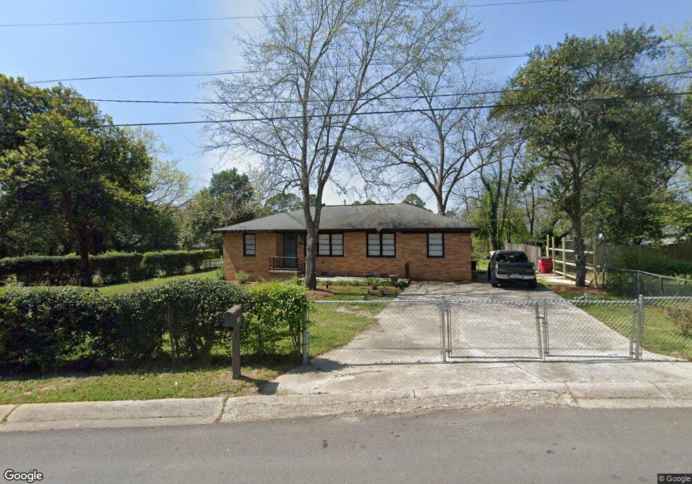
1205 Sherbrooke Dr Macon, GA 31204
Estimated Value: $65,000 - $105,000
3
Beds
1
Bath
1,378
Sq Ft
$66/Sq Ft
Est. Value
About This Home
This home is located at 1205 Sherbrooke Dr, Macon, GA 31204 and is currently estimated at $91,365, approximately $66 per square foot. 1205 Sherbrooke Dr is a home located in Bibb County with nearby schools including Weaver Middle School, Westside High School, and The Learning Place Academy.
Ownership History
Date
Name
Owned For
Owner Type
Purchase Details
Closed on
Nov 20, 2017
Sold by
Heard Sandra Lavell D
Bought by
Waller Charles Douglas
Current Estimated Value
Home Financials for this Owner
Home Financials are based on the most recent Mortgage that was taken out on this home.
Original Mortgage
$16,663
Outstanding Balance
$13,952
Interest Rate
3.91%
Mortgage Type
Unknown
Estimated Equity
$77,413
Purchase Details
Closed on
Oct 16, 2007
Sold by
Heard Sandra
Bought by
City Of Macons Economic & Community Deve
Purchase Details
Closed on
Sep 27, 2006
Sold by
Heard Sandra Lavell D and Heard Robert E
Bought by
Heard Sandra Lavell D
Create a Home Valuation Report for This Property
The Home Valuation Report is an in-depth analysis detailing your home's value as well as a comparison with similar homes in the area
Purchase History
| Date | Buyer | Sale Price | Title Company |
|---|---|---|---|
| Waller Charles Douglas | $15,500 | None Available | |
| City Of Macons Economic & Community Deve | $3,076 | None Available | |
| Heard Sandra Lavell D | -- | None Available |
Source: Public Records
Mortgage History
| Date | Status | Borrower | Loan Amount |
|---|---|---|---|
| Open | Waller Charles Douglas | $16,663 |
Source: Public Records
Tax History
| Year | Tax Paid | Tax Assessment Tax Assessment Total Assessment is a certain percentage of the fair market value that is determined by local assessors to be the total taxable value of land and additions on the property. | Land | Improvement |
|---|---|---|---|---|
| 2025 | $856 | $34,840 | $2,936 | $31,904 |
| 2024 | $817 | $32,162 | $3,154 | $29,008 |
| 2023 | $792 | $31,183 | $2,175 | $29,008 |
| 2022 | $863 | $24,914 | $3,876 | $21,038 |
| 2021 | $608 | $16,000 | $3,876 | $12,124 |
| 2020 | $621 | $16,000 | $3,876 | $12,124 |
| 2019 | $626 | $16,000 | $3,876 | $12,124 |
| 2018 | $552 | $14,302 | $3,876 | $10,426 |
| 2017 | $962 | $25,688 | $3,876 | $21,812 |
| 2016 | $889 | $25,688 | $3,876 | $21,812 |
| 2015 | $1,258 | $25,688 | $3,876 | $21,812 |
| 2014 | $1,447 | $25,688 | $3,876 | $21,812 |
Source: Public Records
Map
Nearby Homes
- 3778 Log Cabin Dr
- 1077 Pike St
- 1171 Washington St
- 3816 Log Cabin Dr
- 3846 Log Cabin Dr
- 3442 Walker St
- 3890 Robinson Rd
- 3908 Log Cabin Dr
- 115 Emily St
- 114 Emily St
- 1184 Edna Place
- 4450 Bluebird Terrace
- 3941 Log Cabin Dr
- 3454 Lawton Rd
- 3462 Lawton Rd
- 1350 Brinwood Dr
- 3470 Lawton Rd
- 3483 Lawton Rd
- 4226 Robinson Cir
- 3491 Bond St W
- 1215 Westmount Rd
- 3748 Log Cabin Dr
- 1103 Sherbrooke Dr
- 1104 Hartridge Dr
- 3754 Log Cabin Dr
- 1225 Westmount Rd
- 1078 Sherbrooke Dr
- 1086 Sherbrooke Dr
- 1094 Sherbrooke Dr
- 3758 Log Cabin Dr
- 3732 Log Cabin Dr
- 1100 Sherbrooke Dr
- 1117 Sherbrooke Dr
- 1112 Hartridge Dr
- 1233 Westmount Rd
- 1105 Hartridge Dr
- 3724 Log Cabin Dr
- 1108 Sherbrooke Dr
- 3764 Log Cabin Dr
- 1125 Sherbrooke Dr
Your Personal Tour Guide
Ask me questions while you tour the home.