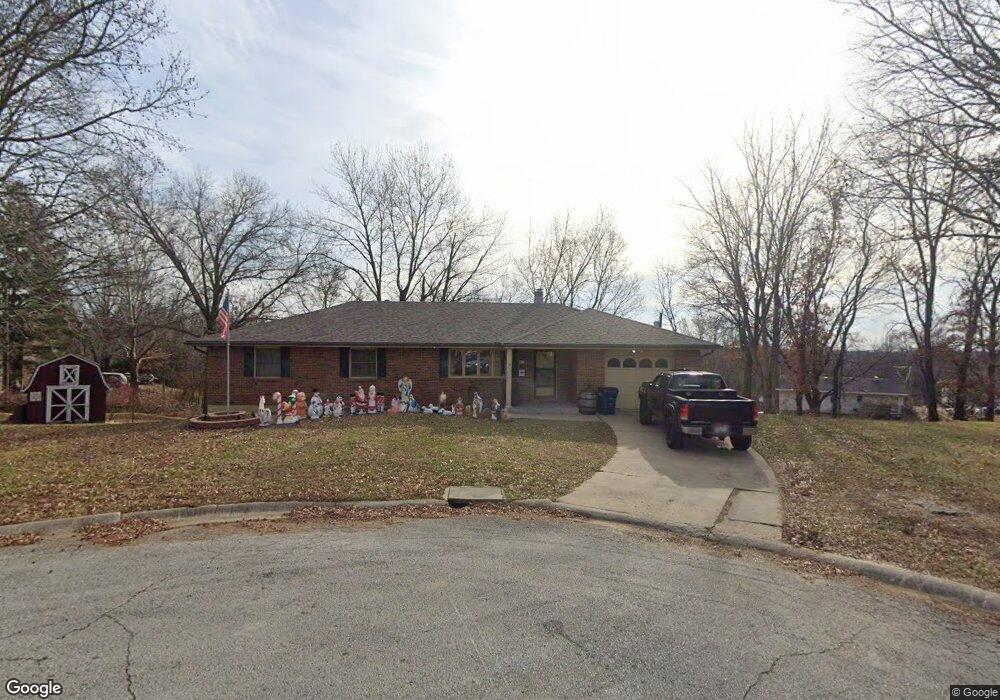
1205 W Forrest Ln Excelsior Springs, MO 64024
Estimated Value: $270,000 - $432,000
4
Beds
3
Baths
1,616
Sq Ft
$204/Sq Ft
Est. Value
About This Home
This home is located at 1205 W Forrest Ln, Excelsior Springs, MO 64024 and is currently estimated at $329,723, approximately $204 per square foot. 1205 W Forrest Ln is a home located in Clay County with nearby schools including Excelsior Springs High School.
Ownership History
Date
Name
Owned For
Owner Type
Purchase Details
Closed on
Nov 29, 2005
Sold by
White G Alberta
Bought by
Snow Jason W and Pein Ashley R
Current Estimated Value
Home Financials for this Owner
Home Financials are based on the most recent Mortgage that was taken out on this home.
Original Mortgage
$139,900
Outstanding Balance
$77,482
Interest Rate
6.12%
Mortgage Type
Fannie Mae Freddie Mac
Estimated Equity
$252,241
Purchase Details
Closed on
Sep 1, 2005
Sold by
White G Alberta and White William
Bought by
Pettet Ronald W and Pettet Shirley Sue
Purchase Details
Closed on
Aug 31, 2005
Sold by
Pettet Nadine M
Bought by
White G Alberta and Pettet Albert W
Create a Home Valuation Report for This Property
The Home Valuation Report is an in-depth analysis detailing your home's value as well as a comparison with similar homes in the area
Home Values in the Area
Average Home Value in this Area
Purchase History
| Date | Buyer | Sale Price | Title Company |
|---|---|---|---|
| Snow Jason W | -- | Chicago | |
| Pettet Ronald W | -- | -- | |
| White G Alberta | -- | -- |
Source: Public Records
Mortgage History
| Date | Status | Borrower | Loan Amount |
|---|---|---|---|
| Open | Snow Jason W | $139,900 |
Source: Public Records
Tax History Compared to Growth
Tax History
| Year | Tax Paid | Tax Assessment Tax Assessment Total Assessment is a certain percentage of the fair market value that is determined by local assessors to be the total taxable value of land and additions on the property. | Land | Improvement |
|---|---|---|---|---|
| 2025 | $2,662 | $43,620 | -- | -- |
| 2024 | $2,662 | $37,960 | -- | -- |
| 2023 | $2,646 | $37,960 | $0 | $0 |
| 2022 | $2,007 | $28,330 | $0 | $0 |
| 2021 | $2,015 | $28,329 | $3,040 | $25,289 |
| 2020 | $2,073 | $28,330 | $0 | $0 |
| 2019 | $2,071 | $28,329 | $3,040 | $25,289 |
| 2018 | $2,144 | $29,240 | $0 | $0 |
| 2017 | $2,091 | $29,240 | $3,040 | $26,200 |
| 2016 | $2,091 | $29,240 | $3,040 | $26,200 |
| 2015 | $2,111 | $29,240 | $3,040 | $26,200 |
| 2014 | $2,053 | $28,180 | $3,420 | $24,760 |
Source: Public Records
Map
Nearby Homes
- 1113 Melanie Ln
- 130 Kevin St
- 117 Kevin St
- 811 Saint Louis Ave
- 821 St Louis Ave
- 607 Old Orchard Ave
- 602 Saint Louis Ave
- 8 Orchard Place
- 1219 Paton St
- 304 Waller Ave
- 332 Woods Ave
- 124 Wildwood St
- 125 Crown Hill Rd
- 507 N Kimball St
- 1101 Williams St
- 936 St Paul Ave
- 101 W Excelsior St
- 934 Williams St
- 2017 Wornall Rd
- Lot 2 Wornall Rd
- 1203 W Forrest Ln
- 1118 Cordell St
- 1120 Cordell St
- 1121 W Forrest Ln
- 1208 W Forrest Ln
- 1116 Cordell St
- 1201 W Forrest Ln
- 1122 Cordell St
- 1206 W Forrest Ln
- 1114 Cordell St
- 1124 Cordell St
- 1119 W Forrest Ln
- 1112 Cordell St
- 1202 W Forrest Ln
- 1119 Cordell St
- 1126 Cordell St
- 1112 W Forrest Ln
- 1121 Cordell St
- 1117 W Forrest Ln
- 1117 Cordell St
