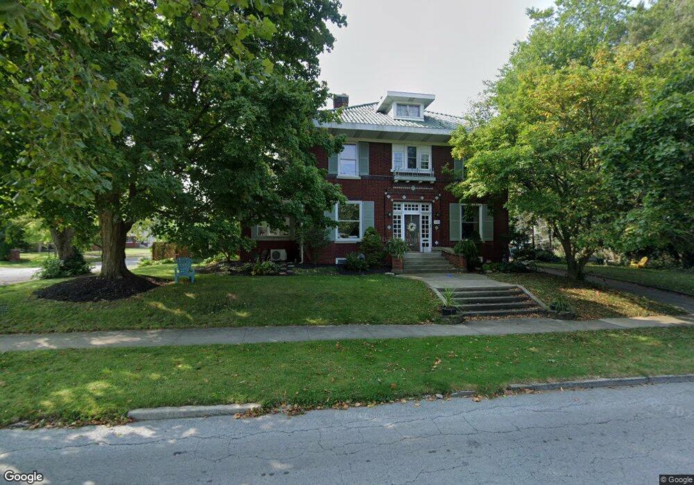
1205 W State St Lima, OH 45805
Riverside North NeighborhoodEstimated Value: $214,000 - $254,635
4
Beds
5
Baths
3,626
Sq Ft
$67/Sq Ft
Est. Value
About This Home
This home is located at 1205 W State St, Lima, OH 45805 and is currently estimated at $243,409, approximately $67 per square foot. 1205 W State St is a home located in Allen County with nearby schools including Heritage Elementary School, Lima West Middle School, and Lima North Middle School.
Ownership History
Date
Name
Owned For
Owner Type
Purchase Details
Closed on
Mar 28, 2016
Sold by
Mills Patricia A
Bought by
Mills Bart H and Mills Jennifer E
Current Estimated Value
Purchase Details
Closed on
Jul 18, 2011
Sold by
Sarven Brian C and Sarven Jill M
Bought by
Mills Patricia A
Home Financials for this Owner
Home Financials are based on the most recent Mortgage that was taken out on this home.
Original Mortgage
$108,500
Outstanding Balance
$73,631
Interest Rate
4.53%
Estimated Equity
$169,778
Purchase Details
Closed on
May 25, 2005
Sold by
Household Realty Corp
Bought by
Sarven Brian Chris
Purchase Details
Closed on
Dec 9, 1985
Bought by
Rezabek John D
Create a Home Valuation Report for This Property
The Home Valuation Report is an in-depth analysis detailing your home's value as well as a comparison with similar homes in the area
Home Values in the Area
Average Home Value in this Area
Purchase History
| Date | Buyer | Sale Price | Title Company |
|---|---|---|---|
| Mills Bart H | -- | None Available | |
| Mills Patricia A | $108,500 | Attorney | |
| Sarven Brian Chris | $30,000 | None Available | |
| Rezabek John D | $45,000 | -- |
Source: Public Records
Mortgage History
| Date | Status | Borrower | Loan Amount |
|---|---|---|---|
| Open | Mills Patricia A | $108,500 |
Source: Public Records
Tax History
| Year | Tax Paid | Tax Assessment Tax Assessment Total Assessment is a certain percentage of the fair market value that is determined by local assessors to be the total taxable value of land and additions on the property. | Land | Improvement |
|---|---|---|---|---|
| 2024 | $2,026 | $57,300 | $7,320 | $49,980 |
| 2023 | $1,894 | $46,590 | $5,950 | $40,640 |
| 2022 | $1,906 | $46,590 | $5,950 | $40,640 |
| 2021 | $2,022 | $46,590 | $5,950 | $40,640 |
| 2020 | $1,972 | $40,220 | $5,670 | $34,550 |
| 2019 | $1,972 | $40,220 | $5,670 | $34,550 |
| 2018 | $1,935 | $40,220 | $5,670 | $34,550 |
| 2017 | $1,877 | $37,070 | $5,670 | $31,400 |
| 2016 | $1,896 | $37,070 | $5,670 | $31,400 |
| 2015 | $1,807 | $37,070 | $5,670 | $31,400 |
| 2014 | $1,807 | $34,730 | $5,920 | $28,810 |
| 2013 | $1,758 | $34,730 | $5,920 | $28,810 |
Source: Public Records
Map
Nearby Homes
- 1211 W Elm St
- 1323 W Elm St
- 233 S Kenilworth Ave
- 308 S Judkins Ave
- 784 S Judkins Ave
- 1440 W Market St
- 1160 W High St
- 2250 Kunneke Ave
- 906 Daniels Ave
- 411 S Collett St
- 1541 Oakland Pkwy
- 1508 Oakland Pkwy
- 932 Faurot Ave
- 426 S Baxter St
- 705 W Elm St
- 852 Faurot Ave
- 1607 W Wayne St
- 846 Faurot Ave
- 210 S Baxter St
- 1517 Allentown Rd
Your Personal Tour Guide
Ask me questions while you tour the home.