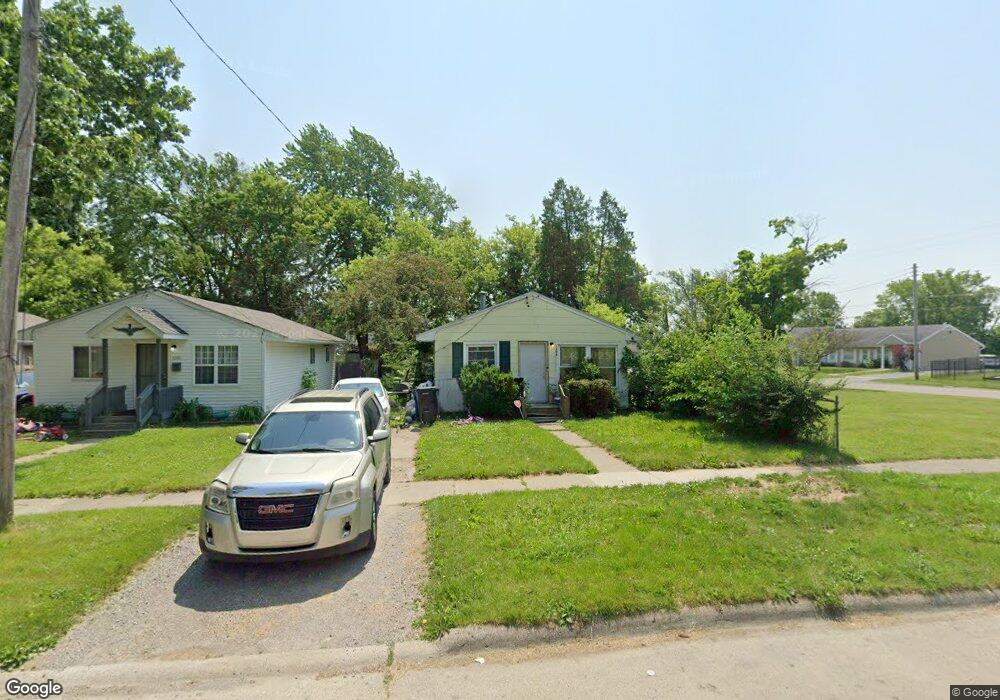
1206 Donaldson Blvd Flint, MI 48504
Ballenger Highway NeighborhoodEstimated Value: $29,000 - $114,596
3
Beds
1
Bath
863
Sq Ft
$74/Sq Ft
Est. Value
About This Home
This home is located at 1206 Donaldson Blvd, Flint, MI 48504 and is currently estimated at $64,149, approximately $74 per square foot. 1206 Donaldson Blvd is a home located in Genesee County with nearby schools including Durant-Tuuri-Mott Elementary School, Greater Heights Academy, and St. Paul Lutheran School.
Ownership History
Date
Name
Owned For
Owner Type
Purchase Details
Closed on
Oct 11, 2017
Sold by
Genesee County Land Bank Authority
Bought by
Edwards Cassandra A
Current Estimated Value
Purchase Details
Closed on
Jul 27, 2015
Sold by
The Genesee County Land Bank Authority
Bought by
Edwards Casandra A
Purchase Details
Closed on
Dec 22, 2014
Sold by
Genesee County Treasurer
Bought by
Genesee County Land Bank
Purchase Details
Closed on
Aug 9, 2013
Sold by
Hardy Taleesha
Bought by
Jackson Casey Kenhaya
Purchase Details
Closed on
Mar 14, 2013
Sold by
B & L Investment Group Llc
Bought by
Hardy Taleesha
Purchase Details
Closed on
Aug 1, 2011
Sold by
Williams Cheryl M
Bought by
B & L Investment Group Llc
Purchase Details
Closed on
Feb 21, 2011
Sold by
William Cheryl M
Bought by
B & L Investments
Create a Home Valuation Report for This Property
The Home Valuation Report is an in-depth analysis detailing your home's value as well as a comparison with similar homes in the area
Home Values in the Area
Average Home Value in this Area
Purchase History
| Date | Buyer | Sale Price | Title Company |
|---|---|---|---|
| Edwards Cassandra A | $3,500 | None Available | |
| Edwards Casandra A | $3,500 | None Available | |
| Genesee County Land Bank | -- | None Available | |
| Jackson Casey Kenhaya | $1,000 | None Available | |
| Hardy Taleesha | -- | None Available | |
| B & L Investment Group Llc | $500 | None Available | |
| B & L Investments | -- | Cislo Title Company |
Source: Public Records
Tax History Compared to Growth
Tax History
| Year | Tax Paid | Tax Assessment Tax Assessment Total Assessment is a certain percentage of the fair market value that is determined by local assessors to be the total taxable value of land and additions on the property. | Land | Improvement |
|---|---|---|---|---|
| 2025 | $647 | $14,500 | $0 | $0 |
| 2024 | $598 | $10,700 | $0 | $0 |
| 2023 | $594 | $8,500 | $0 | $0 |
| 2022 | $0 | $6,900 | $0 | $0 |
| 2021 | $610 | $6,800 | $0 | $0 |
| 2020 | $562 | $7,200 | $0 | $0 |
| 2019 | $555 | $6,100 | $0 | $0 |
| 2018 | $2,414 | $6,000 | $0 | $0 |
| 2017 | $1,280 | $0 | $0 | $0 |
| 2016 | $596 | $0 | $0 | $0 |
| 2015 | -- | $0 | $0 | $0 |
| 2014 | -- | $0 | $0 | $0 |
| 2012 | -- | $10,100 | $0 | $0 |
Source: Public Records
Map
Nearby Homes
- 0 Donaldson St
- 1133 Donaldson St
- 2944 Wolcott St
- 1159 Sutton Ave
- 2930 Prospect St
- 2902 Prospect St
- 3071 Devonshire St
- 2730 Berkley St
- 2725 Prospect St
- 3120 Stratford St
- 3021 Clement St
- 2952 Clement St
- 1220 Forest Hill Ave
- 2536 Orchard Ln
- 2714 Barth St
- 1287 Maxson St
- 2812 Concord St
- 2606 Stevenson St
- 2840 Mallery St
- 2713 Norbert St
- 1210 Donaldson Blvd
- 1202 Donaldson Blvd
- 2932 Raskob St
- 1214 Donaldson Blvd
- 2928 Raskob St
- 2931 Berkley St
- 1218 Donaldson Blvd
- 2927 Berkley St
- 1209 Donaldson Blvd
- 1205 Donaldson St
- 1213 Donaldson Blvd
- 1213 Donaldson St
- 1201 Donaldson Blvd
- 1217 Donaldson Blvd
- 1160 Donaldson Blvd
- 2927 Raskob St
- 2923 Berkley St
- 1252 Donaldson Blvd
- 2919 Berkley St
- 1167 Donaldson Blvd