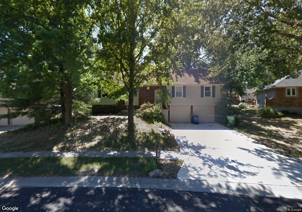
1206 Downing St Liberty, MO 64068
Estimated Value: $318,000 - $337,000
3
Beds
3
Baths
1,494
Sq Ft
$219/Sq Ft
Est. Value
About This Home
This home is located at 1206 Downing St, Liberty, MO 64068 and is currently estimated at $327,913, approximately $219 per square foot. 1206 Downing St is a home located in Clay County with nearby schools including Alexander Doniphan Elementary School, Liberty Middle School, and Liberty High School.
Ownership History
Date
Name
Owned For
Owner Type
Purchase Details
Closed on
Sep 9, 2020
Sold by
South Withers Road Development Llc
Bought by
Aspen Homes Builders Llc
Current Estimated Value
Home Financials for this Owner
Home Financials are based on the most recent Mortgage that was taken out on this home.
Original Mortgage
$40,000
Outstanding Balance
$35,432
Interest Rate
2.8%
Mortgage Type
Credit Line Revolving
Estimated Equity
$292,481
Purchase Details
Closed on
Apr 30, 2014
Sold by
Miller Helene R
Bought by
Miller Helene R and The Helene R Miller Trust
Create a Home Valuation Report for This Property
The Home Valuation Report is an in-depth analysis detailing your home's value as well as a comparison with similar homes in the area
Home Values in the Area
Average Home Value in this Area
Purchase History
| Date | Buyer | Sale Price | Title Company |
|---|---|---|---|
| Aspen Homes Builders Llc | -- | Secured Title Of Kansas City | |
| Miller Helene R | -- | None Available |
Source: Public Records
Mortgage History
| Date | Status | Borrower | Loan Amount |
|---|---|---|---|
| Open | Aspen Homes Builders Llc | $40,000 |
Source: Public Records
Tax History Compared to Growth
Tax History
| Year | Tax Paid | Tax Assessment Tax Assessment Total Assessment is a certain percentage of the fair market value that is determined by local assessors to be the total taxable value of land and additions on the property. | Land | Improvement |
|---|---|---|---|---|
| 2025 | $3,197 | $47,770 | -- | -- |
| 2024 | $3,197 | $41,570 | -- | -- |
| 2023 | $3,251 | $41,570 | $0 | $0 |
| 2022 | $2,985 | $37,680 | $0 | $0 |
| 2021 | $2,962 | $37,677 | $7,220 | $30,457 |
| 2020 | $2,561 | $30,590 | $0 | $0 |
| 2019 | $2,560 | $30,590 | $0 | $0 |
| 2018 | $2,359 | $27,680 | $0 | $0 |
| 2017 | $2,337 | $27,680 | $4,560 | $23,120 |
| 2016 | $2,337 | $27,680 | $4,560 | $23,120 |
| 2015 | $2,338 | $27,680 | $4,560 | $23,120 |
| 2014 | $2,252 | $26,450 | $4,370 | $22,080 |
Source: Public Records
Map
Nearby Homes
- 1218 Canterbury Ln
- 1105 Bristol Way
- 1124 Amesbury Ave
- 1323 Amesbury Ave
- 1331 Park Ln
- 918 Amesbury Ave
- 1304 Wellington Way
- 1537 Canterbury Ln
- 1507 Amesbury Ave
- 862 Amesbury Ave
- 1317 Park Ln
- 1327 Easton Ct
- 1733 Welleslay Ln
- 716 Bristol Ct
- 415 Monterey Ave
- 1209 Liberty Drive Terrace
- 509 Belmont St
- 420 Belmont St
- 442 Circle Dr
- 1030 Maple Woods Dr
- 1200 Downing St
- 1212 Downing St
- 1221 Canterbury Ln
- 1215 Canterbury Ln
- 1209 Canterbury Ln
- 1218 Downing St
- 1132 Downing St
- 1203 Canterbury Ln
- 1227 Canterbury Ln
- 1207 Downing St
- 1201 Downing St
- 1139 Canterbury Ln
- 1233 Canterbury Ln
- 1224 Downing St
- 1213 Downing St
- 1126 Downing St
- 1133 Canterbury Ln
- 1515 Baker St
- 1239 Canterbury Ln
- 1511 Baker St