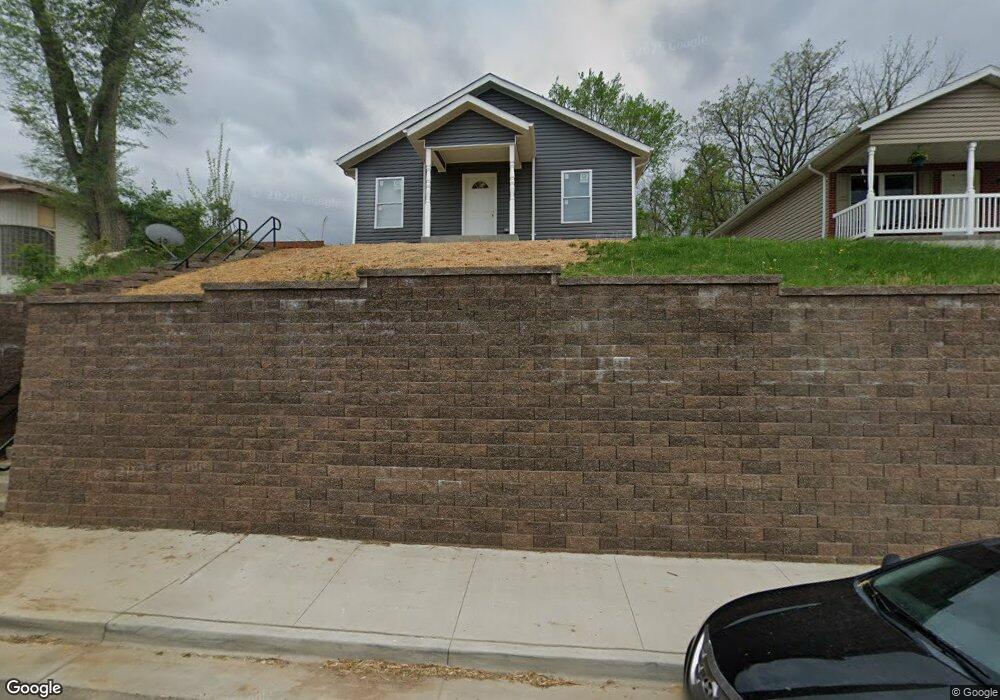
1206 E High St Jefferson City, MO 65101
Estimated Value: $171,000 - $270,594
4
Beds
2
Baths
1,400
Sq Ft
$163/Sq Ft
Est. Value
About This Home
This home is located at 1206 E High St, Jefferson City, MO 65101 and is currently estimated at $227,649, approximately $162 per square foot. 1206 E High St is a home with nearby schools including East Elementary School, Lewis & Clark Middle School, and Jefferson City High School.
Ownership History
Date
Name
Owned For
Owner Type
Purchase Details
Closed on
Apr 26, 2024
Sold by
River City Bank Inc
Bought by
Chappell Josh and Jarrett Kaylynn
Current Estimated Value
Home Financials for this Owner
Home Financials are based on the most recent Mortgage that was taken out on this home.
Original Mortgage
$144,400
Outstanding Balance
$141,771
Interest Rate
6.74%
Mortgage Type
Seller Take Back
Estimated Equity
$85,878
Purchase Details
Closed on
Sep 28, 2018
Sold by
S J & H M Kliethermes Ret
Bought by
River City Habitat Humnty
Create a Home Valuation Report for This Property
The Home Valuation Report is an in-depth analysis detailing your home's value as well as a comparison with similar homes in the area
Home Values in the Area
Average Home Value in this Area
Purchase History
| Date | Buyer | Sale Price | Title Company |
|---|---|---|---|
| Chappell Josh | -- | None Listed On Document | |
| Chappell Josh | -- | None Listed On Document | |
| River City Habitat Humnty | -- | -- |
Source: Public Records
Mortgage History
| Date | Status | Borrower | Loan Amount |
|---|---|---|---|
| Open | Chappell Josh | $144,400 | |
| Closed | Chappell Josh | $144,400 |
Source: Public Records
Tax History
| Year | Tax Paid | Tax Assessment Tax Assessment Total Assessment is a certain percentage of the fair market value that is determined by local assessors to be the total taxable value of land and additions on the property. | Land | Improvement |
|---|---|---|---|---|
| 2025 | $1,274 | $28,880 | $1,330 | $27,550 |
| 2024 | $13 | $21,370 | $1,330 | $20,040 |
| 2023 | $0 | $0 | $0 | $0 |
| 2022 | $0 | $0 | $0 | $0 |
| 2021 | $0 | $0 | $0 | $0 |
| 2020 | $0 | $0 | $0 | $0 |
| 2019 | $457 | $0 | $0 | $0 |
| 2018 | $457 | $8,303 | $1,330 | $6,973 |
| 2017 | $446 | $7,733 | $1,330 | $6,403 |
| 2016 | -- | $7,733 | $1,330 | $6,403 |
| 2015 | -- | $0 | $0 | $0 |
| 2014 | $439 | $8,892 | $1,330 | $7,562 |
Source: Public Records
Map
Nearby Homes
- 1209 E High St
- 1121 E Mccarty St
- 107 N Taylor St
- 1303 E Elm St
- 1403 E Mccarty St
- 613 Houchin St
- 1422 E Miller St
- 201 Buchanan St
- 1606 E Mccarty St
- 927 Harding St
- 503 E High St
- 105 Nash Ct
- 1000 Moreau Dr
- 125 Nash Ct
- 1530 Marsha Ln
- 1000 Fairmount Ct
- 1202 Moreau Dr
- 1303 Eminence Dr
- 906 Monroe St
- 1000 Monroe St
Your Personal Tour Guide
Ask me questions while you tour the home.