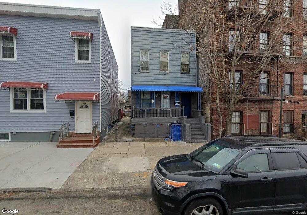
1206 Olmstead Ave Bronx, NY 10462
Unionport NeighborhoodEstimated Value: $606,000 - $946,000
Studio
--
Bath
1,636
Sq Ft
$457/Sq Ft
Est. Value
About This Home
This home is located at 1206 Olmstead Ave, Bronx, NY 10462 and is currently estimated at $747,347, approximately $456 per square foot. 1206 Olmstead Ave is a home located in Bronx County with nearby schools including P.S. 36 Unionport, Herbert H Lehman High School, and St Helena School.
Ownership History
Date
Name
Owned For
Owner Type
Purchase Details
Closed on
Sep 29, 2010
Sold by
Your First Home Llc
Bought by
Ramos Miguel
Current Estimated Value
Home Financials for this Owner
Home Financials are based on the most recent Mortgage that was taken out on this home.
Original Mortgage
$453,887
Outstanding Balance
$299,517
Interest Rate
4.35%
Mortgage Type
Purchase Money Mortgage
Estimated Equity
$447,830
Purchase Details
Closed on
Jun 16, 2010
Sold by
Aurora Loan Services
Bought by
Your First Home Llc
Purchase Details
Closed on
Aug 25, 2008
Sold by
Yoon Esq As Referee Youngik
Bought by
Aurora Loan Services
Purchase Details
Closed on
Nov 19, 2003
Sold by
Maldonado Carmelo I and Maldonado-Sanchez Maria
Bought by
Martinez Carlos
Home Financials for this Owner
Home Financials are based on the most recent Mortgage that was taken out on this home.
Original Mortgage
$275,000
Interest Rate
5.4%
Mortgage Type
Purchase Money Mortgage
Create a Home Valuation Report for This Property
The Home Valuation Report is an in-depth analysis detailing your home's value as well as a comparison with similar homes in the area
Home Values in the Area
Average Home Value in this Area
Purchase History
| Date | Buyer | Sale Price | Title Company |
|---|---|---|---|
| Ramos Miguel | $460,000 | -- | |
| Your First Home Llc | $207,000 | -- | |
| Aurora Loan Services | $467,580 | -- | |
| Martinez Carlos | $290,000 | -- |
Source: Public Records
Mortgage History
| Date | Status | Borrower | Loan Amount |
|---|---|---|---|
| Open | Ramos Miguel | $453,887 | |
| Previous Owner | Martinez Carlos | $275,000 |
Source: Public Records
Tax History Compared to Growth
Tax History
| Year | Tax Paid | Tax Assessment Tax Assessment Total Assessment is a certain percentage of the fair market value that is determined by local assessors to be the total taxable value of land and additions on the property. | Land | Improvement |
|---|---|---|---|---|
| 2025 | $5,440 | $28,663 | $5,893 | $22,770 |
| 2024 | $5,440 | $27,086 | $6,636 | $20,450 |
| 2023 | $5,450 | $26,836 | $6,332 | $20,504 |
| 2022 | $5,056 | $36,000 | $8,820 | $27,180 |
| 2021 | $5,028 | $33,900 | $8,820 | $25,080 |
| 2020 | $5,056 | $27,600 | $8,820 | $18,780 |
| 2019 | $4,722 | $27,600 | $8,820 | $18,780 |
| 2018 | $4,559 | $22,363 | $7,627 | $14,736 |
| 2017 | $4,302 | $21,105 | $6,573 | $14,532 |
| 2016 | $3,980 | $19,911 | $7,087 | $12,824 |
| 2015 | $2,401 | $19,905 | $9,114 | $10,791 |
| 2014 | $2,401 | $18,810 | $8,517 | $10,293 |
Source: Public Records
Map
Nearby Homes
- 2131 Newbold Ave
- 2164 Cross Bronx Expy
- 2016 Haviland Ave
- 2012 Benedict Ave
- 1039 Olmstead Ave
- 2120 Chatterton Ave
- 1163 Havemeyer Ave
- 2053 Mcgraw Ave Unit 4E
- 1966 Newbold Ave Unit 108
- 1966 Newbold Ave Unit 1510
- 1966 Newbold Ave Unit 1502
- 1966 Newbold Ave Unit 505
- 1966 Newbold Ave Unit 408
- 1966 Newbold Ave Unit 904
- 1966 Newbold Ave Unit 308
- 1966 Newbold Ave Unit 303
- 1966 Newbold Ave Unit 405
- 1966 Newbold Ave Unit 104
- 2131 Bruckner Blvd
- 1170 Havemeyer Ave
- 1208 Olmstead Ave
- 2109 Gleason Ave
- 1210 Olmstead Ave
- 2111 Gleason Ave
- 1212 Olmstead Ave
- 1214 Olmstead Ave
- 2110 Ellis Ave
- 2115 Gleason Ave
- 1216 Olmstead Ave
- 2118 Ellis Ave
- 2123 Gleason Ave
- 2129 Gleason Ave
- 2124 Ellis Ave
- 1232 Olmstead Ave
- 2131 Gleason Ave
- 1234 Olmstead Ave
- 2111 Ellis Ave
- 2115 Cross Bronx Expy
- 2133 Gleason Ave
- 2113 Ellis Ave