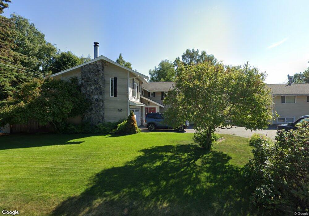
1206 Oxford Dr Anchorage, AK 99503
Spenard NeighborhoodEstimated Value: $458,000 - $507,000
5
Beds
3
Baths
1,789
Sq Ft
$274/Sq Ft
Est. Value
About This Home
This home is located at 1206 Oxford Dr, Anchorage, AK 99503 and is currently estimated at $490,648, approximately $274 per square foot. 1206 Oxford Dr is a home located in Anchorage Municipality with nearby schools including Willow Crest Elementary School, Romig Middle School, and West High School.
Ownership History
Date
Name
Owned For
Owner Type
Purchase Details
Closed on
Apr 25, 1995
Sold by
Lindman Beulah A
Bought by
Lindman Chad R and Lindman Melissa M
Current Estimated Value
Home Financials for this Owner
Home Financials are based on the most recent Mortgage that was taken out on this home.
Original Mortgage
$124,000
Interest Rate
8.44%
Mortgage Type
New Conventional
Create a Home Valuation Report for This Property
The Home Valuation Report is an in-depth analysis detailing your home's value as well as a comparison with similar homes in the area
Home Values in the Area
Average Home Value in this Area
Purchase History
| Date | Buyer | Sale Price | Title Company |
|---|---|---|---|
| Lindman Chad R | -- | -- | |
| Lindman Chad R | -- | -- | |
| Lindman Chad R | -- | -- |
Source: Public Records
Mortgage History
| Date | Status | Borrower | Loan Amount |
|---|---|---|---|
| Closed | Lindman Chad R | $124,000 |
Source: Public Records
Tax History Compared to Growth
Tax History
| Year | Tax Paid | Tax Assessment Tax Assessment Total Assessment is a certain percentage of the fair market value that is determined by local assessors to be the total taxable value of land and additions on the property. | Land | Improvement |
|---|---|---|---|---|
| 2025 | $4,256 | $520,800 | $98,300 | $422,500 |
| 2024 | $4,256 | $488,600 | $98,300 | $390,300 |
| 2023 | $7,369 | $432,700 | $98,300 | $334,400 |
| 2022 | $6,423 | $431,400 | $98,300 | $333,100 |
| 2021 | $6,669 | $370,100 | $98,300 | $271,800 |
| 2020 | $5,489 | $373,200 | $98,300 | $274,900 |
| 2019 | $5,281 | $372,800 | $98,300 | $274,500 |
| 2018 | $5,360 | $376,800 | $98,300 | $278,500 |
| 2017 | $5,826 | $392,000 | $98,300 | $293,700 |
| 2016 | $5,084 | $376,800 | $96,700 | $280,100 |
| 2015 | $5,084 | $382,600 | $96,700 | $285,900 |
| 2014 | $5,084 | $361,500 | $96,700 | $264,800 |
Source: Public Records
Map
Nearby Homes
- 4962 Nottingham Way
- 4904 Cambridge Way
- 4906 Cambridge Way
- 4309 Wilson St
- 4309 Garfield St
- 1808 W 47th Ave
- 1106 W 54th Ave
- 4300 Hayes St
- 4209 Hayes St
- 4113 Cope St
- 4106 N Star St
- 2101 W 47th Ave
- 2040 Wenmatt Cir
- 3901 Hayes St
- 4810 C St
- 3729 Mccain Loop
- 3731 Mccain Loop
- 904 Chugach Way
- 1110 Chugach Way
- 2202 Lincoln Ave
- 1208 Oxford Dr
- 1202 Oxford Dr
- 4807 Buckingham Way
- 4805 Buckingham Way
- 1207 Oxford Dr
- 4853 Nottingham Way
- 4800 Cambridge Way
- 1205 Oxford Dr
- 4803 Buckingham Way
- 1255 Oxford Dr
- 1215 Oxford Dr
- 1209 Oxford Dr
- 4809 Buckingham Way
- 1201 Oxford Dr
- 4804 Cambridge Way
- 1305 Oxford Dr
- 1321 Oxford Dr
- 4811 Buckingham Way
- 1206 W 47th Ave Unit A
- 1206 W 47th Ave Unit C