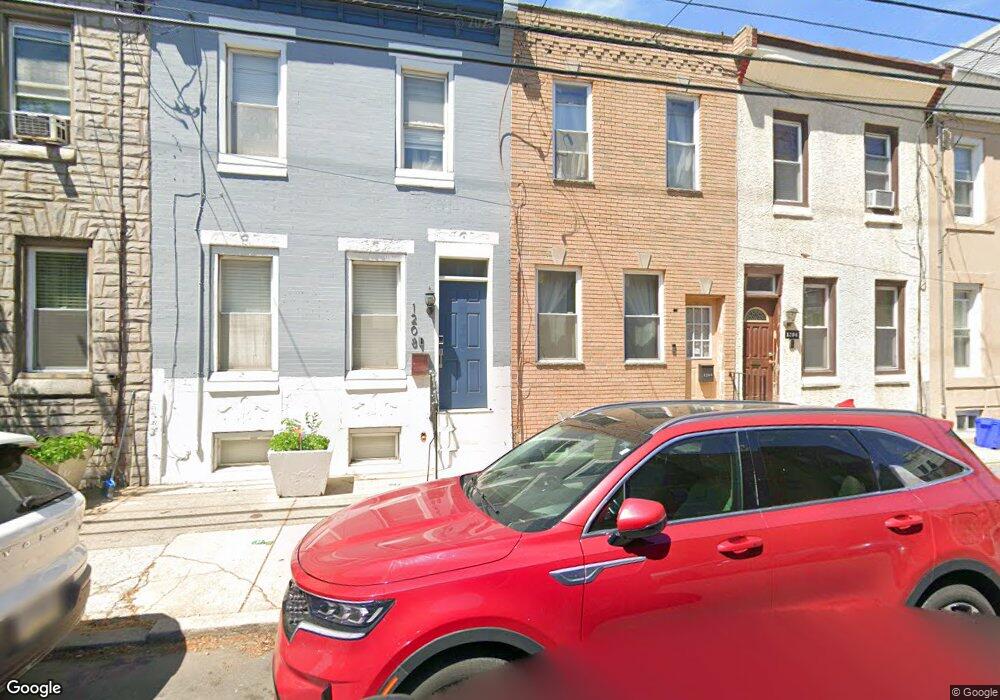
1206 S 21st St Philadelphia, PA 19146
Point Breeze NeighborhoodEstimated Value: $163,000 - $284,806
3
Beds
1
Bath
1,092
Sq Ft
$201/Sq Ft
Est. Value
About This Home
This home is located at 1206 S 21st St, Philadelphia, PA 19146 and is currently estimated at $219,702, approximately $201 per square foot. 1206 S 21st St is a home located in Philadelphia County with nearby schools including Edwin M. Stanton School, South Philadelphia High School, and Crooked Places Made Straight Christian Academy.
Ownership History
Date
Name
Owned For
Owner Type
Purchase Details
Closed on
Sep 12, 2025
Sold by
Simmons Diane
Bought by
Rock Hard Renos Llc
Current Estimated Value
Home Financials for this Owner
Home Financials are based on the most recent Mortgage that was taken out on this home.
Original Mortgage
$258,900
Outstanding Balance
$258,900
Interest Rate
6.72%
Mortgage Type
Credit Line Revolving
Estimated Equity
-$39,198
Purchase Details
Closed on
Jan 28, 1998
Sold by
Simmons Monica and Simmons Diane C
Bought by
Simmons Diane
Create a Home Valuation Report for This Property
The Home Valuation Report is an in-depth analysis detailing your home's value as well as a comparison with similar homes in the area
Home Values in the Area
Average Home Value in this Area
Purchase History
| Date | Buyer | Sale Price | Title Company |
|---|---|---|---|
| Rock Hard Renos Llc | $141,800 | Fortune Title | |
| Simmons Diane | -- | -- |
Source: Public Records
Mortgage History
| Date | Status | Borrower | Loan Amount |
|---|---|---|---|
| Open | Rock Hard Renos Llc | $258,900 |
Source: Public Records
Tax History Compared to Growth
Tax History
| Year | Tax Paid | Tax Assessment Tax Assessment Total Assessment is a certain percentage of the fair market value that is determined by local assessors to be the total taxable value of land and additions on the property. | Land | Improvement |
|---|---|---|---|---|
| 2025 | $924 | $282,200 | $56,440 | $225,760 |
| 2024 | $924 | $282,200 | $56,440 | $225,760 |
| 2023 | $924 | $256,300 | $51,260 | $205,040 |
| 2022 | $924 | $66,000 | $51,260 | $14,740 |
| 2021 | $924 | $0 | $0 | $0 |
| 2020 | $924 | $0 | $0 | $0 |
| 2019 | $924 | $0 | $0 | $0 |
| 2018 | $924 | $0 | $0 | $0 |
| 2017 | $924 | $0 | $0 | $0 |
| 2016 | $924 | $0 | $0 | $0 |
| 2015 | $635 | $0 | $0 | $0 |
| 2014 | -- | $114,600 | $11,810 | $102,790 |
| 2012 | -- | $7,040 | $1,408 | $5,632 |
Source: Public Records
Map
Nearby Homes
- 2117 Latona St
- 2133 Latona St
- 1239 S 21st St
- 2040 Manton St
- 2034 Manton St
- 1228 S 22nd St
- 1226 S 22nd St
- 1267 S 22nd St
- 2016 Manton St
- 2134 Wharton St
- 2019 Manton St
- 2137 Federal St
- 2211 Titan St
- 2139 Sears St
- 2008 Latona St
- 2132 Sears St
- 2232 Oakford St
- 2002 Titan St
- 2225 Wharton St
- 2050 Ellsworth St
- 1208 S 21st St
- 1204 S 21st St
- 1202 S 21st St
- 1210 S 21st St
- 1200 S 21st St Unit 2
- 1200 S 21st St Unit 2
- 1200 S 21st St Unit B
- 1200 S 21st St
- 2108 Federal St
- 1212 S 21st St
- 2111 Manton St
- 2110 Federal St
- 2113 Manton St
- 2112 Federal St
- 2722 Manton St
- 2714 Manton St
- 2718 Manton St
- 2708 Manton St
- 2730-36 Manton St
- 2115 Manton St