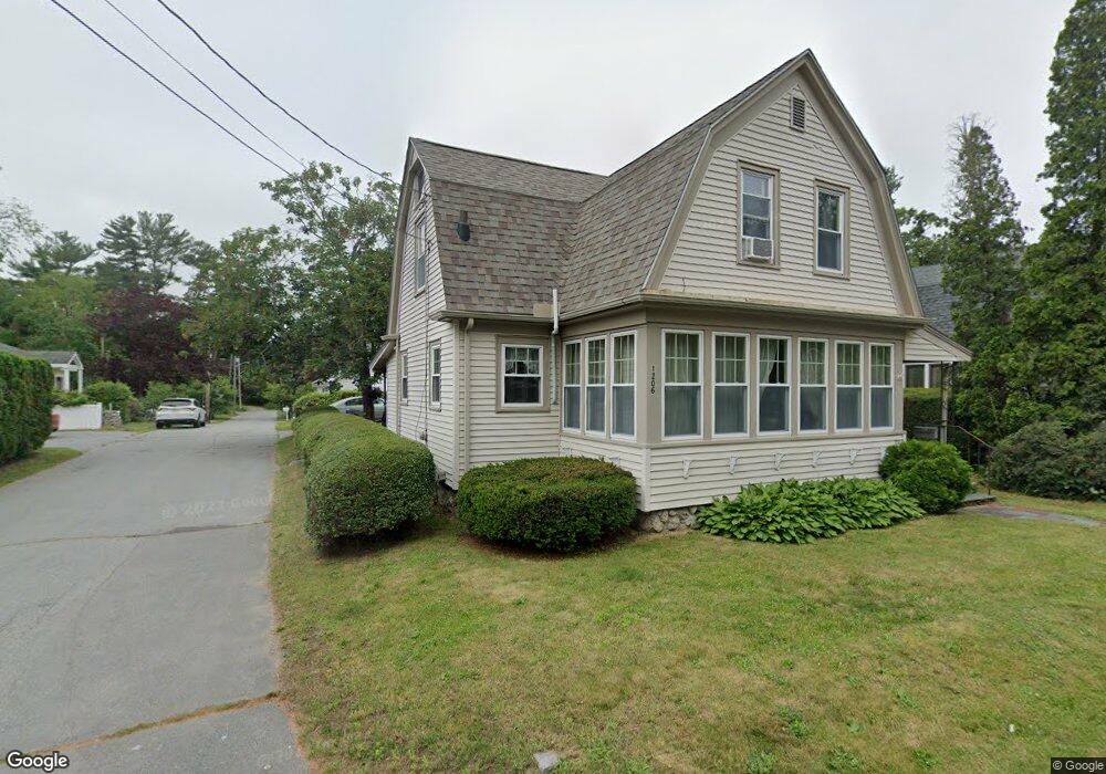
1206 Sassaquin Ave New Bedford, MA 02745
Estimated Value: $375,000 - $457,000
2
Beds
1
Bath
1,280
Sq Ft
$331/Sq Ft
Est. Value
About This Home
This home is located at 1206 Sassaquin Ave, New Bedford, MA 02745 and is currently estimated at $423,944, approximately $331 per square foot. 1206 Sassaquin Ave is a home located in Bristol County with nearby schools including Casimir Pulaski Elementary School, Normandin Middle School, and New Bedford High School.
Ownership History
Date
Name
Owned For
Owner Type
Purchase Details
Closed on
Jan 10, 2003
Sold by
Frey Michael F
Bought by
Maccord William K and Maccord Michelle J
Current Estimated Value
Home Financials for this Owner
Home Financials are based on the most recent Mortgage that was taken out on this home.
Original Mortgage
$173,000
Outstanding Balance
$74,717
Interest Rate
6.19%
Mortgage Type
Purchase Money Mortgage
Estimated Equity
$349,227
Purchase Details
Closed on
Mar 24, 1995
Sold by
Mccarthy Leonie J
Bought by
Frey Michael R and Frey Lisbeth A
Create a Home Valuation Report for This Property
The Home Valuation Report is an in-depth analysis detailing your home's value as well as a comparison with similar homes in the area
Home Values in the Area
Average Home Value in this Area
Purchase History
| Date | Buyer | Sale Price | Title Company |
|---|---|---|---|
| Maccord William K | $188,000 | -- | |
| Maccord William K | $188,000 | -- | |
| Frey Michael R | $73,500 | -- | |
| Frey Michael R | $73,500 | -- |
Source: Public Records
Mortgage History
| Date | Status | Borrower | Loan Amount |
|---|---|---|---|
| Open | Frey Michael R | $173,000 | |
| Closed | Frey Michael R | $173,000 | |
| Previous Owner | Frey Michael R | $93,750 | |
| Previous Owner | Frey Michael R | $53,000 |
Source: Public Records
Tax History Compared to Growth
Tax History
| Year | Tax Paid | Tax Assessment Tax Assessment Total Assessment is a certain percentage of the fair market value that is determined by local assessors to be the total taxable value of land and additions on the property. | Land | Improvement |
|---|---|---|---|---|
| 2025 | $4,060 | $359,000 | $119,200 | $239,800 |
| 2024 | $4,026 | $335,500 | $133,200 | $202,300 |
| 2023 | $3,961 | $277,200 | $100,900 | $176,300 |
| 2022 | $3,561 | $236,900 | $96,400 | $140,500 |
| 2021 | $3,561 | $228,400 | $96,400 | $132,000 |
| 2020 | $3,429 | $212,200 | $96,400 | $115,800 |
| 2019 | $3,381 | $205,300 | $99,900 | $105,400 |
| 2018 | $3,210 | $193,000 | $99,900 | $93,100 |
| 2017 | $3,084 | $184,800 | $98,100 | $86,700 |
| 2016 | $3,044 | $184,600 | $101,600 | $83,000 |
| 2015 | $2,874 | $182,700 | $101,600 | $81,100 |
| 2014 | $2,764 | $182,300 | $101,600 | $80,700 |
Source: Public Records
Map
Nearby Homes
- 16 Swallow St
- 13 Luscomb Ln
- 82 Susan St
- 946 Thorndike St
- 34 Poplar Rd
- 26 Blueberry Dr
- 210 Heritage Dr
- 4597 Acushnet Ave
- 145 Heritage Dr
- 1063 Westgate St
- SS Charbonneau Ln
- 2 Woodland Rd
- 62 Longview Rd
- 700 Pine Hill Dr
- 63 County Rd
- 1269 Bartlett St
- 34 Wood Duck Rd
- 0 Costa Dr
- 1350 Phillips Rd
- 1045 Forbes St
- 1214 Sassaquin Ave
- 3 Oriole St Unit A
- 3 Oriole St Unit B
- 1200 Sassaquin Ave
- 13 Oriole St
- 1216 Sassaquin Ave
- 17 Oriole St
- 12 Oriole St
- 1217 Cardinal St
- 1194 Sassaquin Ave
- 7 Cardinal St
- 12 Thrush St
- 1 Cardinal St
- 1189 Cardinal St
- 1188 Sassaquin Ave
- 1045 Cardinal St
- 0 Cardinal St
- 25 Oriole St
- 26 Oriole St
- 1232 Sassaquin Ave