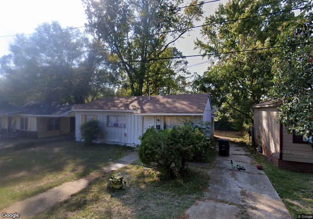
1206 Taylor St Ruston, LA 71270
Estimated Value: $59,000 - $133,000
Studio
--
Bath
1,368
Sq Ft
$76/Sq Ft
Est. Value
About This Home
This home is located at 1206 Taylor St, Ruston, LA 71270 and is currently estimated at $104,595, approximately $76 per square foot. 1206 Taylor St is a home located in Lincoln Parish with nearby schools including Cypress Springs Elementary School, Glen View Elementary School, and Ruston Junior High School.
Ownership History
Date
Name
Owned For
Owner Type
Purchase Details
Closed on
Mar 14, 2018
Sold by
First National Bank
Bought by
Dunaway Cornelius L
Current Estimated Value
Purchase Details
Closed on
Oct 29, 2007
Sold by
Mack George R and Jackson Pentrella Mack
Bought by
Mack George
Create a Home Valuation Report for This Property
The Home Valuation Report is an in-depth analysis detailing your home's value as well as a comparison with similar homes in the area
Purchase History
| Date | Buyer | Sale Price | Title Company |
|---|---|---|---|
| Dunaway Cornelius L | $15,000 | -- | |
| Mack George | -- | None Available |
Source: Public Records
Tax History
| Year | Tax Paid | Tax Assessment Tax Assessment Total Assessment is a certain percentage of the fair market value that is determined by local assessors to be the total taxable value of land and additions on the property. | Land | Improvement |
|---|---|---|---|---|
| 2025 | $341 | $3,997 | $300 | $3,697 |
| 2024 | $341 | $3,997 | $300 | $3,697 |
| 2023 | $312 | $3,516 | $175 | $3,341 |
| 2022 | $314 | $3,516 | $175 | $3,341 |
| 2021 | $291 | $3,516 | $175 | $3,341 |
| 2020 | $309 | $3,719 | $200 | $3,519 |
| 2019 | $302 | $3,719 | $200 | $3,519 |
| 2018 | $294 | $3,719 | $200 | $3,519 |
| 2017 | $295 | $3,719 | $200 | $3,519 |
| 2016 | $293 | $0 | $0 | $0 |
| 2015 | $264 | $3,079 | $200 | $2,879 |
| 2013 | $269 | $3,079 | $200 | $2,879 |
Source: Public Records
Map
Nearby Homes
- 1506 Allen St
- 901 Jones St
- 000 S Vienna St
- 716 Jody Ct
- 615 S Vienna St Unit 615 1/2 S. Vienna St
- 000 Highway 146
- 500 S Bonner St
- 1302 Hodges Ave
- 203 E California Ave
- 509 2nd Ave
- 3216 Sequoia Ave
- 134 Clearwater Cir
- 122 Alder Place
- 620 Riviera Ave
- 2104 Sleepy Hollow St
- 2112 Sleepy Hollow St
- 2113 Sleepy Hollow St
- 3100 Sequoia Ave
- 2109 Merion St
- 128 Baywood Ln
- 1204 Taylor St
- 1208 Taylor St
- 000 W Vaughn Ave
- 410 Lincoln Ave
- 1206 Oakdale St
- 1105 Taylor St
- 1208 Oakdale St
- 1204 Oakdale St
- 1202 Oakdale St
- 1100 Taylor St
- 1106 Oakdale St
- 1103 Taylor St
- 000 Oakdale St
- 000 Oakdale St
- 1102 Oakdale St
- 1017 Taylor St
- 1100 Oakdale St
- 1205 Oakdale St
- 1013 Taylor St
- 1301 Oakdale St
Your Personal Tour Guide
Ask me questions while you tour the home.