Estimated Value: $95,350 - $121,000
Studio
--
Bath
1,181
Sq Ft
$92/Sq Ft
Est. Value
About This Home
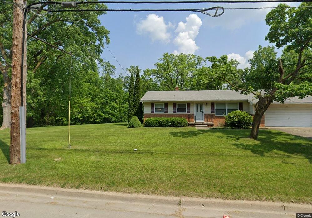
This home is located at 1206 W Hemphill Rd, Flint, MI 48507 and is currently estimated at $109,088, approximately $92 per square foot. 1206 W Hemphill Rd is a home located in Genesee County with nearby schools including South Bendle Elementary School, West Bendle Elementary School, and Bendle Middle School.
Ownership History
Date
Name
Owned For
Owner Type
Purchase Details
Closed on
Mar 27, 2018
Sold by
Hannoeh Talal and Hannoeh Wendy
Bought by
Hannosh Properties Llc
Current Estimated Value
Purchase Details
Closed on
Aug 25, 2005
Sold by
Kildee Daniel T
Bought by
Lee Wendy and Hannosh Talal
Create a Home Valuation Report for This Property
The Home Valuation Report is an in-depth analysis detailing your home's value as well as a comparison with similar homes in the area
Home Values in the Area
Average Home Value in this Area
Purchase History
| Date | Buyer | Sale Price | Title Company |
|---|---|---|---|
| Hannosh Properties Llc | -- | None Available | |
| Lee Wendy | $7,363 | -- |
Source: Public Records
Tax History Compared to Growth
Tax History
| Year | Tax Paid | Tax Assessment Tax Assessment Total Assessment is a certain percentage of the fair market value that is determined by local assessors to be the total taxable value of land and additions on the property. | Land | Improvement |
|---|---|---|---|---|
| 2025 | $1,869 | $44,000 | $0 | $0 |
| 2024 | $1,668 | $35,400 | $0 | $0 |
| 2023 | $1,614 | $36,600 | $0 | $0 |
| 2022 | $310 | $33,700 | $0 | $0 |
| 2021 | $152 | $22,300 | $0 | $0 |
| 2020 | $1,615 | $22,500 | $0 | $0 |
| 2019 | $1,401 | $20,400 | $0 | $0 |
| 2018 | $1,508 | $20,800 | $0 | $0 |
| 2017 | $1,470 | $20,800 | $0 | $0 |
| 2016 | $1,460 | $20,000 | $0 | $0 |
| 2015 | $1,546 | $0 | $0 | $0 |
| 2012 | -- | $17,900 | $17,900 | $0 |
Source: Public Records
Map
Nearby Homes
- 4424 Cheyenne Ave
- 913 Macdonald Ave
- 802 McKeighan Ave
- 621 Lochhead Ave
- 3188 E Hemphill Rd
- 0000 E Bristol Rd
- 621 Burroughs Ave
- 630 Buckingham Ave
- 3614 Comanche Ave
- 4127 Custer Ave
- 3505 Comanche Ave
- 3512 Barcey Ct
- 4205 Red Arrow Rd
- 2207 E Boatfield Ave
- 2231 E Bergin Ave
- 3280 E Atherton Rd
- 326 Burroughs Ave
- 3222 Chambers St
- 3115 Circle Dr
- 2077 E Boatfield Ave
- 1220 W Hemphill Rd
- 1236 W Hemphill Rd
- 1230 W Hemphill Rd
- 3267 Cheyenne Ave
- 3268 Menominee St
- 3271 Cheyenne Ave
- 3272 Menominee St
- 3275 Cheyenne Ave
- 3276 Menominee St
- 3281 Cheyenne Ave
- 3280 Menominee St
- 3285 Cheyenne Ave
- 3268 Cheyenne Ave
- 1117 E Hemphill Rd
- 3272 Cheyenne Ave
- 3271 Menominee St
- 3276 Cheyenne Ave
- 3290 Menominee St
- 3289 Cheyenne Ave
- 3277 Menominee St