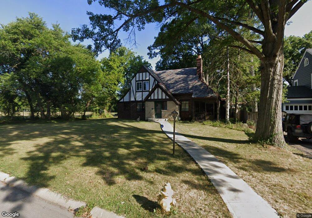
1206 Wionna Ave Cincinnati, OH 45224
College Hill NeighborhoodEstimated Value: $305,000 - $352,000
3
Beds
3
Baths
2,498
Sq Ft
$131/Sq Ft
Est. Value
About This Home
This home is located at 1206 Wionna Ave, Cincinnati, OH 45224 and is currently estimated at $328,309, approximately $131 per square foot. 1206 Wionna Ave is a home located in Hamilton County with nearby schools including Pleasant Hill Elementary School, Robert A. Taft Information Technology High School, and Western Hills High School.
Ownership History
Date
Name
Owned For
Owner Type
Purchase Details
Closed on
Dec 18, 2019
Sold by
Threatts Carlon Allen and Thretts Deborah Elise
Bought by
Threatts Christopher Augustus
Current Estimated Value
Purchase Details
Closed on
Mar 19, 2019
Sold by
Estate Of Betty Jean Threatts
Bought by
Threatts Carlton Allen and Threatts Deborah Elise
Purchase Details
Closed on
Jul 19, 2007
Sold by
Estate Of Charles Threatts Jr
Bought by
Threatts Betty Jean
Purchase Details
Closed on
Apr 28, 2004
Sold by
Gholz Justin
Bought by
Sanders Steven H
Home Financials for this Owner
Home Financials are based on the most recent Mortgage that was taken out on this home.
Original Mortgage
$70,000
Interest Rate
5.25%
Mortgage Type
Purchase Money Mortgage
Purchase Details
Closed on
Sep 23, 2003
Sold by
Threatts Betty Jean
Bought by
Threatts Charles A and Threatts Betty J
Create a Home Valuation Report for This Property
The Home Valuation Report is an in-depth analysis detailing your home's value as well as a comparison with similar homes in the area
Home Values in the Area
Average Home Value in this Area
Purchase History
| Date | Buyer | Sale Price | Title Company |
|---|---|---|---|
| Threatts Christopher Augustus | -- | None Available | |
| Threatts Carlton Allen | -- | None Available | |
| Threatts Betty Jean | -- | Attorney | |
| Sanders Steven H | $70,000 | Chicago Title Insurance Comp | |
| Threatts Charles A | -- | Jets Title Agency Llc |
Source: Public Records
Mortgage History
| Date | Status | Borrower | Loan Amount |
|---|---|---|---|
| Previous Owner | Sanders Steven H | $70,000 |
Source: Public Records
Tax History Compared to Growth
Tax History
| Year | Tax Paid | Tax Assessment Tax Assessment Total Assessment is a certain percentage of the fair market value that is determined by local assessors to be the total taxable value of land and additions on the property. | Land | Improvement |
|---|---|---|---|---|
| 2024 | $4,505 | $75,268 | $14,049 | $61,219 |
| 2023 | $4,607 | $75,268 | $14,049 | $61,219 |
| 2022 | $3,317 | $46,823 | $11,438 | $35,385 |
| 2021 | $3,255 | $46,823 | $11,438 | $35,385 |
| 2020 | $3,265 | $46,823 | $11,438 | $35,385 |
| 2019 | $3,145 | $41,073 | $10,035 | $31,038 |
| 2018 | $3,148 | $41,073 | $10,035 | $31,038 |
| 2017 | $3,031 | $41,073 | $10,035 | $31,038 |
| 2016 | $3,094 | $40,888 | $10,707 | $30,181 |
| 2015 | $2,058 | $40,888 | $10,707 | $30,181 |
| 2014 | $2,074 | $40,888 | $10,707 | $30,181 |
| 2013 | $2,193 | $42,154 | $11,039 | $31,115 |
Source: Public Records
Map
Nearby Homes
- 1205 Wionna Ave
- 1406 Wittekind Terrace
- 6123 Faircrest Ct
- 1453 Larrywood Ln
- 1137 Homeside Ave
- 1428 Ambrose Ave
- 1147 Homeside Ave
- 1437 Ambrose Ave
- 1541 Wittekind Terrace
- 1090 Elda Ln
- 6014 Argus Rd
- 1148 Hollywood Ave
- 5923 Lantana Ave
- 1140 Hollywood Ave
- 1549 Teakwood Ave
- 1063 Roxie Ln
- 1417 Cedar Ave
- 1127 Cedar Ave
- 6340 Hamilton Ave
- 5839 Argus Rd
- 1202 Wionna Ave
- 6301 Edwood Ave
- 6305 Edwood Ave
- 6307 Edwood Ave
- 1203 Wionna Ave
- 6211 Edwood Ave
- 6309 Edwood Ave
- 1319 Wittekind Terrace
- 1325 Wittekind Terrace
- 1329 Wittekind Terrace
- 6209 Edwood Ave
- 6311 Edwood Ave
- 1333 Wittekind Terrace
- 1337 Wittekind Terrace
- 6313 Edwood Ave
- 6300 Edwood Ave
- 1341 Wittekind Terrace
- 6308 Edwood Ave
- 6312 Edwood Ave
- 6205 Edwood Ave