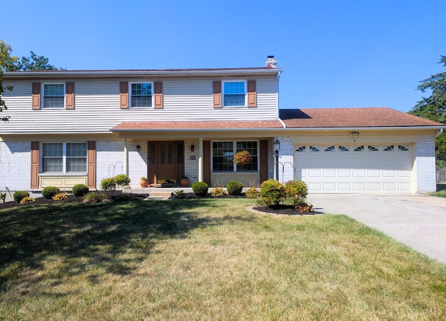
12069 Cantrell Dr Cincinnati, OH 45246
Estimated payment $2,344/month
Highlights
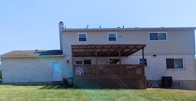
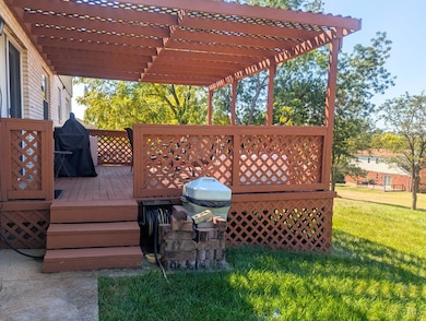
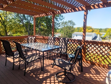
- Covered Deck
- Marble Flooring
- Solid Surface Countertops
- Springdale Elementary School Rated A-
- Traditional Architecture
- No HOA
About This Home
Welcome to the original model home of the community! Upgrades throughout the home include newer windows installed in 2022, new bathrooms with updated tiles scheduled for 2024, a new roof from 2009, an oversized garage, a finished basement, first-floor laundry, and new central air installed in 2023.
Home Details
Home Type
- Single Family
Est. Annual Taxes
- $4,410
Year Built
- Built in 1973
Lot Details
- 0.34 Acre Lot
- Fenced
Parking
- 2 Car Attached Garage
- Oversized Parking
- Garage Door Opener
- Driveway
Home Design
- Traditional Architecture
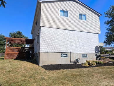
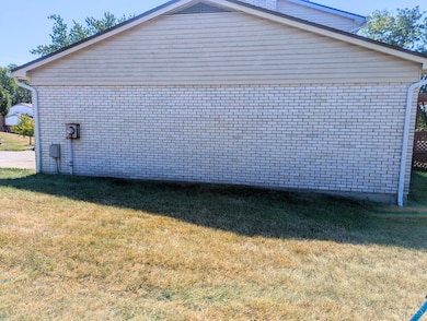
- Brick Exterior Construction
- Poured Concrete
- Shingle Roof
- Vinyl Siding
Interior Spaces
- 2,956 Sq Ft Home
- 2-Story Property
- Beamed Ceilings
- Ceiling Fan
- Chandelier
- Wood Burning Fireplace
- Vinyl Clad Windows
- Insulated Windows
- Double Hung Windows
- French Doors
- Family Room with Fireplace
- Finished Basement
- Basement Fills Entire Space Under The House
Kitchen
- Eat-In Kitchen
- Oven or Range
- Microwave
- Dishwasher
- Smart Appliances
- Solid Surface Countertops
- Solid Wood Cabinet
- Trash Compactor
- Disposal
Flooring
- Wood
- Concrete
- Marble
Bedrooms and Bathrooms
- 4 Bedrooms
- Walk-In Closet
- Dual Vanity Sinks in Primary Bathroom
- Bathtub with Shower
Laundry
- Dryer
- Washer
Home Security
- Smart Security System
- Smart Lights or Controls
- Smart Thermostat
- Fire and Smoke Detector
Accessible Home Design
- Smart Technology
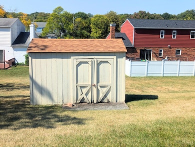
Outdoor Features
- Covered Deck
- Shed
- Outdoor Grill
Utilities
- 95% Forced Air Zoned Heating and Cooling System
- ENERGY STAR Qualified Air Conditioning
- Humidifier
- Hot Water Heating System
- Gas Water Heater
- Water Softener
- Cable TV Available
Community Details
- No Home Owners Association
Listing and Financial Details
- Home warranty included in the sale of the property
Map
Home Values in the Area
Average Home Value in this Area
Tax History
| Year | Tax Paid | Tax Assessment Tax Assessment Total Assessment is a certain percentage of the fair market value that is determined by local assessors to be the total taxable value of land and additions on the property. | Land | Improvement |
|---|---|---|---|---|
| 2024 | $4,410 | $96,530 | $14,749 | $81,781 |
| 2023 | $4,331 | $96,530 | $14,749 | $81,781 |
| 2022 | $3,755 | $68,240 | $12,376 | $55,864 |
| 2021 | $3,730 | $68,240 | $12,376 | $55,864 |
| 2020 | $3,679 | $68,240 | $12,376 | $55,864 |
| 2019 | $3,421 | $58,324 | $10,577 | $47,747 |
| 2018 | $3,225 | $58,324 | $10,577 | $47,747 |
| 2017 | $3,077 | $58,324 | $10,577 | $47,747 |
| 2016 | $3,124 | $58,090 | $11,029 | $47,061 |
| 2015 | $3,107 | $58,090 | $11,029 | $47,061 |
| 2014 | $3,779 | $58,090 | $11,029 | $47,061 |
| 2013 | $3,236 | $61,796 | $11,732 | $50,064 |
Property History
| Date | Event | Price | List to Sale | Price per Sq Ft |
|---|---|---|---|---|
| 10/24/2025 10/24/25 | Price Changed | $374,900 | -6.3% | $127 / Sq Ft |
| 10/05/2025 10/05/25 | Price Changed | $399,900 | -2.4% | $135 / Sq Ft |
| 09/16/2025 09/16/25 | For Sale | $409,900 | -- | $139 / Sq Ft |
Purchase History
| Date | Type | Sale Price | Title Company |
|---|---|---|---|
| Deed | $143,500 | -- | |
| Warranty Deed | -- | -- |
Mortgage History
| Date | Status | Loan Amount | Loan Type |
|---|---|---|---|
| Previous Owner | $114,750 | No Value Available |
Source: MLS of Greater Cincinnati (CincyMLS)
MLS Number: 1855381
APN: 599-0050-0167
Disclaimer: Certain information contained herein is derived from information provided by parties other than Homes.com. All information provided is deemed reliable, but is not guaranteed to be accurate and should be independently verified.
![]() The data relating to real estate for sale on this website comes in part from the Broker Reciprocity programs of the MLS of Greater Cincinnati, Inc.. Those listings held by brokerage firms other than Ten-X are marked with the Broker Reciprocity logo and house icon. The properties displayed may not be all of the properties available through Broker Reciprocity.
The data relating to real estate for sale on this website comes in part from the Broker Reciprocity programs of the MLS of Greater Cincinnati, Inc.. Those listings held by brokerage firms other than Ten-X are marked with the Broker Reciprocity logo and house icon. The properties displayed may not be all of the properties available through Broker Reciprocity.
IDX information is provided exclusively for personal, non-commercial use, and may not be used for any purpose other than to identify prospective properties consumers may be interested in purchasing.
Information is deemed reliable but not guaranteed.
Ten-X does not display the entire Cincinnati MLS Broker Reciprocity™ database on this web site. The listings of some real estate brokerage firms have been excluded.
Copyright 2025, MLS of Greater Cincinnati, Inc. All rights reserved
- 12041 Kenn Rd
- 12189 Kenn Rd
- 3491 Danbury Rd
- 3323 Devonian Dr
- 12025 Springdale Lake Dr
- 755 Hanson Dr
- 21 Aspen Ct
- 11726 Hamlet Rd
- 19 Caribou Ct
- 11685 Hamlet Rd
- 29 Fairgreen Cir Unit 29
- 3745 Mack Rd
- 11649 Kenn Rd
- 18 Oakwood Ct
- 38 Providence Dr
- 11696 Hinkley Dr
- 692 W Kemper Rd
- 780 Fairborn Rd
- 659 W Kemper Rd
- 962 Harrogate Ct
- 1 Westwood Dr
- 3975 Woodridge Blvd
- 100 Kelly Rd
- 6055 Boymel Dr
- 11795 Rose Ln
- 9651 Seward Rd
- 320 Glensprings Dr
- 12000 Lawnview Ave
- 5877 Ross Rd
- 836 Waycross Rd
- 11849 Ramsdale Ct
- 3195 Lighthouse Dr
- 11580 Olde Gate Dr
- 1 Kenilworth Ct
- 144 Merchant St
- 1440 W Kemper Rd
- 151 Versailles
- 11755 Norbourne Dr
- 1578 Pleasant Run Dr
- 11651 Norbourne Dr
