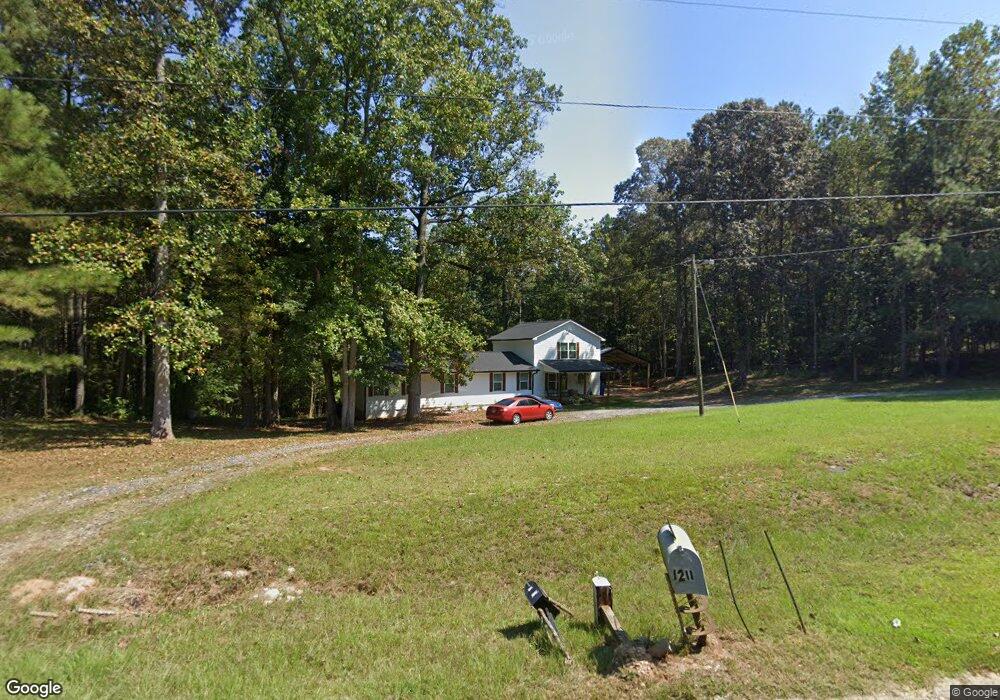
1206A Ferry Rd Franklin, GA 30217
Estimated Value: $178,000 - $463,000
3
Beds
2
Baths
2,016
Sq Ft
$193/Sq Ft
Est. Value
About This Home
This home is located at 1206A Ferry Rd, Franklin, GA 30217 and is currently estimated at $388,482, approximately $192 per square foot. 1206A Ferry Rd is a home located in Heard County with nearby schools including Heard County High School.
Ownership History
Date
Name
Owned For
Owner Type
Purchase Details
Closed on
Nov 5, 2024
Sold by
Stanley Caleb
Bought by
Hurst Eric J
Current Estimated Value
Home Financials for this Owner
Home Financials are based on the most recent Mortgage that was taken out on this home.
Original Mortgage
$410,330
Outstanding Balance
$405,934
Interest Rate
6.25%
Mortgage Type
FHA
Estimated Equity
-$17,452
Purchase Details
Closed on
Jun 20, 2005
Sold by
King Paul
Bought by
J P S & L Llc
Purchase Details
Closed on
Jun 6, 2005
Sold by
King Paul
Bought by
J P S & L Llc
Purchase Details
Closed on
Apr 14, 2000
Sold by
Wade William J Trust
Bought by
King Paul
Purchase Details
Closed on
Feb 1, 1988
Sold by
Mapp Mapp J and Mapp Mary F
Bought by
Turner Patricia
Create a Home Valuation Report for This Property
The Home Valuation Report is an in-depth analysis detailing your home's value as well as a comparison with similar homes in the area
Home Values in the Area
Average Home Value in this Area
Purchase History
| Date | Buyer | Sale Price | Title Company |
|---|---|---|---|
| Hurst Eric J | $417,900 | -- | |
| J P S & L Llc | -- | -- | |
| J P S & L Llc | -- | -- | |
| King Paul | $30,000 | -- | |
| Wade William J Trust | $42,700 | -- | |
| Turner Patricia | $2,500 | -- |
Source: Public Records
Mortgage History
| Date | Status | Borrower | Loan Amount |
|---|---|---|---|
| Open | Hurst Eric J | $410,330 |
Source: Public Records
Tax History Compared to Growth
Tax History
| Year | Tax Paid | Tax Assessment Tax Assessment Total Assessment is a certain percentage of the fair market value that is determined by local assessors to be the total taxable value of land and additions on the property. | Land | Improvement |
|---|---|---|---|---|
| 2024 | $1,181 | $58,593 | $3,617 | $54,976 |
| 2023 | $565 | $27,062 | $2,740 | $24,322 |
| 2022 | $451 | $21,594 | $1,700 | $19,894 |
| 2021 | $397 | $18,078 | $1,700 | $16,378 |
| 2020 | $415 | $18,680 | $1,700 | $16,980 |
| 2019 | $415 | $18,680 | $1,700 | $16,980 |
| 2018 | $423 | $18,680 | $1,700 | $16,980 |
| 2017 | $654 | $28,948 | $1,506 | $27,442 |
| 2016 | $654 | $28,948 | $1,506 | $27,442 |
| 2015 | -- | $25,144 | $2,800 | $22,344 |
| 2014 | -- | $25,146 | $2,800 | $22,346 |
| 2013 | -- | $29,739 | $2,800 | $26,939 |
Source: Public Records
Map
Nearby Homes
- 4230 Joe Stephens Rd
- 0 Newman Rd Unit 10559645
- 323 Newman Rd
- 0 S Bridge Rd Unit 10615531
- 1255 S Bridge Rd
- 192 Hawk Rd
- 220 Dogwood Rd
- 260 Ancient Oak Ln
- 262 Jackson Shoals Rd
- 19860 Georgia 34
- 19860 Ga Hwy 34
- 38 Daniel Cir
- 0 Thomas Powers Rd Unit 10569332
- 0 Thomas Powers Rd Unit 5.54+/- ACRES
- 0 Thomas Powers Rd Unit 24228819
- 17426 Georgia 34
- 642 Elm Rd
- 12439 U S 27
- 0 Joe Cook Rd Unit 4 10550489
- 0 Joe Cook Rd Unit 3 10550484
- 1206 Ferry Rd
- 1255 Ferry Rd
- 1305 Ferry Rd
- 1055 Ferry Rd
- 1408 Ferry Rd
- 979 Ferry Rd
- 88 Sims Cemetery Rd
- 239 Sims Cemetery Rd
- 1614 Ferry Rd
- 1646 Ferry Rd
- 195 Sims Cemetery Rd
- 867 Ferry Rd
- 867 Ferry Rd
- 867 Ferry Rd
- 187 Sims Cemetery Rd
- 2204 Ferry Rd
- 2204 Ferry Rd
- 2000 Ferry Rd
- 00 Ferry Rd
- 3955 Joe Stephens Rd