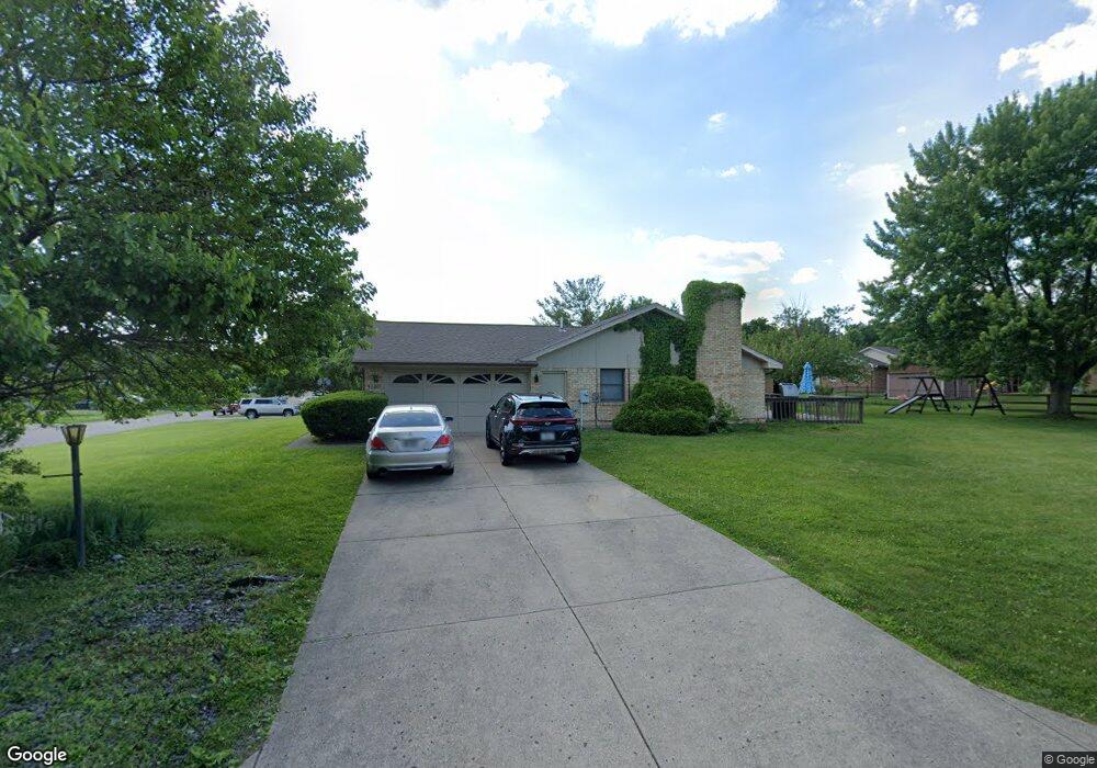
1207 Brookside Dr Beavercreek, OH 45434
Estimated Value: $351,190 - $393,000
4
Beds
3
Baths
2,224
Sq Ft
$164/Sq Ft
Est. Value
About This Home
This home is located at 1207 Brookside Dr, Beavercreek, OH 45434 and is currently estimated at $364,798, approximately $164 per square foot. 1207 Brookside Dr is a home located in Greene County with nearby schools including Main Elementary School, Jacob Coy Middle School, and Beavercreek High School.
Ownership History
Date
Name
Owned For
Owner Type
Purchase Details
Closed on
May 27, 2010
Sold by
Jmac Equities Inc
Bought by
Jmac Equities Llc
Current Estimated Value
Purchase Details
Closed on
Apr 27, 2001
Sold by
Wells Hewett S and Wells Hewitt S
Bought by
Jmac Equities Inc
Purchase Details
Closed on
May 28, 1999
Sold by
Sharp Homes
Bought by
Wells Hewett S
Home Financials for this Owner
Home Financials are based on the most recent Mortgage that was taken out on this home.
Original Mortgage
$123,200
Interest Rate
6.94%
Purchase Details
Closed on
Jun 27, 1997
Sold by
Lambert Ronald A
Bought by
Sharp Homes
Create a Home Valuation Report for This Property
The Home Valuation Report is an in-depth analysis detailing your home's value as well as a comparison with similar homes in the area
Home Values in the Area
Average Home Value in this Area
Purchase History
| Date | Buyer | Sale Price | Title Company |
|---|---|---|---|
| Jmac Equities Llc | -- | Attorney | |
| Jmac Equities Inc | $160,000 | -- | |
| Wells Hewett S | $154,000 | -- | |
| Sharp Homes | $165,000 | -- |
Source: Public Records
Mortgage History
| Date | Status | Borrower | Loan Amount |
|---|---|---|---|
| Previous Owner | Wells Hewett S | $123,200 |
Source: Public Records
Tax History
| Year | Tax Paid | Tax Assessment Tax Assessment Total Assessment is a certain percentage of the fair market value that is determined by local assessors to be the total taxable value of land and additions on the property. | Land | Improvement |
|---|---|---|---|---|
| 2025 | $6,645 | $98,870 | $22,270 | $76,600 |
| 2024 | $6,645 | $98,870 | $22,270 | $76,600 |
| 2023 | $6,583 | $98,870 | $22,270 | $76,600 |
| 2022 | $5,614 | $74,430 | $17,820 | $56,610 |
| 2021 | $5,504 | $74,430 | $17,820 | $56,610 |
| 2020 | $5,545 | $74,430 | $17,820 | $56,610 |
| 2019 | $5,330 | $65,310 | $14,580 | $50,730 |
| 2018 | $4,717 | $65,310 | $14,580 | $50,730 |
| 2017 | $4,639 | $65,310 | $14,580 | $50,730 |
| 2016 | $4,307 | $57,750 | $14,580 | $43,170 |
| 2015 | $4,282 | $57,750 | $14,580 | $43,170 |
| 2014 | $4,220 | $57,750 | $14,580 | $43,170 |
Source: Public Records
Map
Nearby Homes
- 2331 Wedgewood Dr
- 1446 Long Island Ct
- 2267 Old Post Rd
- 2331 Eastwind Dr
- 1957 John Bull W
- 2418 Owen Cir W
- 1260 Camden Trace
- 1359 Fudge Dr
- 2282 Whitey Marshall Dr
- 895 Alpha Rd
- 2721 Sky Crossing Dr
- 2915 Sky Crossing Dr Unit 63
- 2900 Sky Crossing Dr
- 2896 Sky Crossing Dr Unit 70
- 636 Goldfinch Dr
- 632 Goldfinch Dr Unit 101
- 620 Goldfinch Dr Unit 99
- 620 Goldfinch Dr
- 2891 Sky Crossing Dr
- 2891 Sky Crossing Dr Unit 58
- 2422 Dakem Dr
- 1217 Brookside Dr
- 2433 Christalee Dr
- 2411 Dakem Dr
- 1206 Brookside Dr
- 1196 Brookside Dr
- 1216 Brookside Dr
- 2423 Dakem Dr
- 2445 Christalee Dr
- 2434 Dakem Dr
- 1186 Brookside Dr
- 1226 Brookside Dr
- 1177 Brookside Dr
- 2433 Dakem Dr
- 2457 Christalee Dr
- 2420 Christalee Dr
- 2432 Christalee Dr
- 1176 Brookside Dr
- 2446 Dakem Dr
- 2444 Christalee Dr
Your Personal Tour Guide
Ask me questions while you tour the home.