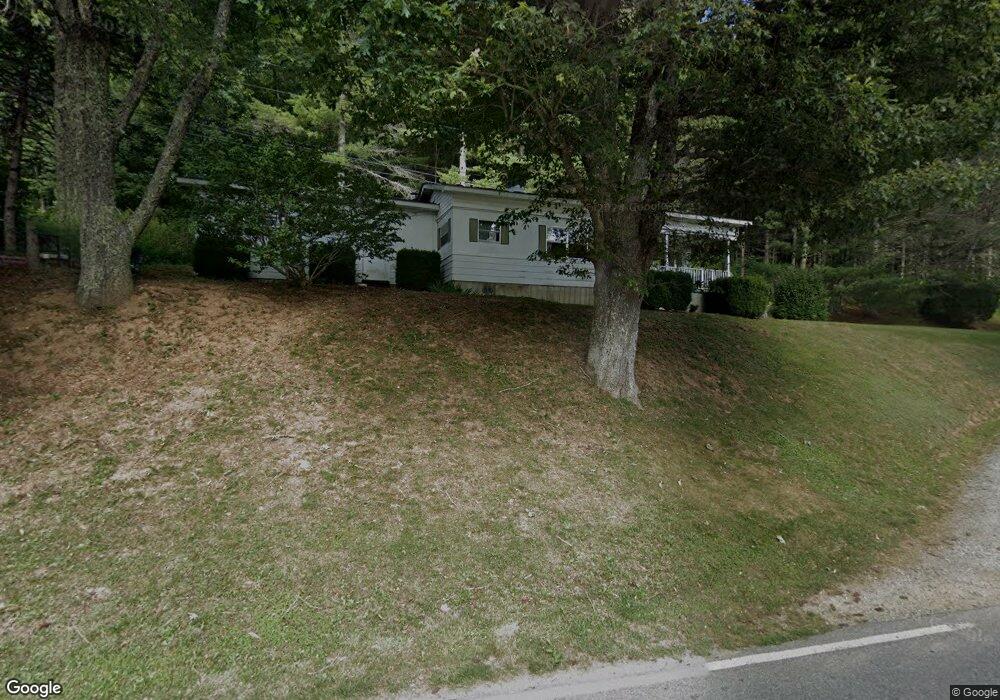
1207 Brownwood Rd Unit 1209 Deep Gap, NC 28618
Estimated Value: $231,000 - $283,191
2
Beds
1
Bath
952
Sq Ft
$276/Sq Ft
Est. Value
About This Home
This home is located at 1207 Brownwood Rd Unit 1209, Deep Gap, NC 28618 and is currently estimated at $262,730, approximately $275 per square foot. 1207 Brownwood Rd Unit 1209 is a home located in Watauga County with nearby schools including Parkway Elementary School and Watauga High School.
Ownership History
Date
Name
Owned For
Owner Type
Purchase Details
Closed on
Nov 20, 2023
Sold by
Lookabill Nancy and Lookabill John
Bought by
Cornette Joseph Scott
Current Estimated Value
Purchase Details
Closed on
Feb 23, 2021
Sold by
Norris Laura Jeanette
Bought by
Norris Laura Jeanette and Cornette Joseph Scott
Purchase Details
Closed on
Jul 22, 2020
Sold by
Cornette Michael Kevin and Cornette Collen
Bought by
Norris Laura Jeanette
Purchase Details
Closed on
Aug 20, 2007
Sold by
Norris Laura Jeanette
Bought by
Cornette Michael Kevin
Purchase Details
Closed on
Jun 25, 2007
Sold by
Norris Laura Jeanette
Bought by
Cornette Michael Kevin
Create a Home Valuation Report for This Property
The Home Valuation Report is an in-depth analysis detailing your home's value as well as a comparison with similar homes in the area
Home Values in the Area
Average Home Value in this Area
Purchase History
| Date | Buyer | Sale Price | Title Company |
|---|---|---|---|
| Cornette Joseph Scott | -- | None Listed On Document | |
| Cornette Joseph Scott | -- | None Listed On Document | |
| Norris Laura Jeanette | -- | None Available | |
| Norris Laura Jeanette | -- | None Available | |
| Cornette Michael Kevin | -- | None Available | |
| Cornette Michael Kevin | -- | None Available |
Source: Public Records
Tax History Compared to Growth
Tax History
| Year | Tax Paid | Tax Assessment Tax Assessment Total Assessment is a certain percentage of the fair market value that is determined by local assessors to be the total taxable value of land and additions on the property. | Land | Improvement |
|---|---|---|---|---|
| 2024 | $507 | $186,300 | $60,800 | $125,500 |
| 2023 | $484 | $186,300 | $60,800 | $125,500 |
| 2022 | $484 | $186,300 | $60,800 | $125,500 |
| 2021 | $605 | $115,900 | $38,000 | $77,900 |
| 2020 | $605 | $115,900 | $38,000 | $77,900 |
| 2019 | $605 | $115,900 | $38,000 | $77,900 |
| 2018 | $547 | $115,900 | $38,000 | $77,900 |
| 2017 | $547 | $115,900 | $38,000 | $77,900 |
| 2013 | -- | $108,400 | $36,000 | $72,400 |
Source: Public Records
Map
Nearby Homes
- 165 All Hallows Rd Unit 201
- 123 Railroad Grade Rd
- 135 Mountain Ivy Ln
- 490 Laurelwood Ln
- 133 Pinewood Cir
- 508 Laurelwood Ln
- 496 Laurelwood Ln
- 260 Laurel Gap Ridge
- Tbd Cranberry Springs Rd
- Lot 3 Sec 11 Talons Dr
- 612 Wildcat Rd
- TBD Green Meadows Dr
- Lot 2 Sec II Talon Dr
- Lot 1 Sec II Talon Dr
- 136 Day Dr
- 11 Knob Hill Dr
- 849 River Ridge Rd
- 130 Cornerstone Ln
- 281 New River Farms Rd
- Lot 3 Cedar Cove Ln
- 1351 Brownwood Rd
- 1119 Brownwood Rd Unit Apartment 1
- 1119 Brownwood Rd Unit 1121
- 1375 Brownwood Rd
- 1349 Brownwood Rd
- 1330 Brownwood Rd
- 126 Old Glade Rd
- 1446 Brownwood Rd
- 117 Old Glade Rd
- 1023 Brownwood Rd
- 980 Brownwood Rd
- 1563 Brownwood Rd
- 145 Clyde Ray Rd
- 1571 Brownwood Rd
- 1565 Brownwood Rd
- 645 Chestnut Dr
- 883 Brownwood Rd
- 246 Clyde Ray Rd
- 1567 Brownwood Rd
- 247 Clyde Ray Rd