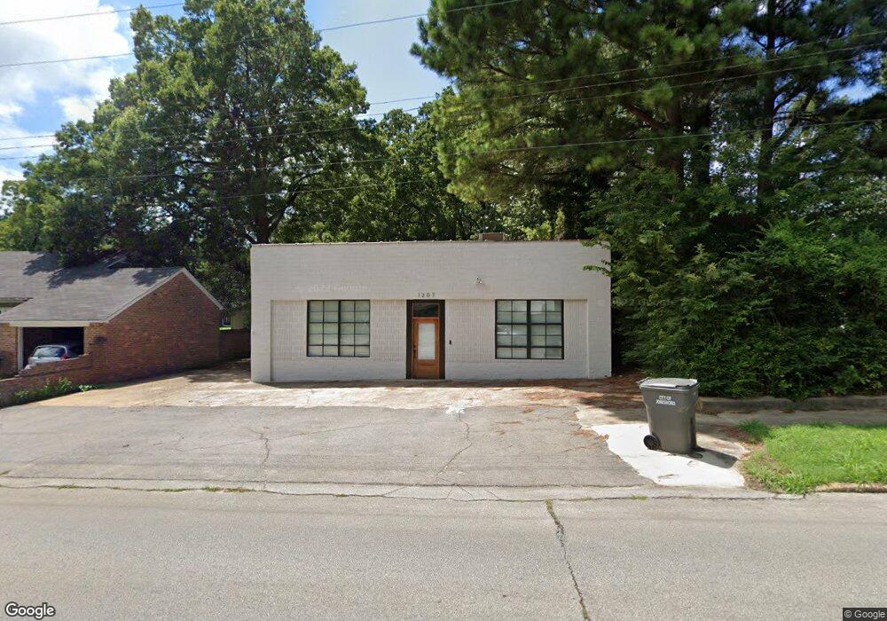
1207 Flint St Jonesboro, AR 72401
Estimated Value: $134,000 - $240,000
--
Bed
2
Baths
3,150
Sq Ft
$61/Sq Ft
Est. Value
About This Home
This home is located at 1207 Flint St, Jonesboro, AR 72401 and is currently estimated at $190,974, approximately $60 per square foot. 1207 Flint St is a home located in Craighead County with nearby schools including Annie Camp Junior High School, The Academies at Jonesboro High School, and Montessori School of Jonesboro.
Ownership History
Date
Name
Owned For
Owner Type
Purchase Details
Closed on
May 24, 2019
Sold by
Citifirst Property Group Llc
Bought by
Thrasher Roddy
Current Estimated Value
Home Financials for this Owner
Home Financials are based on the most recent Mortgage that was taken out on this home.
Original Mortgage
$222,000
Interest Rate
4.2%
Mortgage Type
New Conventional
Purchase Details
Closed on
Sep 28, 2017
Sold by
Thrasher Reese
Bought by
Citifirst Property Group Llc
Purchase Details
Closed on
Dec 9, 2003
Bought by
Esau
Create a Home Valuation Report for This Property
The Home Valuation Report is an in-depth analysis detailing your home's value as well as a comparison with similar homes in the area
Home Values in the Area
Average Home Value in this Area
Purchase History
| Date | Buyer | Sale Price | Title Company |
|---|---|---|---|
| Thrasher Roddy | $80,000 | None Available | |
| Citifirst Property Group Llc | $76,500 | -- | |
| Esau | $75,000 | -- |
Source: Public Records
Mortgage History
| Date | Status | Borrower | Loan Amount |
|---|---|---|---|
| Closed | Thrasher Roddy | $222,000 |
Source: Public Records
Tax History Compared to Growth
Tax History
| Year | Tax Paid | Tax Assessment Tax Assessment Total Assessment is a certain percentage of the fair market value that is determined by local assessors to be the total taxable value of land and additions on the property. | Land | Improvement |
|---|---|---|---|---|
| 2025 | $1,011 | $28,816 | $2,400 | $26,416 |
| 2024 | $1,011 | $28,816 | $2,400 | $26,416 |
| 2023 | $524 | $28,816 | $2,400 | $26,416 |
| 2022 | $535 | $28,816 | $2,400 | $26,416 |
| 2021 | $517 | $21,143 | $2,400 | $18,743 |
| 2020 | $517 | $21,143 | $2,400 | $18,743 |
| 2019 | $596 | $23,000 | $2,400 | $20,600 |
| 2018 | $971 | $23,000 | $2,400 | $20,600 |
| 2017 | $890 | $23,000 | $2,400 | $20,600 |
| 2016 | $809 | $19,160 | $2,400 | $16,760 |
| 2015 | $809 | $19,160 | $2,400 | $16,760 |
| 2014 | $809 | $19,160 | $2,400 | $16,760 |
Source: Public Records
Map
Nearby Homes
- 1233 Flint St
- 507 Elm Ave
- 606 Elm Ave
- 635 Poplar Ave
- 1117 S Madison St
- 637 W Oak Ave
- 1105 S Madison St
- 1226 S Madison St
- 701 W Nettleton Ave
- 622 W Oak Ave
- 1411 S Madison St
- 515 W Thomas Ave
- 1217 Olive St
- 730 W Cherry Ave
- 621 W Thomas Ave
- 1130 Vine St
- 735 W Oak Ave
- 812 W Nettleton Ave
- 636 Warner Ave
- 801 S Culberhouse St
- 602 Poplar Ave
- 601 Elm Ave
- 604 Poplar Ave Unit 606 POPLAR
- 604 Poplar Ave
- 605 Elm Ave
- 1233 Flint St Unit 1235 Flint and 603 p
- 1233 Flint St Unit 1235 Flint, 603 Popl
- 1214 Flint St
- 515 Elm Ave
- 1235 Flint St Unit 1233 Flint and 603 P
- 1235 Flint St
- 603 Poplar Ave Unit 1233 Flint and 1235
- 603 Poplar Ave
- 1230 Flint St
- 621 Elm Ave
- 511 Elm Ave
- 1245 Flint St
- 605 Poplar Ave
- 512 Poplar Ave
- 630 Poplar Ave